
Bikepacking The Wilson’s Ramble in the Linville Gorge Wilderness of NC
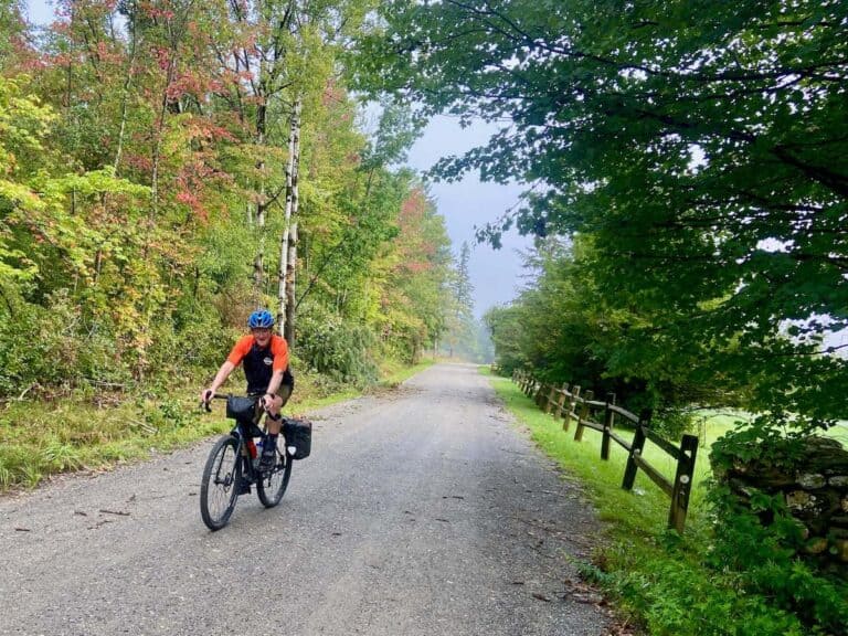
At first glance, the Wilson’s Ramble looks like an uncomplicated and easy-going bikepacking route along gravel roads and flowing singletrack in Western North Carolina. Its name does suggest a ‘ramble’, right? But it’s so much more than that.
This route is full of surprises – in a good way! From stretches of awesome singletrack (more than expected) to incredible viewpoints, countless hidden swimming holes, long, tough climbs, and beautiful remote campsites, the Wilson’s Ramble exceeded my expectations, both in awesomeness and in difficulty.
A friend and I rode the Wilson’s Ramble as a 3-night/4-day adventure and while it was tough, I don’t think I’d change anything about the way it unfolded. Read on to learn more about our adventure and start planning your Wilson’s Ramble bikepacking trip!
The Wilson’s Ramble at a glance
These stats are for my trip and they vary slightly from the Bikepacking.com route stats. We took a few wrong turns and did a few bonus miles.
- Location: Linville, NC
- Days needed: 3-4 (I highly recommend 4)
- Distance: 136 miles
- Rideable time: 99%
- Fitness level: Very good
- Skill level: Intermediate
- Elevation gain: 15,265 ft*
- Elevation loss: 15,265 ft*
- High point: 3,959 ft
- Singletrack: 17% (felt like more)
- Best time to ride: May-Nov (spring and fall are ideal)
- Ease of navigation: Moderate**
*As measured by my Garmin Edge 830
**I always recommend having the route downloaded on the Ride With GPS app
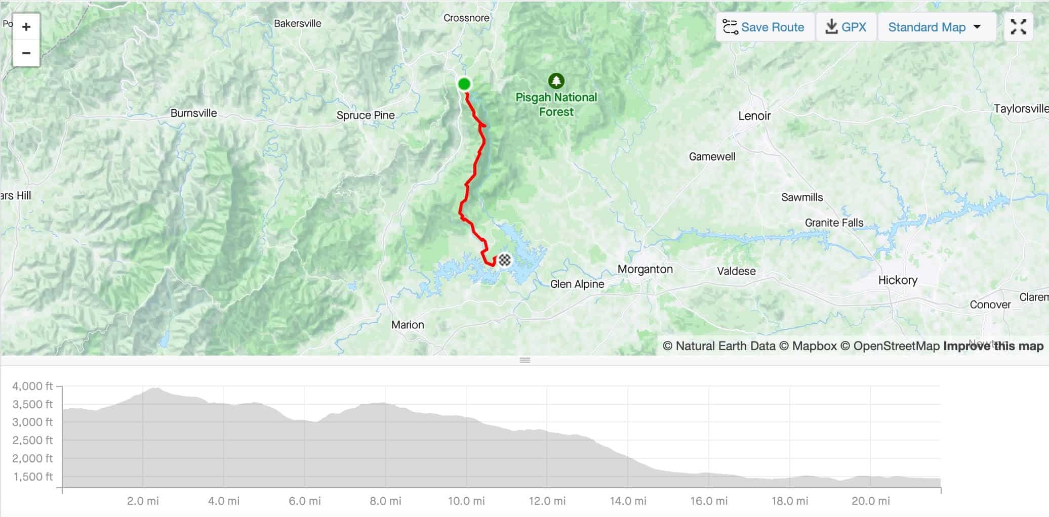
Wilson’s Ramble Map
See the Wilson’s Ramble on Bikepacking.com
Why Ride The Wilson’s Ramble?
The Wilson’s Ramble is a ~125-mile bikepacking loop through the Linville Gorge Wilderness Area and Wilson’s Creek watershed of Western North Carolina.
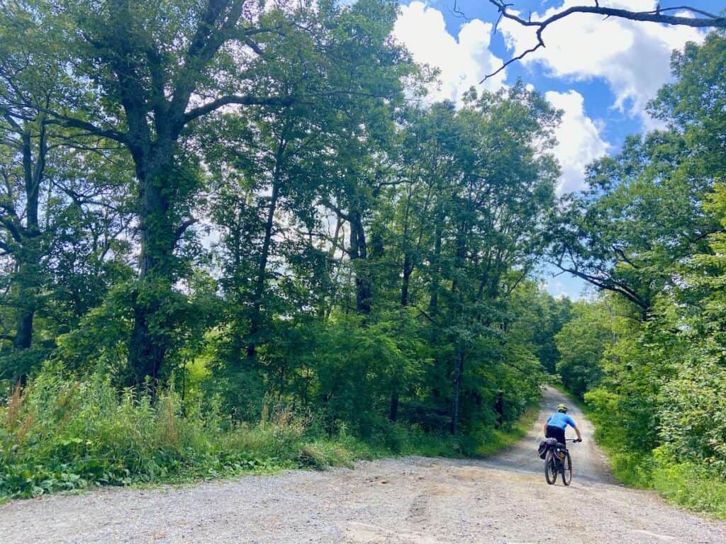
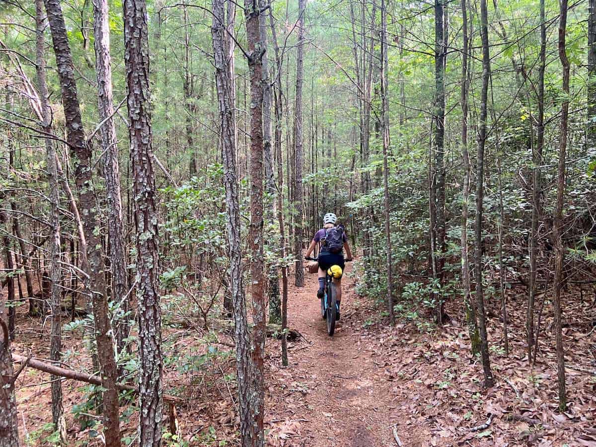
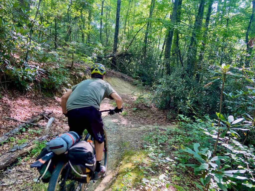
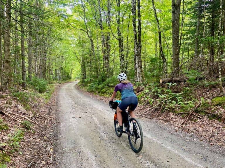
The route features a mix of tracks and terrain from well-established gravel roads to overgrown doubletrack to legit mountain biking singletrack. There is very little pavement.
I was actually quite surprised at how much singletrack there was and how rugged and remote the route is. It’s definitely NOT a gravel ride (see below for what kind of bike to take).
Every stretch of the route is sprinkled with highlights like awesome views (definitely go out to Wiseman’s View), secluded swimming holes, a roadside brewery, amazing mountain bike trails, and middle-of-nowhere fire roads that you are almost guaranteed to have to yourself.
Every day seemed like it brought a new surprise and something different, which, when you’re pedaling mile after mile, really helps to break up the monotony that afflicts some multi-day bikepacking trips.
Overall, I loved the Wilson’s Ramble. The climbs were tough at times, but the whole route in general exceeded my expectations and I think it will for you, too!
Here are a few highlights of the route:


Important Things to Know
Bikepacking the Wilson’s Ramble is awesome, but there are a few things to know before setting off:
The Lake James Trails
There are two things to note about the Lake James singletrack: first, they close the trails when it rains (which would be a big bummer) and second, they change the direction of the loops every season.
We rode the trails opposite of what the map and GPS said and it required a little extra attention to navigate.

Resupply points
There are very few resupply points along the Wilson’s Ramble. You’ll need to carry most – if not all – of your food. See below for more information about what to bring.
This is a mountain bike route
It may look like the Wilson’s Ramble is a gravel route at first glance, but it’s more rugged and remote than it looks.
Try to do it during the week
We rode the loop Mon – Thurs and we had all of the dispersed campsites and most of the roads to ourselves. I have a feeling that weekends get pretty busy in some areas, though.
Route navigation
Check and double-check you have the route downloaded. You absolutely need a GPS map to navigate this route.
Planning your Wilson’s Ramble Bikepacking Trip
While part of the appeal of bikepacking is heading into the unknown, here are a few tips for planning your Wilson’s Ramble trip.
What bike to take
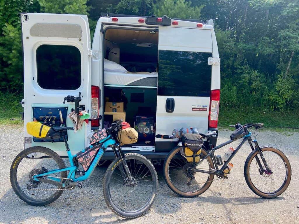
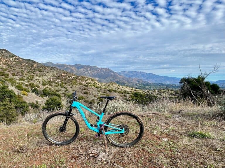
When I first started looking at the Wilson’s Ramble, I thought it was a gravel ride. But that is definitely not the case! I’m so glad I choose my short-travel Juliana Joplin mountain bike instead of a skinny tire, fully rigid gravel bike.
There are long stretches of singletrack and rough, overgrown doubletrack that would not be very fun on a standard gravel bike.
The ideal bike would be one of these:
- Short-travel mountain bike
- Hardtail mountain bike
- Wide-tire fully rigid ‘adventure’ bike
For tires, I’d go with at least 2.0 in/50 mm width.
Bikepacking gear
For a complete list of what to pack, head over to my bikepacking gear list. Below are a few items I’d consider specifically for the Wilson’s Ramble:
- Water filter – there are numerous creeks, rivers, and streams to fill up
- Hydration/electrolyte powder – especially if you do the route in the hot summer months
- Something to sit on – the ground can be wet and uncomfortable
- Dehydrated dinners – there are virtually no resupply points along the route
- Bug spray or wipes – NC bugs can be nasty, although we really weren’t too inundated in July, surprisingly
- Tent with rainfly and footprint – Western North Carolina gets a lot of rain
- Downloaded podcasts/music – some of the climbs are best with a distraction
- A rope to hang your food – we didn’t see any black bears, but they do abound in NC. Hang your food at night.
Food
Resupplies on this route are very limited, so you will need to bring pretty much all of your food with you for your trip. That means breakfasts, lunches, dinners, and snacks for 3 or 4 days.
The only potential resupplies are:
- Day 1: The Fonta Flora Brewery at Whippoorwill Farm has very light snacks like chips (and beer/cider). If you hit it on a weekend, there is a hot dog food truck that is open Thurs – Sun. See hours here.
- Day 1: A concession stand at the Lake James State Park swimming area, which has snacks, candy, and soft drinks. It’s open daily from May 1 to September 30 from 10 am to 6 pm.
- Day 4: Coffey’s General Store & Museum in Edgemont. We didn’t stop here but I really wish we had. It’s supposed to have some interesting history and tasty treats.
- Day 3 or 4: Betsy’s Old Country Store is not on the route, but you can make a detour to Mortimer if you need to. This will add some miles, though.
Looking for meal ideas? Head over to my detailed post on Bikepacking Food for ideas on how to eat well on a bikepacking trip.
Water
Western North Carolina gets a lot of rain, so there are numerous places to fill up and filter water each day from creeks and rivers.
I carried a 3L water bladder in my hydration pack and a water bottle filled with Tailwind Endurance Fuel (I drink a lot of water). My friend carried three 21 oz water bottles in cages (about 2L).
We filled up/filtered water at least once each day and camped by water at night.

Camping
There are a lot of really nice free dispersed campsites along this route. In fact, our second night’s campsite was one of my all-time favorite campsites ever! (See photo above).
Aside from the Lake James State Park campground, all the campsites are dispersed, meaning they have no facilities like bathrooms.
The map below shows where we camped for our three nights on the Wilson’s Ramble. I honestly thought they were pretty perfectly spaced out and I’d do it the same way next time.
Note: If you plan on camping at the Paddy’s Creek Campground at Lake James State Park, it’s a good idea to make a reservation, especially if you’re camping on a weekend. You can make reservations online at NCParks.gov. You want the Paddy’s Creek Access Only Tent-Camping Drive-In Sites.

Where to start/end
The Wilson’s Ramble is a loop that starts and ends at the Linville Falls parking area (Google directions here). I left my van there for three nights and it was fine while I was gone. The parking area is quite busy and felt safe. There are no facilities.
Technically, you could start anywhere along the route, but I thought Linville Falls was a great place to start/end.
When to go
Bikepacking.com says that this route can be ridden year-round, but winter would be chilly, especially with rain.
Spring and fall are probably the best times for cooler temps and beautiful scenery (flowers in the spring and foliage in the fall).
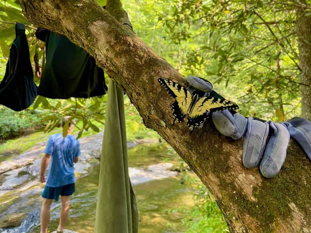
We rode it in July, which may sound crazy, but the temps and humidity actually weren’t that bad since most of the route is in the woods and shaded. Plus, it was perfect for enjoying all the beautiful swimming holes!
Route navigation
You will definitely need some sort of GPS device to help you navigate the Wilson’s Ramble. There are a lot of twists and turns and without a map, you will most definitely get off course. We had a GPS and we still got off course a few times.
I used my Garmin Edge 830 bike computer, which I take on all my bikepacking trips. It’s easy to use, the battery lasts a long time (although I did bring my BioLite Charge 40 PD), and you can sync it with Ride With GPS (double check to make sure the route/map is actually downloaded to your device).
Need a GPS Computer?
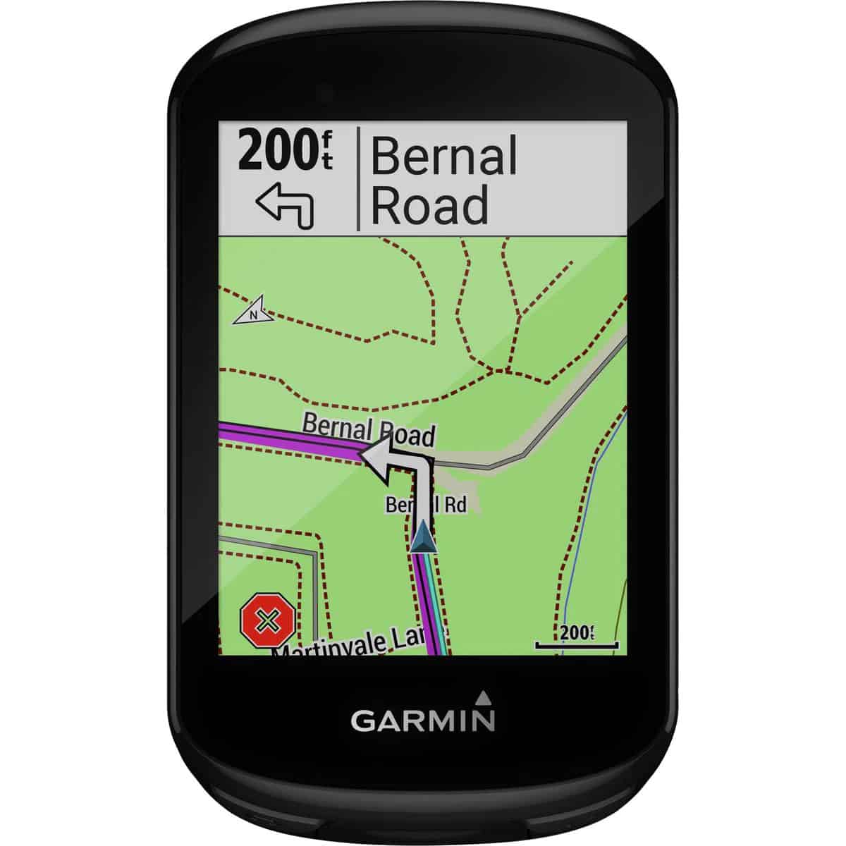
Never get lost again! I’ve been using my Garmin Edge bike computer for a number of years now and it has never led me astray (although it has told me that climbs were over when they clearly were not…).
I’ve used the Garmin Edge on multi-day bikepacking trips, long gravel rides, and even to navigate my epic adventure on the Ruta Maya through Central America.
It has all the features you need for a cycling trip like GPS tracking, an easy-to-use touchscreen, tons of stats, and the ability to connect to other apps like Ride With GPS, Strava, and TrailForks.
If you want to learn more, read my full review of the Garmin Edge.
I also recommend downloading the Ride With GPS app and map to your phone as a backup. You will need a Premium Subscription ($10/mo) to access the map offline, but I think it’s worth it.
How hard is the Wilson’s Ramble?
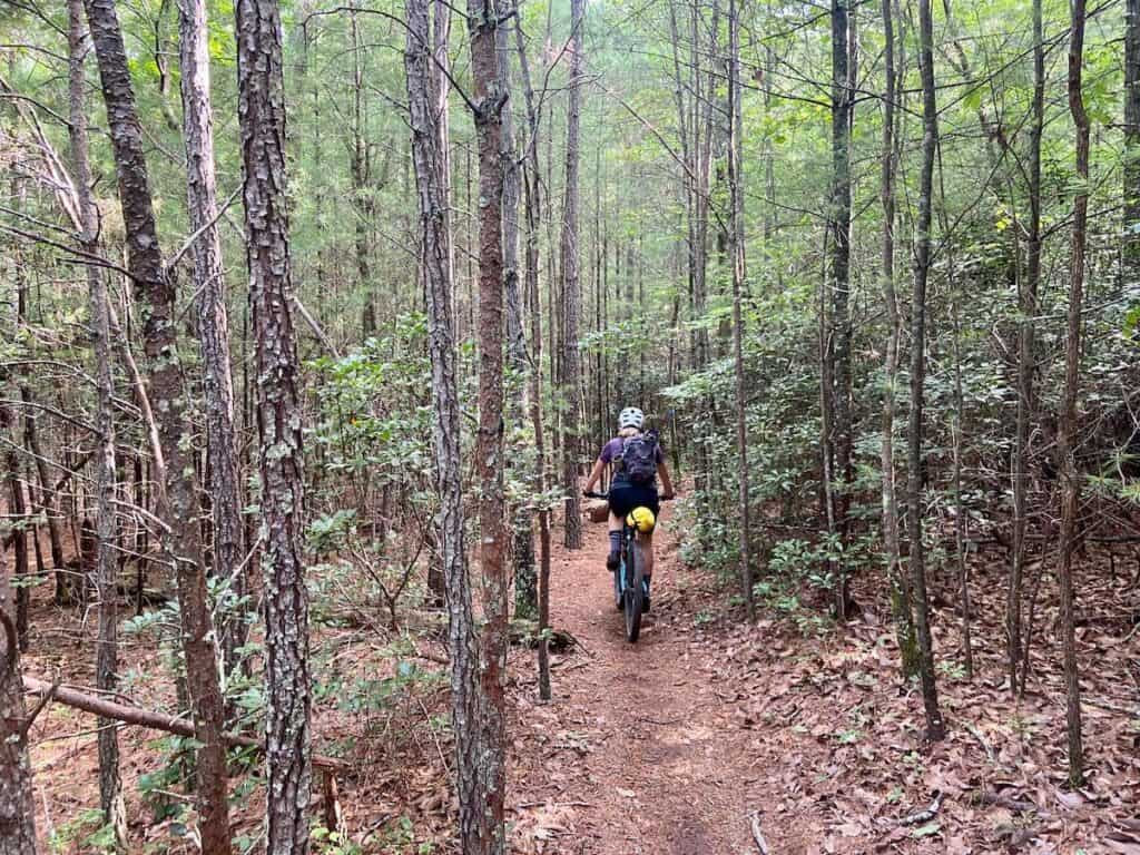
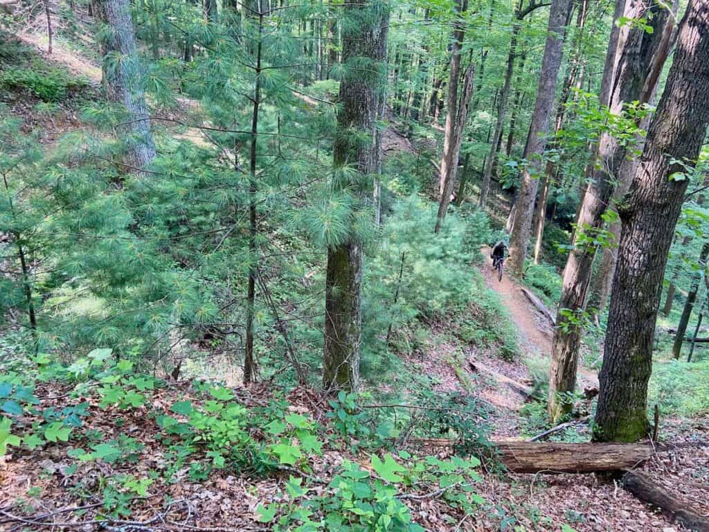
I’m not going to lie, the Wilson’s Ramble was more challenging than I thought it would be. I’m more of a mountain biker, so the long dirt road climbs were a bit of a grind for me. The singletrack sections were awesome, but there are a few spots on Yancey Ridge Trail that may need to be walked for non-mountain biker bikepackers.
Bikepacking.com rates the route as a 6.5 out of 10, but I felt like it was harder than that (I’m in reasonable shape and I bike a lot).
In addition to the big climbs, the lack of resupply points makes it that much more challenging as you’ll need to carry all – or most – of your food with you from the start.
My Wilson’s Ramble Adventure
We rode the Wilson’s Ramble in 3-nights/4-days and we managed to spread out the miles and elevation perfectly (although two days had a lot of climbing!). You could do the route in 2-nights/3-days, but it would be tough!
Here’s the breakdown of our trip:
Day 1: Linville Gorge Views
Day 1 in detail
Knowing that we only had about 20 miles to ride on day 1, we arrived at the Linville Falls parking area around 10 and after packing everything up, started riding around noon.
While the ‘trend’ of day 1 is downhill, don’t let that fool you – there are some steep (but short) climbs right off the bat!
The views out over Linville Gorge are the best on this day, so definitely take your time and enjoy them. I highly recommend doing the short out-and-back to Wiseman’s View – the views are amazing.
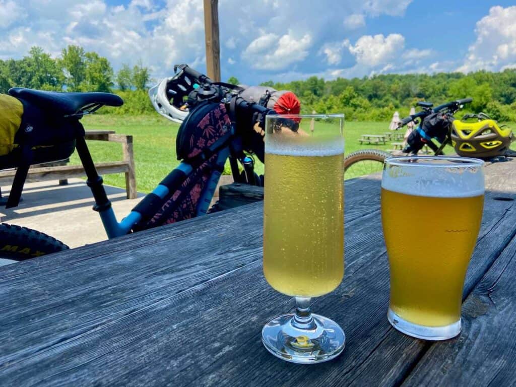
We timed our ride to stop at the Fonta Flora Brewery at Whippoorwill Farm (mile 16-ish) in the afternoon. It’s a great place to relax for a bit, play some cards, drink cold beer or cider, and maybe have a hot dog if the food truck is open.
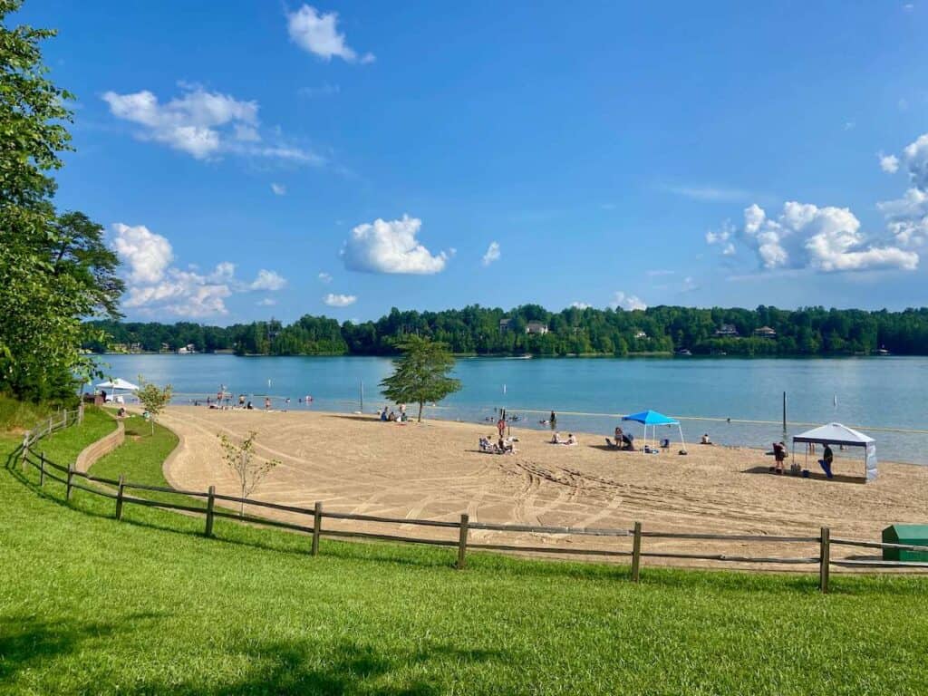
From the brewery, it was an easy 5-mile pedal to Lake James State Park and campground. We hadn’t made camping reservations, so we stopped at the Visitor’s Center and paid for a site at Paddy’s Creek. If you’re staying on the weekend, I recommend reserving a site ahead of time since it can get busy.
After setting up the tent, we rode our bikes down to the beach to swim and relax on the grass before heading back for a dehydrated dinner. Day 1 done!


Day 2: Lake James Singletrack
Day 2 in detail
Day 2 started off on the trails at Lake James State Park. These trails are perfect for loaded bikepacking bikes – fast, flowy, and fun!
Note: It’s easy to do bonus miles in Lake James State Park. We ended up doing about 2-miles extra because we got off track. Pay attention to trail signs and your GPS or else you might get stuck going in circles and making a big day even bigger.
After exiting the trails at Lake James, we stayed on singletrack for another few miles via the Fonta Flora trail, which will eventually span 100 miles and connect Asheville to Morgantown.
We had lunch at the Fonta Flora County Park (the water fountains were out of order, but the dog fountain worked…) before starting a tough climb up and over Table Rock Road.
This is by far the hardest climb of the route. It’s super steep, super rocky and rutted, and definitely type 3 fun. I walked most of it because it wasn’t worth the extra effort.
After topping out, there’s a long, fast descent on better gravel road before the route takes a sharp (and very easy to miss) lefthand turn onto overgrown doubletrack. This section felt the most remote of the whole trip!
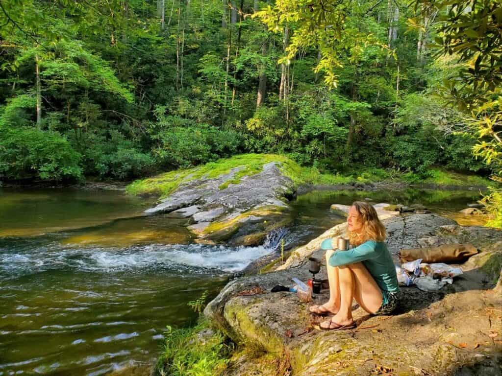
We ended our day at a beautiful campsite ride by a river with a nice swimming hole and large rocks to relax on. I’ve camped in a lot of places and this site will go down as one of my favorite ever.


Day 3: Wilson’s Creek Gorge
Day 3 in detail
Day three was long and challenging, but I’m glad we pushed the extra few miles and final hill climb to get to our campsite because it made the final day (day 4) a lot easier and more enjoyable.
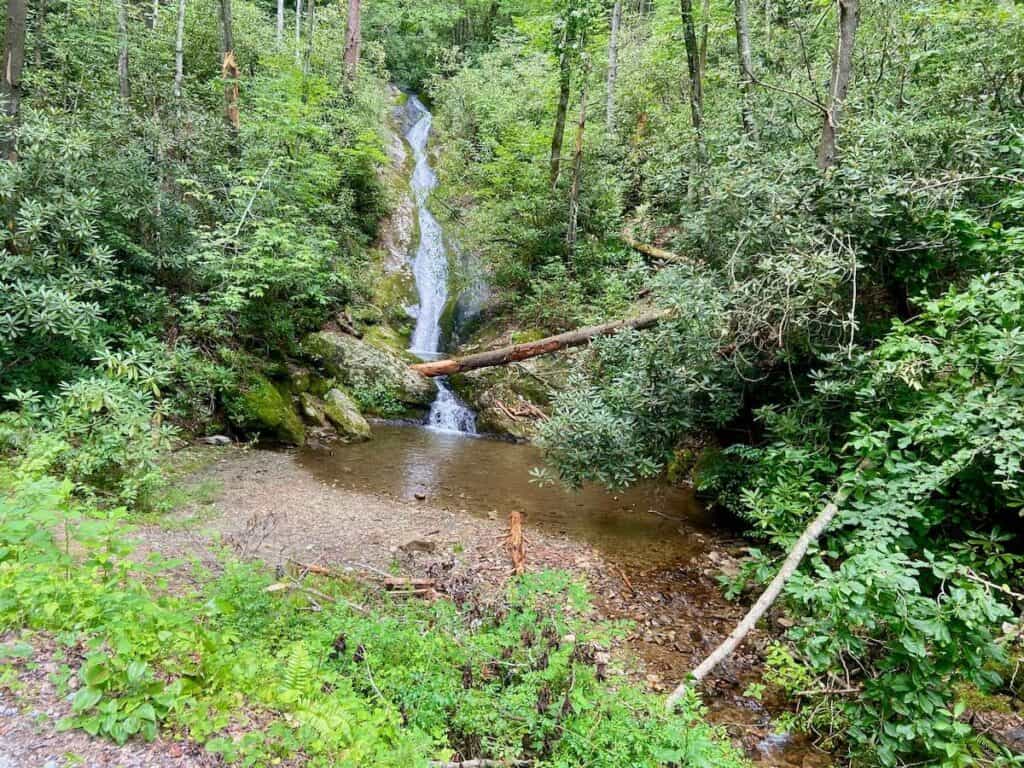
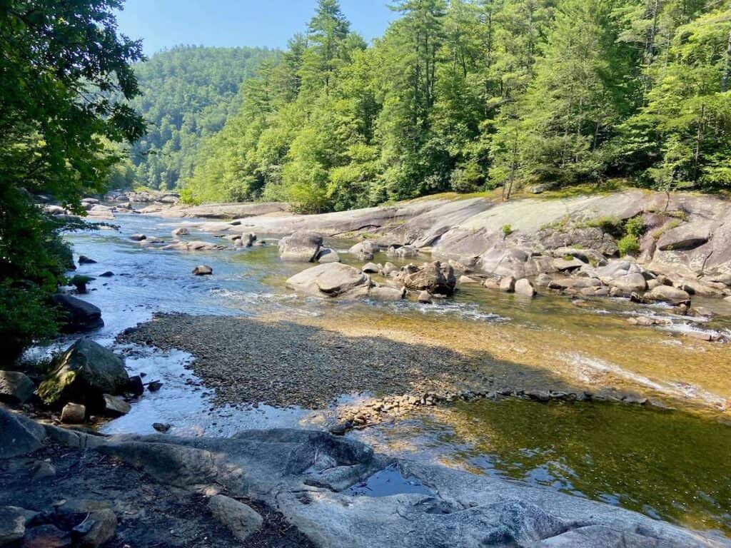
From our (awesome) riverside campsite, we climbed out of the river bed and hit a main dirt road that took us down to the stunning Wilson’s Creek and Brown Mountain Beach Rd. This stretch is beautiful! Definitely stop and go down to the river for a snack break or quick dip.
Instead of taking the Brown Mountain Beach Rd. all the way through the gorge, the route turns left onto Lower Wilson Ridge Trail. The singletrack pedaling is easy at first, but the last stretch is a bit of a hike-a-bike.
The next 13 miles were my least favorite part of the ride. Maple Sally Road is a meandering gravel road that is beautiful, but monotonous in its ups and downs, twists and turns. If you brought some music or a podcast, this is a good time to switch it on.
Originally, we had planned on camping at the base of the next hill climb (named “campsite at confluence/bridge on Bikepacking.com), but since it was only 3:30pm, we decided to push on up the hill. I’m so glad we did! Even though the campsite was beautiful with its own little waterfall and swimming pool, climbing that hill on day 3 was a lifesaver on day 4.
We camped at a dispersed site next to Wilson Creek, which didn’t have quite as nice swimming, but still allowed us to rinse off the day’s sweat and dust.

Day 4: Yancey Ridge Trail
Day 4 in detail
The last day! This day was the best and the worst. The best part was Yancey Ridge Trail, which is a (mostly) fast and flowy stretch of singletrack that will have you grinning from ear to ear. There are more than a few annoying steep climbs that definitely disrupt the flow, but overall it’s a highlight of the trip. Enjoy it!
The worst part of the day is the final climb out of Edgemont on Old Mortimer Road. The climb goes on f.o.r.e.v.e.r. I had to put on a podcast (I highly recommend Against The Odds) and just remind myself to keep my legs spinning. The climb is about 10 miles with a pretty manageable grade, but still… 10 miles.
Once you’re at the top, though, it’s pretty much a coast back to the start where, if you’re up for it (we weren’t), can head down to Linville Falls for a final glimpse at the beauty of Linville Gorge Wilderness Area (no swimming allowed, unfortunately).
The Wilson’s Ramble exceeded my expectations in almost every way. There was more singletrack than expected, it was more rugged and remote than expected, and it was more beautiful than expected.
It was also harder than expected, but I’m always up for a good challenge 🙂
If you’re looking for a short bikepacking trip that packs a punch and you don’t mind getting off the beaten track and immersing yourself in nature, definitely add this one to your list.
It’s a classic for sure!
Read next
Looking for more two-wheeled adventures in North Carolina? Check out these related blog posts:
Have you heard of the Wilson’s Ramble bikepacking route? Is this a trip you’d like to do? What questions do you still have? Leave a comment below!


I think Wiseman’s View is what you’re referring to (rather than Wilson’s Overlook).
You are correct, thanks!