10 Best Bay Area Mountain Biking Trails + Route Recommendations
Learn about the top Bay Area mountain biking trails around San Francisco that offer great views, fun flow, and an escape from the city
When I worked briefly as a Backroads Trip Leader, I was based in Berkley, CA. Berkeley may sound like an ideal place to live – especially when you don’t have to pay rent – but as someone who thrives on mountains and open spaces, the concrete jungle of the city was far from ideal (one of the many reasons I did not excel as a trip leader). So when I was not leading trips in Wine Country or in Yosemite, I was out exploring the Bay Area mountain biking scene.
Surprisingly, though, despite the fact that Marin County is considered the birthplace of mountain biking in the US, there really isn’t a whole lot of singletrack around the Bay Area. Both the NIMBY movement (Not In My Backyard) and urban sprawl have done a great job to curtail mountain biking singletrack around San Francisco.
That being said, there are a few fun places to ride that offer great views and good flow if you’re willing to seek them out. I’m still exploring the networks around the Bay Area, but here are the best places I’ve found to ride to date.
***Important: There have continually been armed bike robberies on some Bay Area mountain bike trails, particularly Wildcat Canyon and Oakland Hills. Please do not ride alone. Ride with a group and have a phone with you.
North Bay Area Mountain Biking
1. China Camp
China Camp is a super fun and casual loop located north of San Francisco just outside of San Rafael. In the late 1880’s/early 1990s the area was settled by Chinese-Americans who made their living as shrimp fishermen, but today, China Camp is a popular State Park open to hikers and mountain bikers.
There is one big 9-mile loop around China Camp that is made up of three trails: Shoreline Trail, Bayview Trail, and Oak Ridge. The riding is not overly technical so it’s great for families and cross-country enthusiasts.
Like every natural area around San Francisco, though, China Camp does get busy – especially on the weekends, so stay patient and be courteous.
Need To Know:
- There is a $3 Trail Use fee to use the trails at China Camp. This money goes back into the park, so please pay it. There is a Kiosk at the main trailhead
- You can park outside of the park (free) or in one of the parking areas ($5 for both parking and trail use)
- The trails are bidirectional, but I prefer to ride the loop counterclockwise
- China Camp can get super busy, especially on weekends!
Route recommendation
>> China Camp Loop
There are several places you can start the China Camp loop with plenty of parking along North San Pedro Road. You can ride the loop in either direction, but I personally recommend clockwise for the best flow.
The loop is 9 miles long with just under 1,000ft of climbing. There aren’t many places to bail, so be sure to bring lots of water, snacks, and sunscreen.
Route directions: China Camp Parking > Shoreline Trail > Bay View Trail > Oak Ridge
Do more: There are a few trails near the western side of the China Camp Loop called Woodrat, Canary, and JT Howell. I haven’t ridden any of them, but they could be a good option to add a few miles and some more climbing.
2. Camp Tamarancho
Camp Tamarancho is another great Bay Area mountain biking loop north of San Francisco. The land is owned by the Boy Scouts of America, but they generously offer up their trails to mountain bikers when the rest of Marin is mostly off-limits.
The whole Camp Tamarancho loop is about 7 miles with 1,550 ft of climbing, or more if you start from Sir Francis Boulevard (see route below).
It’s definitely a step up from China Camp, so a good choice if you’re looking for a bit more of a challenge. The loop links up the trails Broken Dam, Goldman, Serpentine, Wagon Wheel, and B-17 and is a mix of cross-country, flow trail, and techy rock gardens so be prepared for a lot of different terrain (and amazing views!).
Things to Know:
- The Boy Scouts of America request that you purchase a $5 day pass or annual pass before riding their trails. This can be done online here. It’s an honor system because no one’s really going to check to see if you’ve bought a pass, but do you really want to stiff the Boy Scouts?
- There are several places you can park, but I like parking off of Sir Francis Drake Boulevard and pedaling in via Porcupine Trail. You can also start at the bottom of Alchemist Trail.
- The loop is best ridden clockwise
- Endor is a super fun flow trail. Lap it a few times before you pedal out!
Route recommendation
>> Camp Tamarancho Loop
You can start this loop in several different places, but I like to start at the Lower Porcupine Trailhead (which is the blue parking circle on the map above). You can also start in the town of Fairfax and climb up the Alchemist Trail which will cut off a few hundred feet of climbing.
The Camp Tamarancho Loop is mostly cross-country pedaling, but there are a few technical rocky features to navigate and some tight switchbacks. Endor is a super fun flow trail that you’ll start the loop on and you can lap it at the end if you still have juice in your legs.
Route directions: Lower Porcupine Trail Parking > Porcupine Trail > White Hill Fire Road > Endor Flow Trail > Broken Dam > Goldman > Serpentine > Wagon Wheel > B-17
Do less: To cut off some miles and climbing, you can park in town at one of the bike shops or public parking spaces and climb up Alchemist Trail.
3. Annadel State Park
Annadel State Park is a bit of a trek from San Francisco (about 1.5 hours one way) but it’s definitely worth the extra effort. Annadel is one of the largest and most well-known Bay Area mountain biking networks and even though it suffered some damage from the 2017 Santa Rosa fire, the trails are back in action.
There are over 40 miles of singletrack ranging from rocky and rooty technical tracks to fast and smooth flow trails. Two of the most popular downhill trails are North Burma and South Burma, which are featured in the loop below.
Things to Know:
- Trails are multi-use. Share them with hikers and equestrians
- Annadel State Park is known for its rocks and roots, so bring your full-suspension bike
Route recommendation
>> Tour of the Burmas Loop
This loop hits the two most popular descents in Annadel State Park: South Burma and North Burma.
The trails are a mix of fast-flow and techy rock gardens with a few features like jumps and drops thrown in. It’s a local’s favorite!
Route directions: Spring Lake Regional Park > Canyon Trail > Marsh Trail > Ridge Trail > Pig Flat > Marsh Trail > South Burma > North Burma > Live Oak > Up and Over > Cobblestone > Smokin’ Aces
Do less: If you’re looking for a shorter route, skip the upper Ridge Trail and Marsh Trail loop and just drop into South Burma.
4. Rockville Hills State Park
Rockville Hills is one of the best-kept secrets in the Bay. It has 18 miles of singletrack, some tech (yes, lots of rocks), and a little lake in the middle.
There’s not a whole of ascending or descending to be had throughout the park, but if you’re willing to pedal it can be a great time with lots of cool features.
Things to Know:
- There is a $3 per person day fee that can be paid at the main parking area. This money goes back into the trails, so please respect it and pay up
Route recommendation
>> Rockville Chill Loop
Since Rockville is so condensed and the trails loop back on one another, you don’t really need to follow a route.
If you want a mellow loop before tackling the more challenging stuff or you’re just interested in the easier trails, this 4-mile Chill Loop is a great ride.
var script = document.createElement(“script”); script.setAttribute(“src”, “https://es.pinkbike.org/ttl-86400/sprt/j/trailforks/widget.js”); document.getElementsByTagName(“head”)[0].appendChild(script); var widgetCheck = false;Route directions: Rockville Parking > Rockville Trail > Old Ranch Road > Lake Front > Arch Trail > Dirt Road
Do more: If you know you want to do more than four miles, this is a good 10-mile route.
South Bay Area Mountain Biking
5. Soquel Demonstration Forest
Located outside of the seaside town of Santa Cruz, the Soquel Demonstration Forest is definitely worth a visit if you have time while you’re in the Bay Area. Read my full Santa Cruz Flow Trail write-up here.
There are two main trails in Demo Forest: The Flow Trail and Braille. The Flow Trail is 3.5 miles of pure machine-built singletrack that is smooth, fast, and fun while Braille is its opposite: rough, raw, and steep. They’re both awesome, but both very different.
I like to do two laps when I head to Soquel Forest, but be prepared to do A LOT of climbing to get the reward.
Things to Know:
- Santa Cruz is 1.5-2 hours south of San Francisco
- There is A LOT of climbing involved at Soquel Demonstration Forest. Be prepared with water, snacks, and sunscreen
- The Flow Trail and Braille are very different trails. The Flow Trail is beginner-friendly while Braille is for intermediate/expert riders
- The road into Soquel Demonstration forest is long and a little sketchy
Head over to my Flow Trail Blog Post to learn more about riding at Soquel Demonstration Forest
6. El Corte de Madera Creek Open Space Preserve
I haven’t (yet) ridden El Corte de Madera Creek but it looks and sounds like a legit zone with plenty of rugged and flowy singletrack through beautiful Redwood forests. There are steep climbs, technical descents, buffed trails, and lots of beautiful scenery.
I’ve read reports that it gets super muddy with rain, so hold off if the weather looks soggy.
Route recommendation
>> Skeggs 15-mile Loop
This 15 miles loop covers some of the most popular trails in El Corte Madera Creek and links them up in the least punishing way (I’ve heard that there are some steep climbs in this network!).
I haven’t ridden this route, so if you do, please leave a comment on how it was!
Skeggs: Blue Blossom, Salamander, Resolution, Manzanita, Sierra Morena on Trailforks.comRoute directions: El Corte de Madera Parking > Sierra Morena Trail > Oljon > Lawrence Creek Rd. > Blue Blossom > Crossover > Timberview Rd. > Manzanita > Timberview > Giant Salamander > Methuselah > North Leaf > El Corte de Madera Creek > Sierra Morena Trail
Route note: This is a pretty big ride. Make sure you’re up for over 3k of climbing! If you want an easier route, check out this one, which still has a fair amount of up.
East Bay Area Mountain Biking
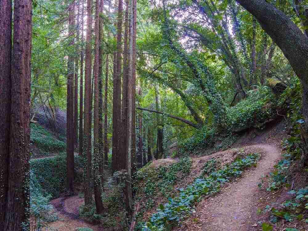
7. Joaquin Miller Park
Joaquin Miller is a gem within the confines of SF chaos. It’s located in Oakland and has about 14 miles of singletrack with two pretty legit descents: Chaparral and Cinderella. Big Tree is super fun, too.
Joaquin Miller is the kind of zone that you can do a few laps in and not get tired of the same trails. The trails are multi-use, so be prepared to share them with hikers, dog walkers, horses, and joggers.
Things to Know:
- This is a very popular park. Watch out for pedestrians and other traffic on the trails
- Do not leave any valuables in your car. This area is known for being a little sketchy
Route recommendation
>> Big Tree & Cinderella Loop
This route covers a wide range of trails in Joaquin Miller Park from mellow and meandering doubletrack to a rowdy descent down Cinderella. Since the network is packed in tightly, you can modify this loop however you want.
Route directions: Joaquin Miller Parking > Sunset > Sequoia-Bayview Trail > Connector > Big Trees > Steps and Stones > Dunn > Baccharis > West Ridge > Scout Trail > Castle Park > Cindarella > Sunset
Make it shorter: If you want a shorter ride or minimize the climbing then skip Dunn and West Ridge.
8. Crockett Hills
I haven’t ridden Crockett Hills, but several people have mentioned it in the comments, so I figured I should add it. Sounds like Tree Frog and Sugar City are the highlights.
The photos also look beautiful!
Route recommendation
>> Ride the Crockett Hills
I have not ridden this route, but Crockett Hills is small and it looks like this link-up hits the two highlight trails: Tree Frog and Sugar City
It was also created by YouTube star BKXC, so I trust it 😉.
Route directions: Crockett Hills Parking > Edwards Creek Trail > Wood Rat > Soaring Eagle > Sugar City > Big Valley Rd. > Tree Frog > Big Valley Trail > Soaring Eagle > Edwards Loop Trail
9. Shell Ridge
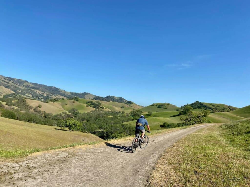
If you’re looking for a mellow pedal through the East Bay’s stunning hills, Shell Ridge is a great place to explore. It’s the perfect place for beginner mountain bikers in the bay area.
There’s no singletrack here, but the doubletrack roads (closed to motorized vehicles) are still fun to pedal along and the views are beautiful.
Try to ride this area in the spring when the hills are lush and green and dotted with wildflowers.
Things to know:
- There is no singletrack here, it’s all doubletrack
- There’s a 15-mile-per-hour speed limit 🙄
- Share the trails with hikers and equestrians
- There are a lot of gates to go through. Please close them behind you.
Route recommendation
>> Shell Ridge Loop
This route starts with a climb up to the foothills of Mt. Diablo. You’ll definitely feel like you’re pedaling uphill, but it does roll well with some fun descents along the way.
At the top, there’s a slightly technical descent down into a beautiful wooded area and then it’s more rolling singletrack to finish the loop. The descent back to the car is fast and winding. Watch your speed and look out for hikers. I really enjoyed this loop even though it’s not singletrack mountain biking.
It would be a great ride with the family or a mellow weekend pedal with friends.
Shell Ridge Loop on Trailforks.comRoute directions: Marshall Drive Parking > Briones to Mt. Diablo > Well Point Fire Road > Dusty Road > Stage Road > Briones to Mt. Diablo
10. Mt. Diablo
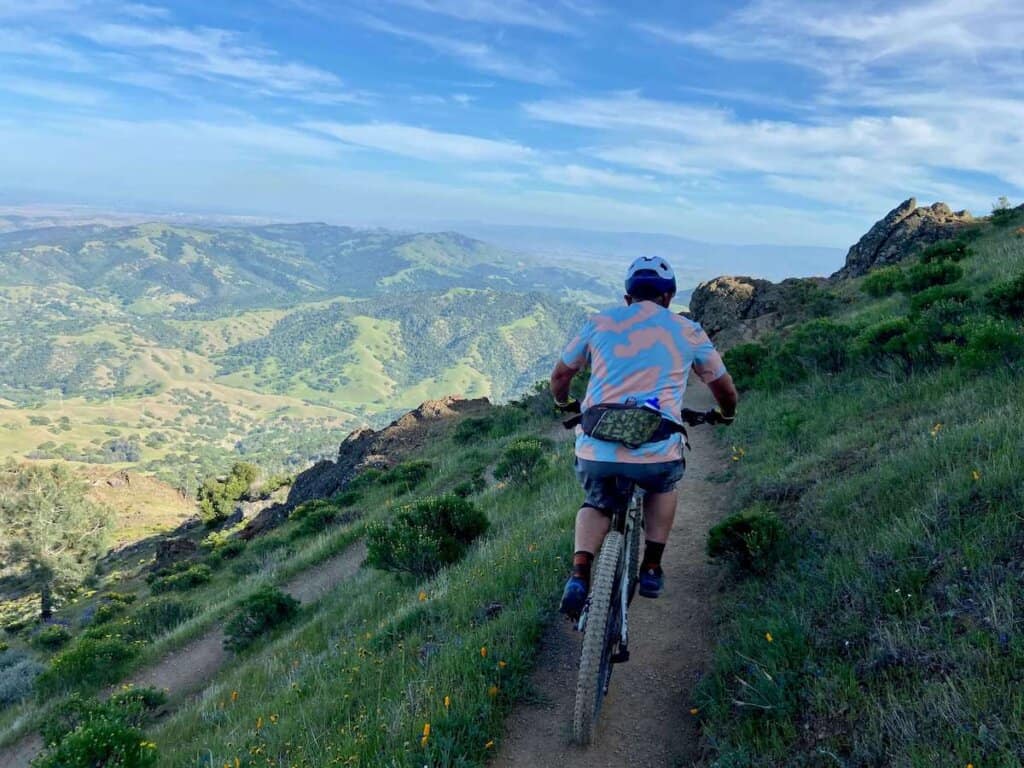
Mt. Diablo is a 3,849-foot peak that stands tall above the East Bay of San Francisco. The drive up to the top is worth doing even if you aren’t planning on mountain biking. It’s a stunning road and the views from the top are spectacular (although the smog is a bit of a drag…)
As far as mountain biking goes on Mt. Diablo, it’s quite underwhelming. There is definitely more potential than actual trail (remember, people in the Bay Area aren’t stoked about mountain bikers).
Most ‘trails’ open to mountain bikers are on fire roads that either climb straight up the mountain or descend straight down.
There is one legal 2-mile stretch of singletrack that is fun while it lasts. The Summit Trail is a moderately technical descent with awesome views and some tight switchbacks. It’s also quite eroded in places, which gives it an extra level of excitement.
But the main bummer is that there’s nothing really to connect the Summit Trail into unless you’re willing to beat yourself up on steep fire roads.
Maybe someone here can chime in on a good way to link up a fun route on Mt. Diablo?
RELATED POSTS
Looking for more great riding around California? Check out these other mountain biking trails and networks:
What are your favorite Bay Area mountain biking trails or networks? What would you add to this list? Let us know in the comments below!

If I wanted to go to those trials and the bike park, where would I go/and park?
The trails I mention in this post are spread out across the Bay Area, so there’s no one place to go or park. I recommend downloading the TrailForks app or looking at the TrailForks website to get a better idea of where each network is.
Hi Becky,
I’ve been reading your posts/adventures for quite awhile now and have thoroughly enjoyed them (and agree with most of your thoughts about the trails I’ve had the pleasure of exploring (Hurricane, Bend, Downieville, Bentonville, Sedona, Hurricane, Dupont, etc.). Since you included Soquel in Santa Cruz, another Demonstration State Forest to the north in Mendocino County is the Jackson (JDSF), an area highlight. The claim is almost 100 miles of trails (https://mendocc.org/content.aspx?page_id=22&club_id=270091&module_id=516419) beautifully located in the redwoods (and a bit of the pygmy forest too). Many forest roads (mostly closed to vehicle traffic) connect the beautiful flowy singletrack trails. Trails not to be missed include Manly, Forest History, Observatory, Big Tree, Sweet Pea, Lindquist Loops, and Ride Thru.
thanks for all your blogs!!!
Here are a couple ride suggestions:
https://www.strava.com/routes/3122623703454358584
https://www.strava.com/routes/3122622162761281592
Thanks for the tips! I’ve actually heard of Jackson demo forest and was supposed to check it out a few years ago, but plans got derailed. I’ll definitely add it to my list next time I’m back in CA. The routes look great!
Thanks to trail maintenance, Crockett Hills is in good condition right now. I suggest you check it out.
Sugar City and Tree Frog are the highlights. Soaring Eagle, Wood Rat, and Edwards Creek are fun descents.
Thanks for the update!
Great list!
Definitely check out Skyline Wilderness Park (technical, single track and double track), Moore Creek Park (single track and double track, water crossings), and Las Posadas park (more wooded singletrack) in Napa Valley – all possess excellent vistas and great climbs.
Thanks for those tips! I have a lot of riding to do around SF 🙂
Agreed re: Skyline! Just rode it a couple weeks back and it was epic. Just make sure to hit it early before it gets too hot!
Another sort-of-hidden gem is the new-ish Sonoma Ridge trail at Jack London state park. Parking is $7 but if you start from the bottom at the lake service fire road and climb mountain trail up to Sonoma Ridge climb you will be rewarded with a heck of a view of the valley’s, downtown SF from a distance and a super-fun mostly-smooth downhill out-and-back. Check it out!
So I somehow ended up on your blog after a random Google suggestion – I’m hoping I can someday hit a fraction of the places you’ve been outside of the Bay Area!
Ever since the pandemic hit, I’ve been trying to come up with creative, comprehensive routes for as many Bay Area riding spots as possible – on both the gravel bike and the mountain bike. Have you done much riding in Del Valle (Livermore), Mount Tam, or Big Rock Ridge and Ponti Ridge in Marin yet?
Thanks so much for reading! The Bay Area does have some good riding if you’re willing to seek it out 🙂 I haven’t ridden in those areas yet – are they worth checking out?
Hi Becky! I never got notified of your response – glad I checked up!
I feel like each of those places are totally worth checking out. Mount Tam is one of my favorites – there’s actually a decent amount of legal singletrack, and has what I feel is one of the most scenic singletrack descents in the Bay Area (Coastal View).
https://www.strava.com/activities/6956612344
Del Valle is wonderful in the spring, with singletrack rolling through hills covered in green grass and wildflowers. Everyone I’ve taken up there has been blown away by the beauty of it – the singletrack is fun to ride as well!
I’ve been doing it on my gravel bike, but a friend who did the same loop on his MTB was glad he had the extra gearing and tire volume.
https://www.strava.com/activities/6749425930
Big Rock and Ponti intimidated me for a while, as I didn’t think there was a reasonable climb to the top. Turns out the Big Rock singletrack climb is pretty mellow – the grades start to shoot up near the top, but it’s not unreasonable with mtb gearing. The views from the top are some of my favorites in the Bay Area.
I like combining it with Loma Alta, on the other side of Lucas Valley Road. Smith Ridge is a grind of a climb up, while 680 is a fun descent that is part singletrack, diving in and out of tree cover after providing stellar views near the top:
https://www.strava.com/activities/6586916850
Hope these give you some ideas!
Looks like I have some riding to do 🙂 Thanks for the beta!
Lime Ridge on the shoulder of Mt. Diablo has the best singletracks and drops around Walnut Creek area. Intermediate trails you can do laps on (Thorn Alley, Back 9 and Middle), a diy bike park with a couple fun jumps hidden across the street and an old quarry where you find STEEP and fun drops. Crockett Hills has Sugar City and Tree Frog, both good flow with Sugar City the best jumps and Tree Frog a little ponderous and not fast enough for me. Briones has great high speed single track (mostly legal!) that you kind of have to explore to find.
Read your post on Quincy and Mt Hough a while back. Rode that before the recent fire (very sad). Super fun with the shuttle! Thanks for all the info
Thanks, Max! I’ve heard good things about Crockett, but I’ll have to check out the other areas. Glad you enjoyed Mt. Hough – fingers crossed they’ll have the trails cleaned up by next year…
Great summary! You have some elevation typos for the Tamarancho Loop…just doing the loop, there’s about 1550 ft of elevation. Cheers!
Thanks Robin! I updated it 🙂