
Trail Guide: The Palm Canyon Epic In Palm Springs, CA
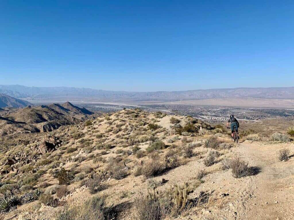
The Palm Canyon Epic is truly an epic mountain bike ride. Nestled amid the ridges and canyons of the Santa Rosa and San Jacinto Mountains above Palm Springs, California, this ride boasts a mix of incredible views, flowy singletrack, rugged backcountry terrain, and more.
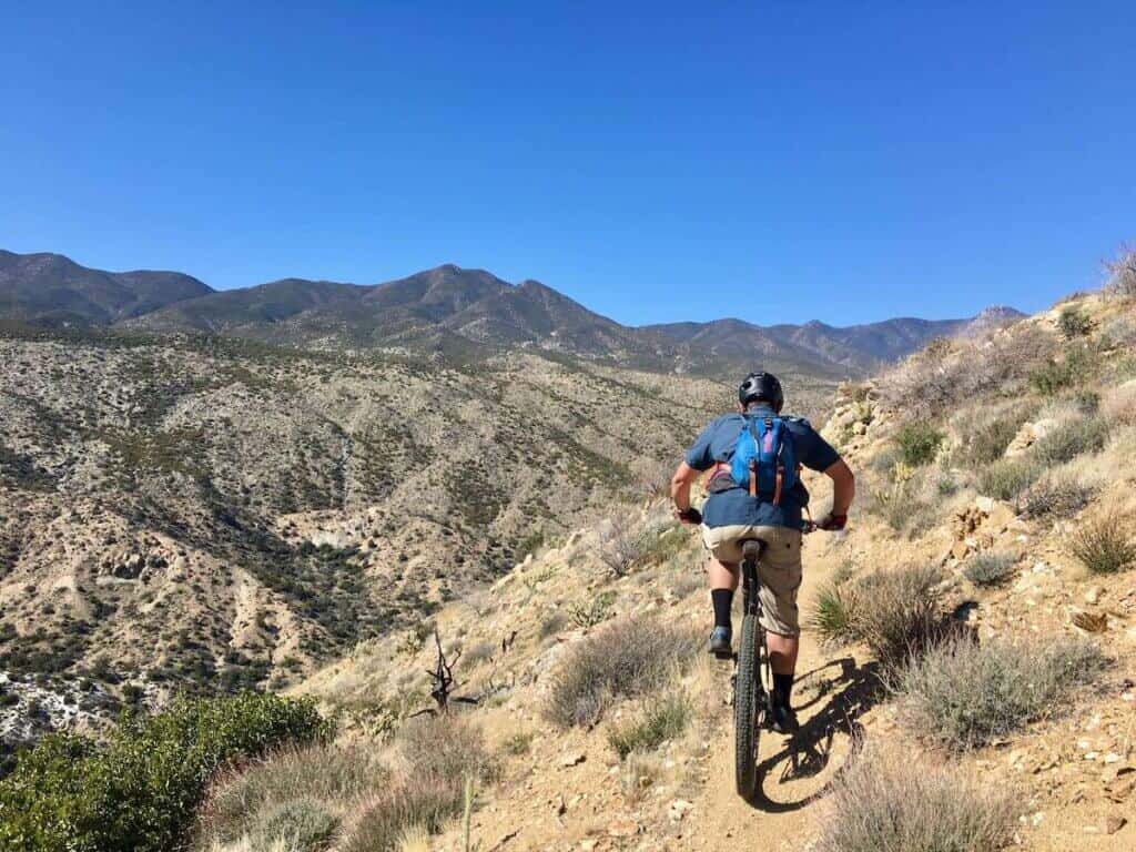
Because of its remoteness and length, though, the Palm Canyon Epic is not a ride for the beginner or the faint-of-heart. It’s a long 28 miles with almost 2,800ft of climbing and several sections of narrow sidehill trail with some moderate exposure (and a lot of cacti).
But if you’re game for a big backcountry day you’ll dig it. The views are incredibly rewarding and the terrain changes every couple of miles to keep things interesting. There are steep, chundery descents, long flowy singletrack along stunning ridges, sandy washes, narrow sidehill, and even a jump line at the top! It’s truly the epitome of an epic ride.
At A Glance
Quick Stats
- Location: Palm Springs, California
- Miles long: 28 miles
- Ascent: ~ 2,733ft
- Descent: ~6,719ft
- Elevation high: 4,306ft
- Time needed: 4-6 hours
*These numbers are approximate and measured by my Garmin Fenix watch
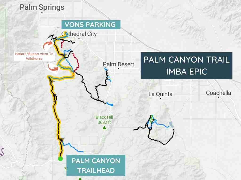
Palm Canyon Epic Map
What to Expect
- This is not a beginner ride. While not overly technical, it’s a big day with lots of climbing and no real options to bail or get help. Once you’ve started you’re pretty much committed to at least 15 miles of rugged, backcountry desert riding.
- THERE IS NO WATER ON THE TRAIL. Do not underestimate how much water you’ll need. Take at least 3L in a hydration back and a water bottle in the cage.
- The Palm Canyon Epic is best ridden during the cooler winter months of November-March. It gets REALLY hot in the summer. I can’t imagine riding the whole thing in 90+ degrees.
- It does snow occasionally in the Santa Rosa and San Jacinto mountains. Check the weather forecast before heading out.
- Respect the privacy of the Native Americans. Do not ride on their reservation land.
Shuttle Options
The Palm Canyon Epic is definitely a shuttled ride. I doubt that even the craziests would attempt to pedal all the way up and then come back down. Some people do out-and-backs on the lower trails, but if you’re doing the full Palm Canyon Epic you need to shuttle. There are a couple of options:
- Shuttle yourself. If you have two cars, this is by far the easiest and cheapest option. There are a couple of different ways to end the Palm Canyon Epic which I’ve covered above, but if you’re doing the classic ride you’ll want to drop one car at the Vons on East Palm Canyon Drive.
- PD Bike & Brews. PD Bike & Brews is a bike shop and pub in Palm Springs and they offer three shuttle times for the PCE with a minimum of 4 people.
- Uber! This isn’t ideal because it takes about 2 hours roundtrip from Vons at the bottom to your vehicle at the start of the Palm Canyon Trail and back down but if you have no other option, a friendly Uber driver has got you covered.
Where to start
If you’re shuttling yourself or relying on an Uber at the end, you’ll need to make your way to the trailhead above Palm Springs. You can park a vehicle and the Vons grocery store in Cathedral City where the classic Palm Canyon Epic route ends.
The Palm Canyon Trail starts at the end of a short access road across from the little community of Ribbonwood. To get there, take route 74 (Pines to Palms Highway) or click here for instant directions!
If you get carsick, you might want to claim the front seat because the drive is very windy. It’s about a 50-minute drive.
When you arrive at the top, you can either park on the access road or there’s plenty of parking on the other side of the highway.
There is another starting point for the Palm Canyon Epic which is at the Pinyon Flat Campground in Pinyon Pines, just a few miles down the road. It’s called the Pinyon Pines Trail and it connects into the Palm Canyon Trail about 3.5 miles in. I have not ridden this section of trail, but it used to be the start of the PCE. It doesn’t get great reviews on TrailForks, so…
Trails that make up the Palm Canyon Epic
The Palm Canyon Trail
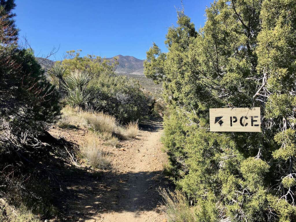
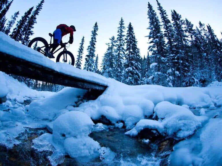
The Palm Canyon Epic starts off with a fast, flowy jump line. I’m assuming that locals have put these jumps and drops in, but I doubt that they are sanctioned by the forest service. Some of the jumps are huge. Nothing is mandatory, though, so keep your speed up and get your flow on! Keep following the signs that say PCE.
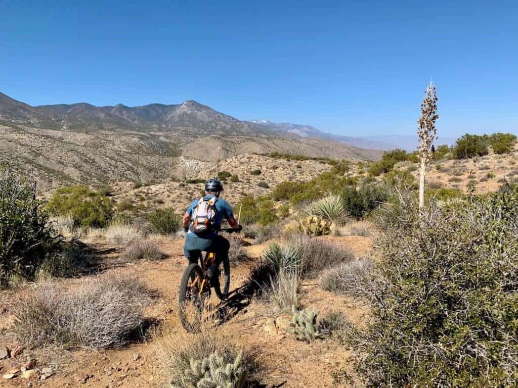
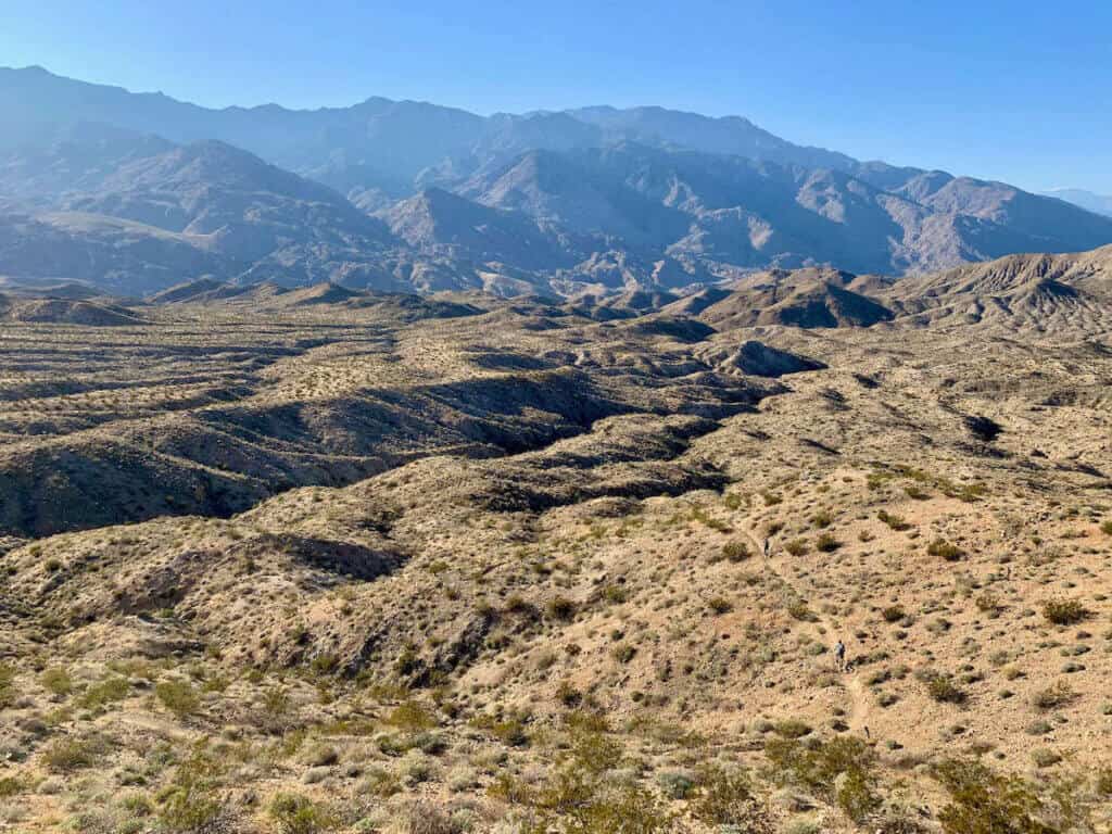
Once you pass through the gate (please shut it after you), there’s a short little hike-a-bike and then the trail opens up onto a beautiful ridge. The views are stunning! From there the trail transitions into sidehill singletrack with some pretty high-stakes sections, so be sure to look where you’re going.
The last time I rode the PCE there was a bit of erosion, making a few sections extra spicy. Try not to go over the edge.
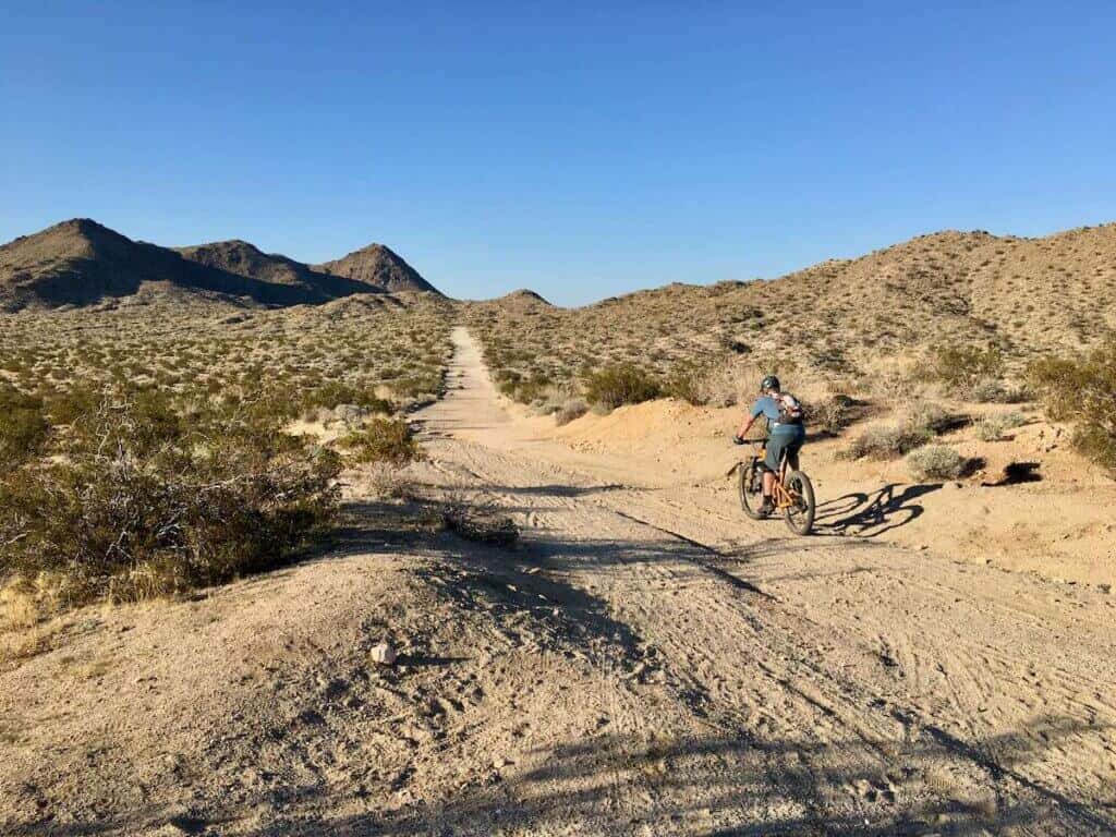
Dry Wash Trail
Toward the end of the first 13 miles, you’ll come to a fork that is clearly marked. To the left is Indian reservation land and mountain bikers are not permitted to ride through unless there is an emergency. There is a sign that points to the right that very clearly says “mountain bikers”. Please respect the tribe’s privacy and follow the signs clearly marked for mountain bikers. This will lead you down a super sandy wash where you’ll come to another intersection and then begins the dreaded three-mile slog…
This three-mile slog is exactly what it sounds like. Three miles of pedaling up a sandy wash. At first, it’s not bad at all. The doubletrack is actually packed down pretty well and the grade is manageable. But it goes on f.o.r.e.v.e.r. Every time you think you’ve made it to the top there’s another bend in the trail and another curse.
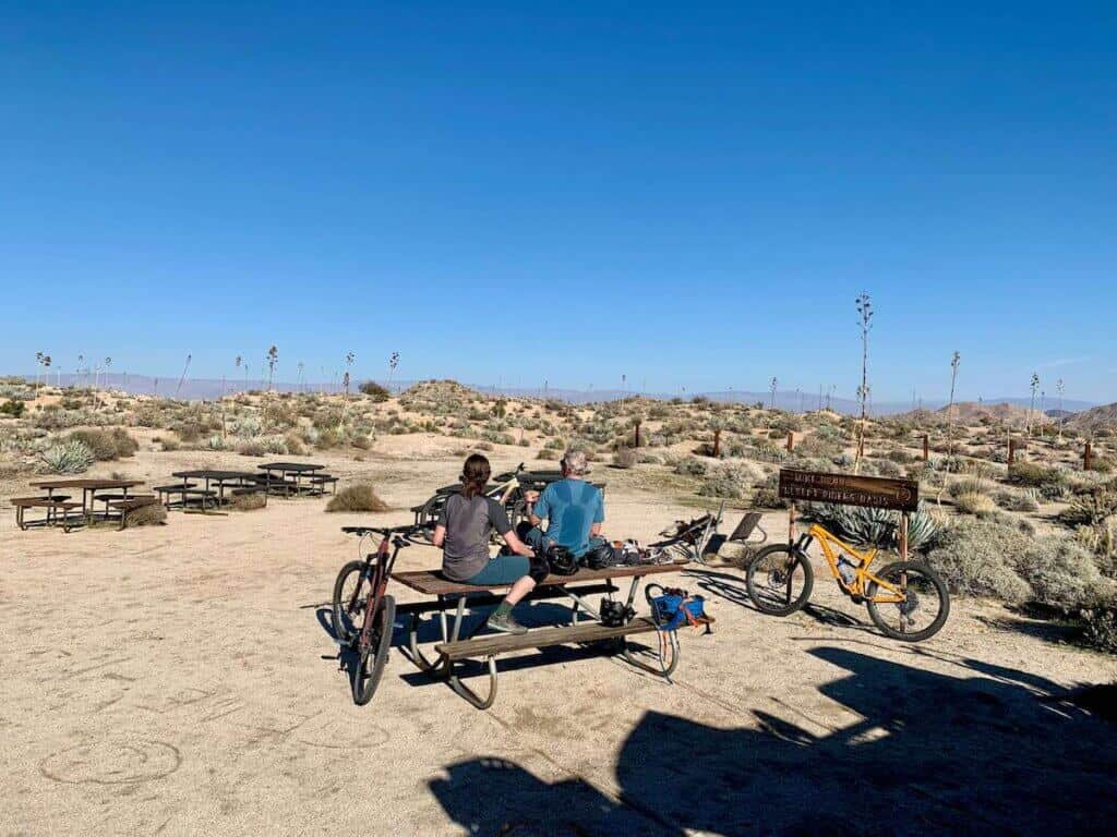
Dunn Road
Once you make it to the intersection with Dunn Road, though, you’re almost there! It’s a short spin up to the Desert Rider’s Oasis for a much-deserved snack break.
Options for ending your ride
Once you make it to Mike’s Oasis, you have options for exiting and finishing the Palm Canyon Trail:
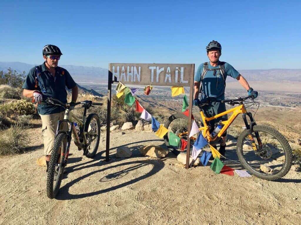
OPTION 1: The classic Palm Canyon Epic is to take Hahn/Buena Vista Trail across from the Desert Oasis to Wildhorse which drops you at Vons grocery store. This is perhaps the most scenic, most amazing section of the whole ride and I definitely recommend choosing this option if it’s your first time riding the Palm Canyon Epic.
There’s a bit of climbing to start (which will have you groaning after riding up the three-mile slog), but it’s totally worth it. The Hahn/Buena Vista Trail is stunning and there’s a truly amazing fast flowy section at the end.
Wildhorse also has a bit of climbing and I would definitely rate it as a black more than a blue because of some of the steep switchbacks down from the top. The final descent down into town can either be on the doubletrack access road or if you’re feeling adventurous you can try some of the hidden locally-built singletrack on either side of the road.
These local trails are known as the Goat Trails and some of them are quite rugged and technical. After 25 miles of backcountry riding you’ll probably be feeling pretty worked at this point, so ride accordingly.
OPTION 2: Option two from the Desert Oasis is to take the Art Smith Trail. I have never ridden this trail, but it gets good reviews on TrailForks. You could then connect that into the Hopalong Cassidy Trail back to Palm Springs. If you did your own shuttle, take into consideration where you parked because this doesn’t lead back to the Vons in Cathedral City!
OPTION 3: If you’re feeling done (or you’ve run out of water) and want an “easier” way out, take Dunn Road back to town. There’s still some climbing involved and I’ve heard that it gets pretty rutted out, but it’s the fastest way down and out.
OPTION 4: A final option is to take the beautiful Hahn/Buena Vista trail and then instead of taking Wildhorse out, take Cathedral. I have not ridden this trail either, but it also gets good reviews on TrailForks.
What to Pack
The biggest concern for the Palm Canyon Epic is water, so make sure you bring plenty with you. Here’s what I recommend bringing with you for your ride:
- Hydration pack with 3L water bladder. I like the Osprey Raven (women’s) or Osprey Raptor (men’s). Bring at least a liter of water per hour you plan on being out.
- Spare tube and/or tire plug kit
- Hand pump w/ CO2 cartridges
- Multi-tool
- Sunscreen (it gets hot out there!)
- Snacks/lunch and hydration powder (the Skratch single packs are great)
- Medical kit (you won’t need it unless you do!)
- Cell phone with TrailForks downloaded
For a more complete list of what to carry in your pack, head over to my post on Mountain Bike Pack Essentials.
Related: Surviving Your First Mountain Bike Trip to the Desert
Final Thoughts
The Palm Canyon Epic is one of the most “epic” of IMBA Epics that I’ve ridden. The views are crazy and the backcountry remoteness of the ride makes it pretty special. It’s NOT for everyone, though, so know your skill and fitness levels.
There aren’t a whole lot of places to bail, so once you start, you’re pretty committed. That being said, it’s an amazing way to spend a full day and it’s a ride that I would gladly do year after year.
Related Posts:
- The Buffalo Creek Loop in Colorado
- The Tahoe Flume Trail in Nevada
- The Hurricane Rim Trail in Utah
- The South Boundary Trail in New Mexico
Have you ridden the Palm Canyon Epic? What was your experience like? What questions do you still have? Leave a comment below!


This looks like an awesome ride. Thanks for the write up. The only thing I would recommend is to use a Garmin (or other GPS) with the route downloaded. My Garmin will last a few days out in the wild, but my iPhone will only last a few hours (shorter than that) if I’m relying on it for navigation.
Good point! I’ll add that tip when I update this post.
Hey! I’m doing this ride this weekend for the first time and it looks like there’s some rain in the foercast a couple days before and also the day of, but nothing over 40% at the moment. Do you know anything about how that area handles the rain? I know it can help in the sandy spots but don’t wanna hit mud or flooded areas or anything.
Hi Henry – there are definitely some canyons and steep sidehill sections that have the potential to get flooded or eroded. I’d say if the rain is really heavy, it’s best to wait a few days. If it’s just some normal showers you should be fine. Have fun!
Great post w a lot of great info! Thank you!
Glad you found it helpful!
Thanks for this long post. You are in cred contention with Mountain Bike Bill. Most of the trail is in BLM ownership, but I believe the south (top) trailhead is on private land. Recently Friends of the Desert Mountains (a private conservation organization) purchased the land the PCE traverses in its first few miles, after the private landowners. They have great concerns with the increasing side trails that occur near the “official” trailhead. They have requested assistance from Desert Trails Coalition (a group organization of horse riders, hikers, and mountain bikers) to encourage better and more sustainable use. To that goal, DTC is developing a plan to improve the south trailhead and signage along the PCE.
Thanks for that update, Tom! I did notice the last time I rode the PCE that there were more side trails and features near the top. Hopefully, the DTC can work with the private landowners to come up with a sustainable solution ?