
The South Boundary Trail: Trail Guide to New Mexico’s Classic MTB Route

New Mexico tends to fly under the radar when it comes to mountain biking (and outdoor adventure in general), but it’s got some seriously good riding if you know where to look. One of the state’s most iconic trails is the South Boundary Trail, an IMBA Epic that delivers 21 miles of high-country singletrack through aspen groves, pine forests, and rugged backcountry terrain.
Just outside the artsy town of Taos and a stone’s throw from Angel Fire (one of my all-time favorite bike parks) this shuttled ride starts at a lung-busting 10,500 feet and gradually descends the slopes of Mt. Osha. While it’s not my favorite trail in the world, it’s absolutely worth checking out if you’re in the area for a few days.
From mellow sidehill to fast, techy descents (the last few miles get spicy), the South Boundary Trail offers a bit of everything. Sound like your kind of ride? Keep reading to get all the trail beta.
The South Boundary Trail at a Glance
Remote backcountry riding, beautiful aspen groves, sweet and fast singletrack
What I like about the South Boundary Trail
What I don’t
Quick Tips
For riding the South Boundary Trail
TWW Take
Please note that these are my personal opinions – you may argue otherwaaaaise! And if so, state your case (politely) in the comments 🙂
Fun-ness Factor
Trail Variety
Average Difficulty
Preparing for your South Boundary Trail Shuttle
How to shuttle it
You can self-shuttle if you have two vehicles, but I recommend booking a shuttle with Shuttle Taos. The drive takes over an hour and the last part is on a very rough fire road that I highly recommend having a 4×4 vehicle for.
Tip: Want to ride Angel Fire and Taos Bike Parks without spending extra money? Grab a Loam Pass! It gives you a free shuttle up South Boundary Trail and two free days at both bike parks.
South Boundary Trail Map
What to expect from top to bottom
The South Boundary Trail is best ridden as a shuttle starting from the high-elevation trailhead near Osha Pass and finishing just outside Taos. Here’s how the ride breaks down, mile by mile(ish):
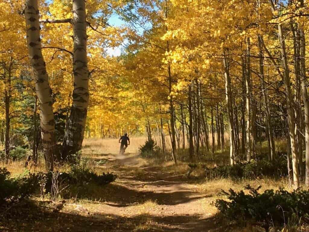
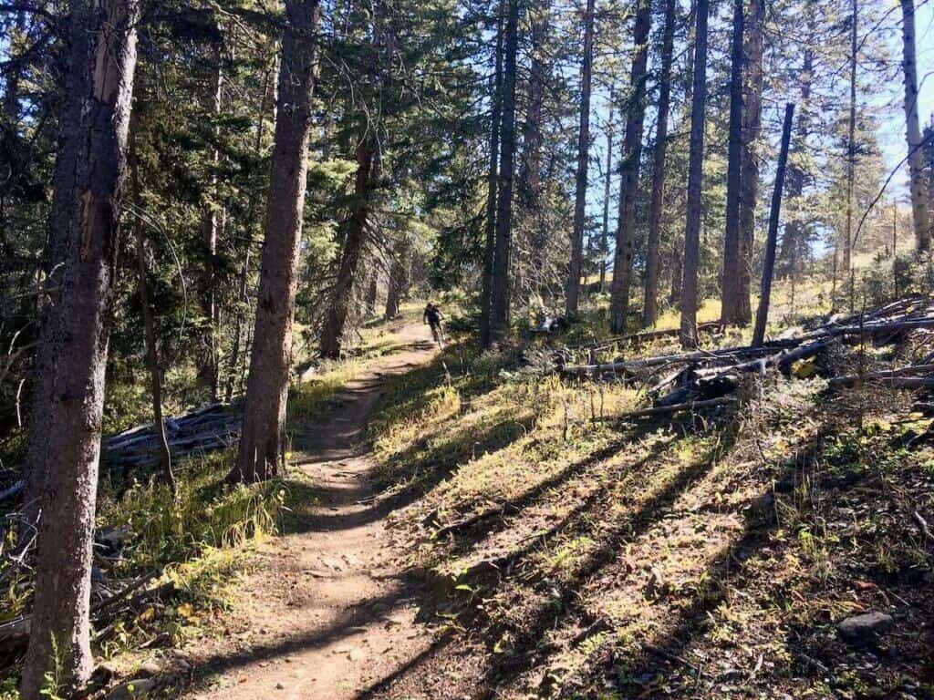
Miles 0–1: Osha Pass
Update: Good news! It looks like there’s now a new shuttle drop-off point that skips the brutal 800-foot slog up Osha Pass. Instead, the ride now starts with a much more manageable 1-mile, 200-foot climb on a trail called Jarocito on TrailForks. I haven’t ridden this new section yet, but honestly, it sounds way better than the sufferfest I endured. If that’s the new standard drop-off, consider yourself lucky!
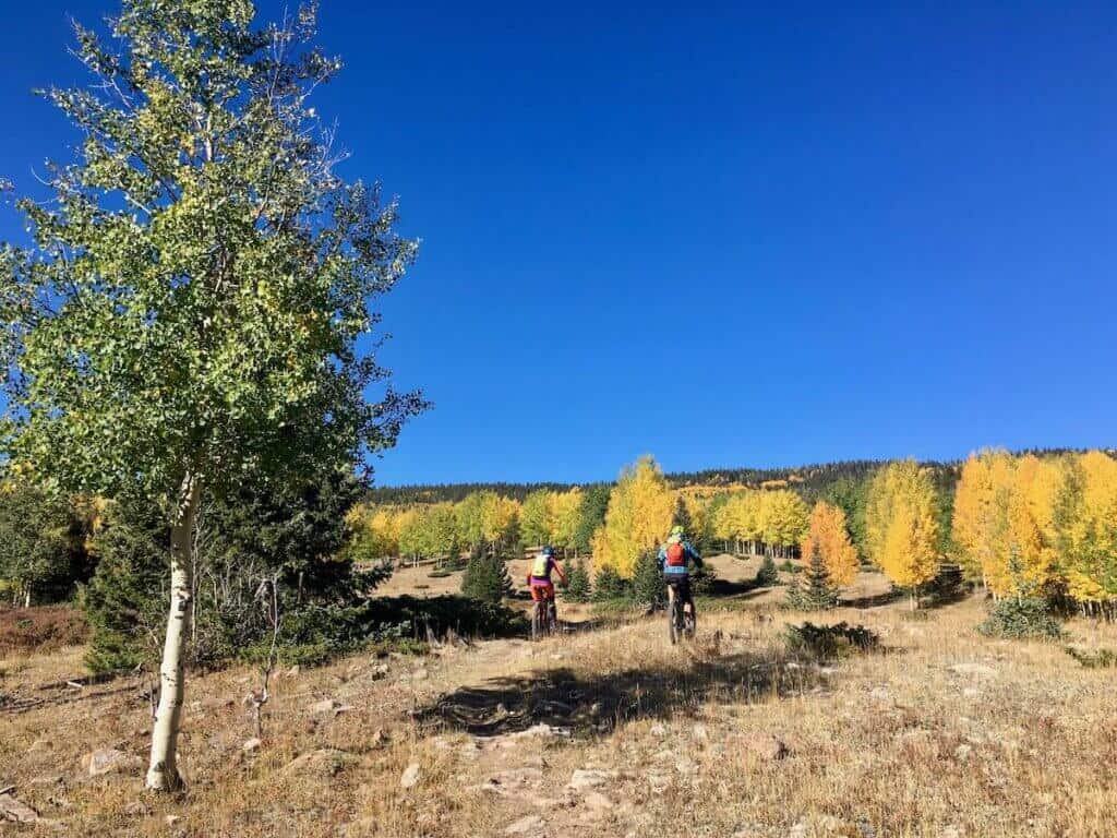
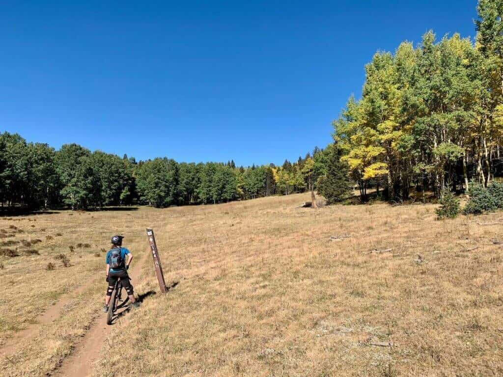
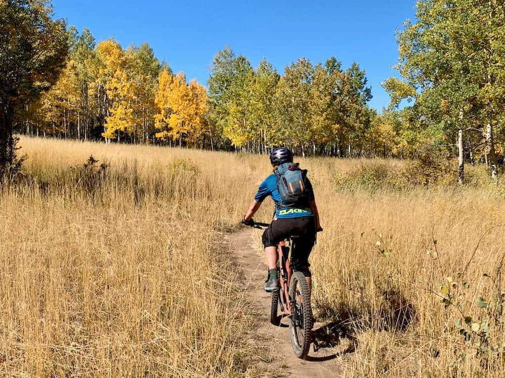
Miles 1–17: The South Boundary Trail
Miles 17-21: El Nogal
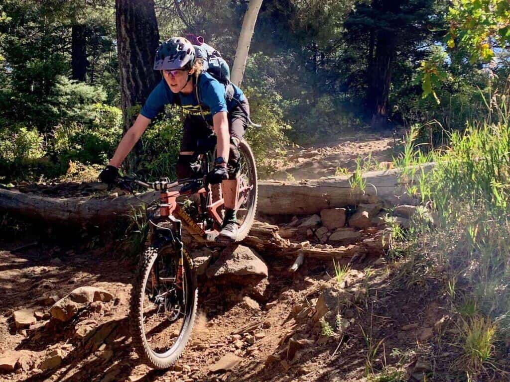
Ojitos Trail Optional Finish: The last four miles of the South Boundary Trail are pretty steep, rocky, and full-on. If you want to bypass this section and finish on a mellower note, you can take Ojitos trail. I haven’t ridden it personally, but from what I read, it seems like an easier way to finish the ride.
FAQs for riding The South Boundary Trail
Got questions? I’ve got answers! Here are some helpful tips for riding TSBT in Taos
Need gear recs?
Head over to my gear closet! I’m always testing out new pieces of bike gear and if I really like them, they earn a place on this page.
I give the South Boundary Trail a 2.5 out of 5 on the IMBA Epic scale. While it has its moments, like the dreamy Heaven on Earth section and the rowdy El Nogal descent, it’s mostly a pedaly cross-country ride with long stretches of smooth, somewhat repetitive singletrack and very few standout features. The middle 10-ish miles, in particular, kind of blurred together for me, and despite the elevation, there aren’t many sweeping views or dramatic overlooks.
That said, the forest itself is beautiful, especially in the fall when the aspens are popping. If you’re someone who enjoys long backcountry rides with a remote, peaceful feel (and you don’t mind a bit of a grind) you might love this trail. But if you’re chasing technical features, fast flow, or big-mountain views, it might fall a little flat.
Still, it’s a classic New Mexico ride, and checking it off the list is part of the fun. Ride it for yourself and see where you land!
Have you ridden the South Boundary Trail? What did you think? Let me know in the comments below!


I love hearing from you and appreciate your comments! However, if you leave a rude, unconstructive, or spammy comment, it will be deleted. It’s cool to be kind. Have an awesome day!