
How to Mountain Bike The Buffalo Creek IMBA Epic Loop in Colorado
Denver has no shortage of great mountain biking, but Buffalo Creek is a local (and personal!) favorite. Just about an hour southwest of the city (traffic willing…), this trail system is packed with miles of mellow, flowy singletrack, plus a few pockets of unique rock features if you know where to look (👀 Black Jack). The Colorado Trail even passes through, adding to its bragging rights.
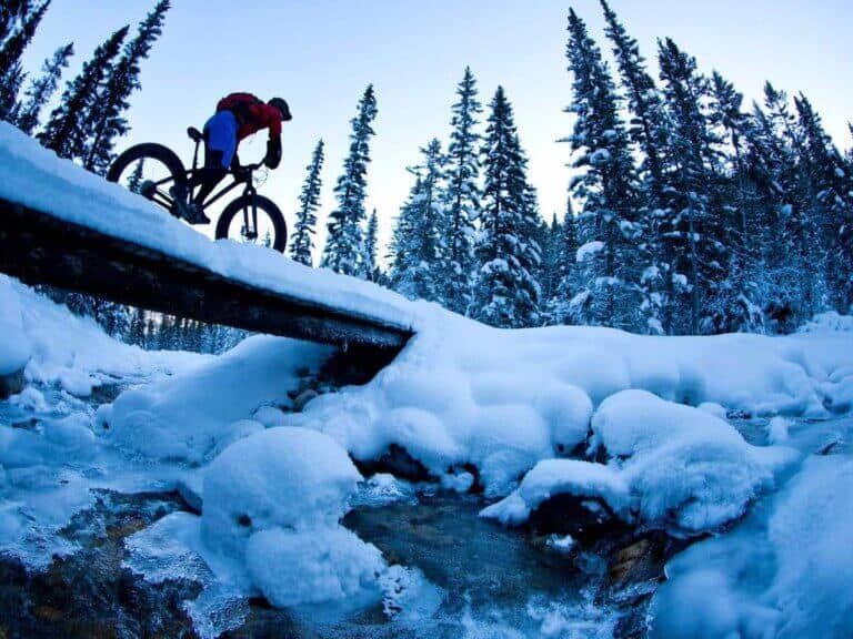
I’ve only ridden Buffalo Creek once, but I went all in with the 24.5-mile IMBA Epic Loop. While all-day XC grinds aren’t usually my thing (I prefer a little more variety and tech) I did really enjoy it and left wishing I had time to explore more.
If you’re planning a ride near Denver and want a taste of classic Colorado singletrack, here’s how to make the most of your Buffalo Creek adventure. whether you’re eyeing the full IMBA Loop or a shorter (and arguably more interesting) sampler.
The Buffalo Creek IMBA Epic Loop at a Glance
A rolling cross-country loop at elevation with great views, fast singletrack & fun downhill finish
Note: There are a lot of ways to ride Buffalo Creek, not just the IMBA Epic Loop. Personally, if I were to ride here again, I’d probably do a shorter ride and focus more on the ‘best’ of Buffalo Creek vs laying down the miles. I give a few other shorter route options below if that sounds more appealing to you, too.
What I like about Buffalo Creek
What I don’t
Quick Tips
For riding the Buffalo Creek Loop
TWW Take
Please note that these are my personal opinions – you may argue otherwaaaaise! And if so, state your case (politely) in the comments 🙂
Fun-ness Factor
Trail Variety
Average Difficulty
Preparing for your Buffalo Creek Rides: IMBA Loop & Other Options
The Full Buffalo Creek Loop
If you only have a day at Buffalo Creek and you want to cover as much ground as possible, the full 24.5 mile IMBA Epic Loop will deliver. I did this ride on my visit to Buffalo Creek and while I enjoyed it, I’m not exactly at XC ‘enthusiast’. If I went back, I’d probably do one of the below routes instead, which offer a bit more variety.
Alternative routes
Where to park: Here are the directions to the main parking area for Buffalo Creek. But depending on which route you do, there are several other parking areas.
Buffalo Creek IMBA Epic Loop Map
Trail breakdown
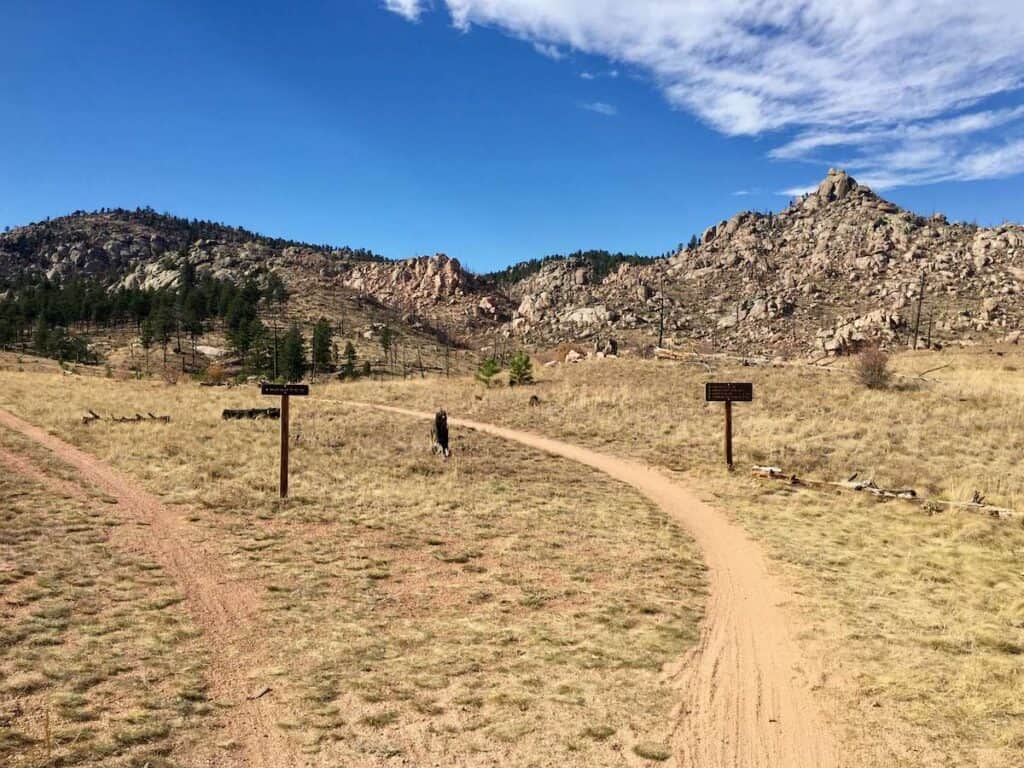
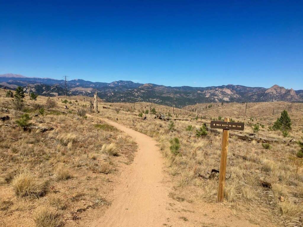
The Buffalo Creek loop starts off along a mellow fire road leading out of the main parking area. The road is flat and a good warm-up spin for the legs. You’ll pass by Sandy Wash on the right, which is the exit at the end of the loop. A bit further on, you’ll see the entrance to Nice Kitty on the left.
Nice Kitty
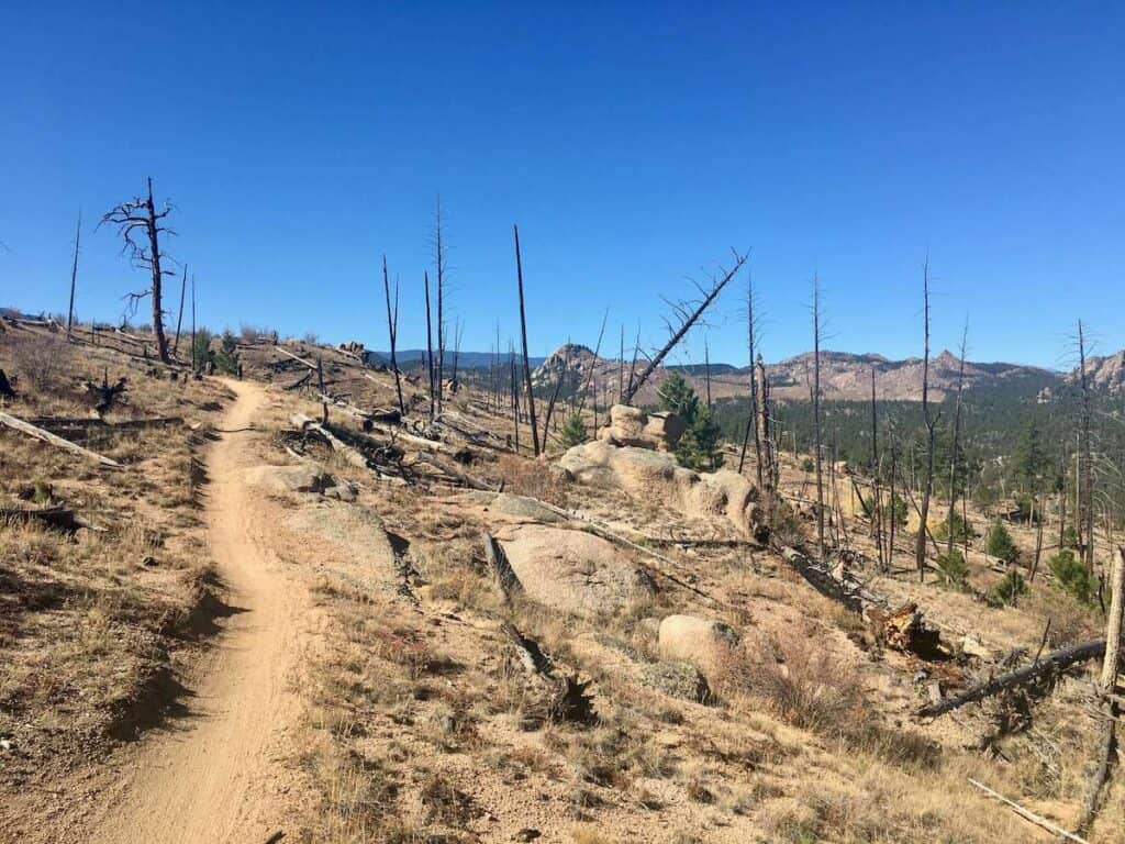
Nice Kitty is the longest and steepest climb of the whole loop, but that being said, it’s not that bad (unless you aren’t yet adjusted to the elevation which starts at 6,700ft and ends at 7,600ft).
The first mile on Nice Kitty is the steepest and actually probably the most technical part of the ride with a few punchy boulders to get up and over and several steep pitches to grunt up. From there, the trail mellows out and switchbacks up the mountain through a huge burned area. Be sure to look back the way you came for awesome views!
Buffalo Burn
After making it to the top of Nice Kitty, Buffalo Burn continues to the right at a slight incline to the Little Scraggy parking area. After spending most of the Nice Kitty climb out in the open through a burn area, Buffalo Burn heads back into the forest for a rolling pedal among the trees.
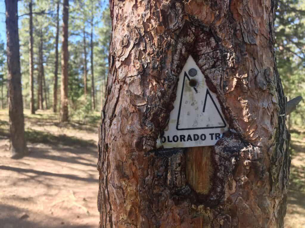
Colorado Trail
By far the largest portion of the Buffalo Creek Loop is spent on the Colorado Trail. The full Colorado Trail traverses the state from Denver to Durango and sections of it are actually part of the larger Continental Divide Trail that spans the length of the US from north to south.
This portion of the Colorado Trail is mostly rolling as you head out from the Little Scraggy parking area. There is one big climb followed by a super fast and fun descent down a wash. Like the rest of the loop, there are really no technical sections on the Colorado Trail. It’s mostly smooth, buff singletrack with rolling terrain.
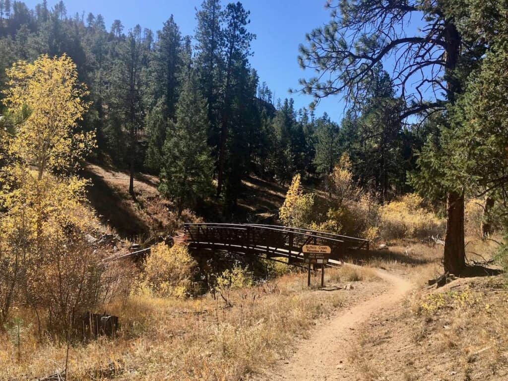
Redskin Creek & Gashouse
After about 8 miles on the Colorado Trail, the loop turns off onto Redskin Creek. There’s an initial fun descent and then it’s a pedal up to Gashouse Gulch parking area. You can choose to stay on the trail or if you’re feeling the miles and elevation, the road leads to the parking area as well.
Gashouse is the final climb of the route and while it’s a 2.5-mile climb, the slope is very manageable and the pedaling is mellow (although there are a few rocky features that may cause your legs to groan).
Charlie’s Cut, Homestead, & Sandy Wash
Once you reach the top of the Gashouse climb, it’s time to descend! Don’t get too excited though, because there’s still a tiny bit more climbing throughout the descent, but for the most part, you can coast back to the car.
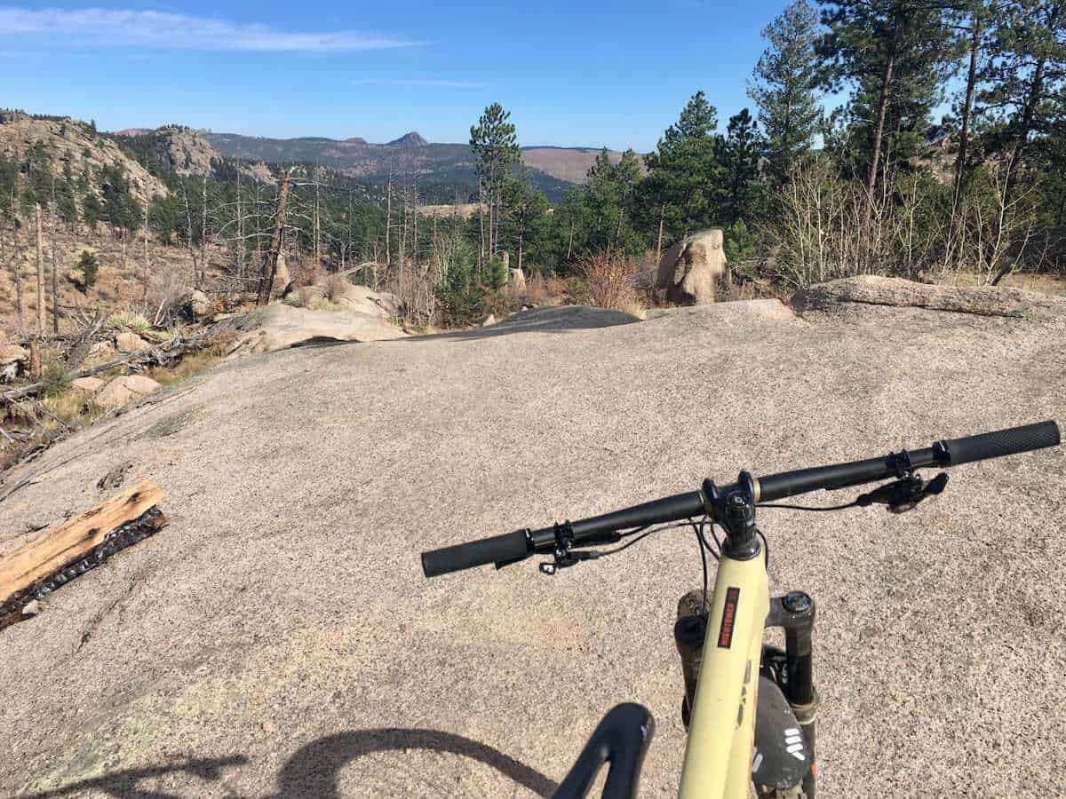
Charlie’s Cut to Homestead to Sandy Wash is a super fun and fast descent through the forest with lots of granite rock rollers, sandy corners, and great views out over the peaks. This is the reason you should ride the Buffalo Creek Big Loop clockwise. If you ride it counterclockwise you’ll have to climb this bomber descent!
Everything on this section is made to be rideable, so there should be no surprises (unless someone didn’t read this post and is riding the loop counterclockwise). The trail will spit you out on the fire road you pedaled in on and then it’s a quick, easy spin back to the parking area.
FAQs for riding Buffalo Creek
Got questions? I’ve got answers! Here are some helpful tips for planning your ride:
Need gear recs?
Head over to my gear closet! I’m always testing out new pieces of bike gear and if I really like them, they earn a place on this page.
The Buffalo Creek IMBA Epic loop and trails are super fun and scenic cross-country rides. As far as ‘epicness’ goes, I wouldn’t say it’s the most epic of IMBA epics. There’s really nothing technical or difficult about this ride other than the miles and elevation.
I’m glad I did it once – and you should definitely ride it if you haven’t already – but if and when I return to Buffalo Creek I think I’ll choose to explore some of the other trails and loops in the area instead.
Have you explored the Buffalo Creek mountain bike trails outside of Denver? Have you done the IMBA Epic Loop? What did you think? Leave a comment below!


I love hearing from you and appreciate your comments! However, if you leave a rude, unconstructive, or spammy comment, it will be deleted. It’s cool to be kind. Have an awesome day!