
Mountain Biking Sedona: Your Ultimate Planning Guide
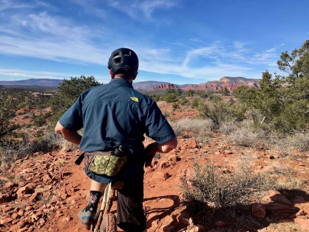
Sedona is hands-down one of my absolute favorite places to explore on two wheels. The incredible landscape, vast network of trails, grippy red rock, and fast dirt make it a mountain bikers playground. Give me the option of mountain biking anywhere in the US and I’d probably choose Sedona.
I’ve ridden this magical place countless times and it never gets old. Maybe it’s the vortex vibes that keep bringing fresh energy?
In this post, I share my favorite trail networks, route recommendations, and a few tips to help you make the most of your mountain bike trip to Shredona.
Let’s ride!
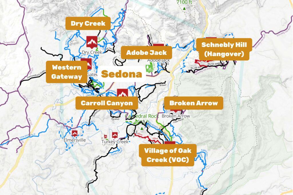
Sedona Mountain Biking Map
Sedona mountain biking is spread out over a number of trail networks. For more info on each trail network including route recommendations, keep reading!
Will you like Sedona mountain biking?
Before you plan a trip to Sedona, you should probably do your due diligence to figure out if you’ll like it or not, right? (Spoiler alert: you will!)
Here are a few reasons why you might or might no enjoy Sedona mountain biking
What to love about it
What to not

Top 10 Mountain Bike Trails in Sedona
People always ask me, “what are your favorite mountain bike trails in Sedona?” It’s a legit question, but it’s hard to answer because there are so many good trails!
If I had to choose, here are my top 10 contenders. If you want more details about these trails including route suggestions, head over to my post on the best mountain bike trails in Sedona.
Sedona isn’t the best place for new mountain bikers, but if you’re looking for some easier trails check out my guide to the best beginner-friendly mountain bike trails in Sedona.
Watch Nate Hills ride some of his favorite trails in Sedona
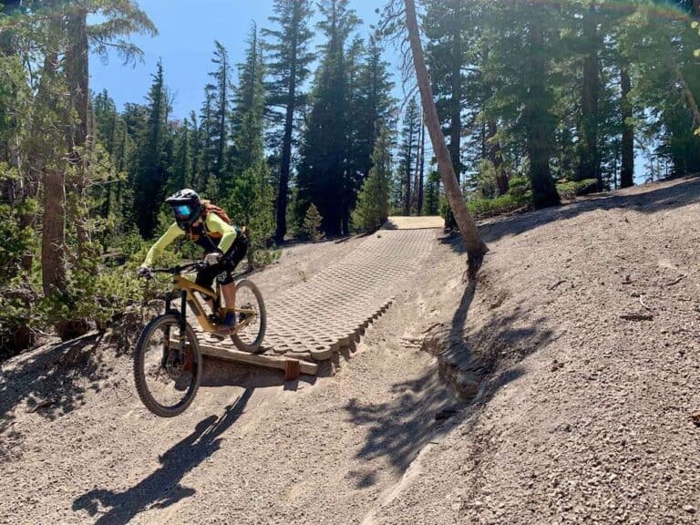
The Trail Networks + Route Suggestions
Now to the fun stuff! The mountain biking in Sedona is broken up into seven main trail networks:
- The Village of Oak Creek
- Dry Creek
- Western Gateway
- Adobe Jack
- Carroll Canyon
- Broken Arrow
- Schenbly Hill
Navigating Sedona’s mountain bike trails: I use TrailForks for my route suggestions and I highly suggest you download the app to your phone if you’re not already a user. It’s $30-something a year and an absolute must if you plan on riding outside of your home trails.
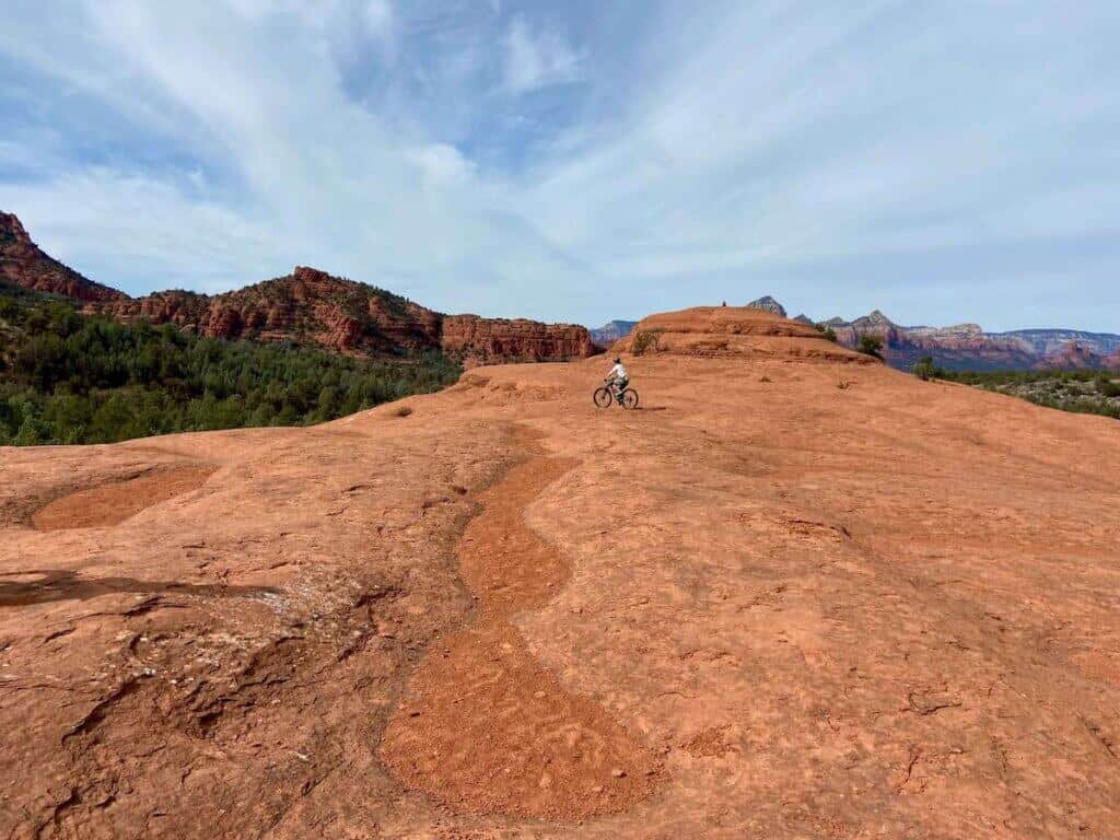
1. Village of Oak Creek

Ride it for:
- Some of the best riding and views in Sedona
- The iconic Hiline Trail
Need to know:
- e-bikes are not allowed. Please respect this
- Trails get very busy – be kind and courteous and practice good trail etiquette
- Hiline is expert-only (seriously)
- A Red Rock Pass is required to park at the main parking areas
The Village of Oak Creek is not technically Sedona, but it’s only a short 20-minute drive away (or an hour-long slog if traffic is terrible…). VOC (as it’s locally called) is a little town in and of itself with bike shops (Absolute Bikes and Bike & Bean) as well as great restaurants, cafes, and many places to stay (I prefer to stay in VOC over Sedona because it’s less busy).
Personally, I think VOC has some of the best mountain biking in Sedona and some of the best views. You’ll find the iconic Bell Rock here as well as the famous Hiline trail. If you only have a few days in Sedona, definitely start in the Village of Oak Creek.
2. Dry Creek
Ride it for:
- More cross-country terrain
- Longer mile days
- Beginner-friendly trails
- Mescal Trail
Need to know:
- e-bikes are not allowed. Please respect this
- Make sure you have a ride plan – you can get yourself into 20+ mile days
Dry Creek is the trail network northwest of Sedona. This area is more cross-country and has less rocky tech (although there’s some of that here too).
If you’re looking for longer days out in the saddle or you’re more of a beginner rider, Dry Creek is a great place to spend a ride or two. Definitely do Mescal Trail – I think it’s one of the most beautiful trails in Sedona.
It’s important to note, though, that you can get yourself into trouble here if you don’t have a ride plan. It’s easy to do a 20+ mile ride and there is no water out on the trail. I’ve definitly done that! Be sure to have TrailForks downloaded to your phone and have a general idea of what your route is. Also, remember where you parked your car – there are multiple trailheads!
3. Western Gateway

Ride it for:
- A step up from Dry Creek
- Fewer crowds than VOC or Broken Arrow
Need to know:
- e-bikes are not allowed. Please respect this
- Make sure you have a ride plan – you can get yourself into 20+ mile days
- Bottom Out is the most technical trail in Western Gateway
If you’re looking for a bit more tech than Dry Creek, I recommend heading south to the Western Gateway trails. This area is definitely a step up, but still not quite as techy or rocky as Village of Oak Creek or Broken Arrow (aside from Bottom Out trail).
The Western Gateway area has seen the most recent trail development over the past few years and Ground Control, Last Frontier, and Ledge-n-Airy are some of the newer trails around Sedona.
Again, make sure you have a ride plan or you might find yourself 10 miles away from where you parked!
4. Adobe Jack

Ride it for:
- A quick lap
- Awesome views
Need to know:
- e-bikes are not allowed. Please respect this
- Parking can be an issue. If there are no spaces at the trailhead, park at the nearby bike skills park
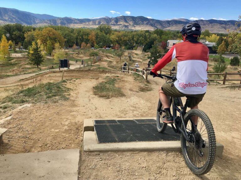
Adobe Jack is a great place for a quick ride or multiple loops if you want to lap Grand Central (so fun!) or Javelina (a bit more pedaly, but still fun). It’s also a nice place to be when the traffic in and out of Sedona is maddening. Bring snacks, though, because the climb up Adobe Jack is on the steeper side.
The Sedona Bike Park is also located near Adobe Jack, so you can do a lap on Grand Central or Javalina and then hit up the skills park.
5. Carroll Canyon
Ride it for:
- Ditch the crowds
- Because you’ve ridden everything else
- The descents down Pyramid, Herkenham, and Ridge are actually really fun and techy
Need to know:
- e-bikes are not allowed. Please respect this
- The only climbing trail is really Old Post, which kind of sucks
Carroll Canyon kind of feels like the black sheep of Sedona mountain biking because it’s not quite as well known or ridden. That being said, it’s a locals favorite and there are some awesome trails.
If you’ve already hit the other trail networks or you’re looking to get away from the crowds, head over to Carrol Canyon and ride Scorpion, Herkenham, and Ridge.
I honestly haven’t found the best way to link up these trails. There isn’t a good climbing trail (Old Post sucks…), so if you ride here, be prepared to work for your descents!
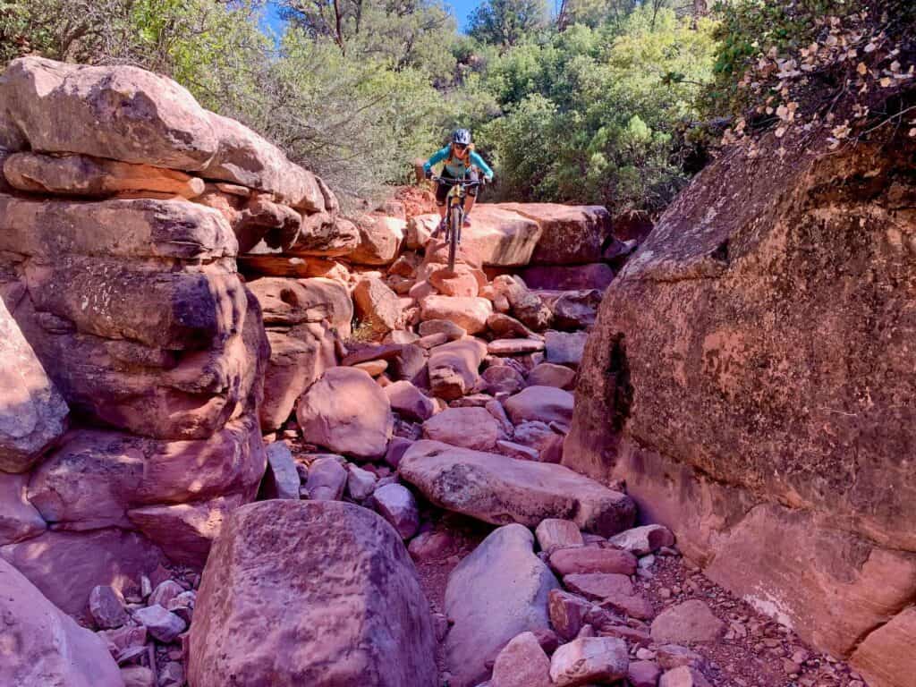
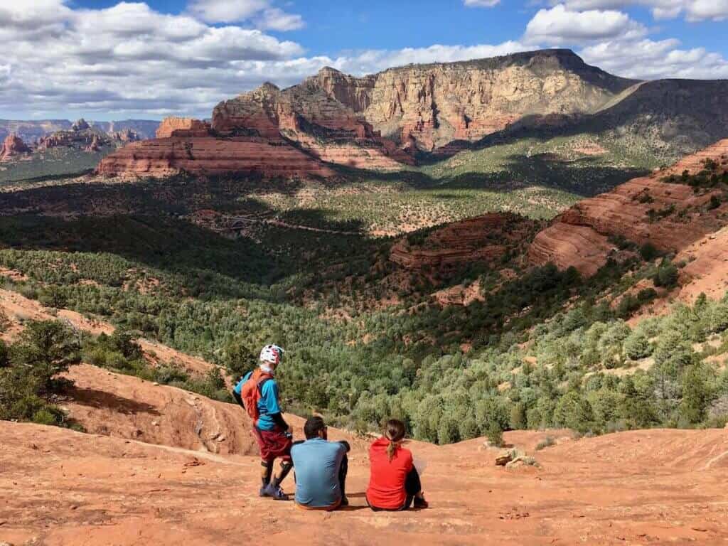
6. Broken Arrow
Ride it for:
- Iconic red rock riding
- Some of the most technical riding in Sedona
- Amazing views from Chicken Point and Submarine Rock
Need to know:
- e-bikes are not allowed. Please respect this
- This is a challenging trail network with some high-stakes sections
- Don’t underestimate the miles here – they’re hard
Broken Arrow is my personal favorite place to ride. It has a great mix of tech, flow, and incredible views. That being said, it’s definitely not the easiest trail network, so I recommend checking out one of the above networks before tackling Broken Arrow so you get a sense of what Sedona mountain biking is all about.
The highlight trails of Broken Arrow are the Hog Trails, which are super fun, but very technically challenging with the potential for high consequences.
Pedaling out to Submarine Rock and Chicken Point are also a must! Chicken Point is where the famous White Line is….
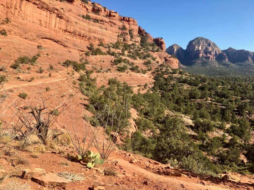
7. Schnebly Hill
Ride it for:
- Views from the saddle
- Hangover is an iconic trail
Need to know:
- e-bikes are not allowed. Please respect this
- Hangover is expert-only with massive exposure
Schnebly Hill is home to Hangover Trail, which is an expert-only trail with extreme exposure that would result in death if you fell. That being said, I do not like heights, and I never really felt unsafe. Just go slow and take your time. Walk if needed. It’s a very unique and beautiful trail with a long, steep red rock roller at the end.
Other than Hangover, there’s really no reason to head to Schnebly Hill unless you want to pedal up to the saddle for the views (which are stunning). It does take some effort to get up there, though!
Read next
Planning a trip to Sedona? Use these guides to help your trip go smoother:
Tips for Mountain biking in Sedona
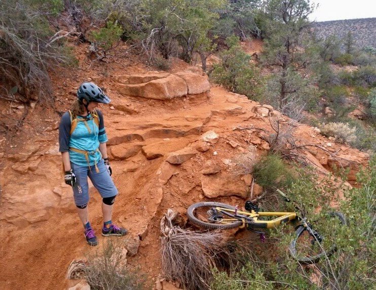
Sedona is an amazing place to ride, but as would be expected, there are a few things you should know before planning your Sedona mountain biking adventure. Here are a few tips I’ve learned throughout all my trips to Sedona:
New to desert riding? Check out my tips on how to survive your first mountain bike trip to the desert.
Sedona Mountain Biking Itineraries
There is SO much riding in Sedona that it can be hard to even know where to start. Below are two rough itineraries to help you plan your trip. If you want more tips and details, let’s chat over Zoom!
The Sedona Sampler
Give Me The Tech!
Sedona Mountain Biking Planning tips & resources
Have I convinced you that mountain biking in Sedona is awesome? It is! But now you need to plan your trip… here are a few helpful tips and resources to help you plan an epic getaway.
Red Rock Pass
Most trailheads around Sedona require a Red Rock Pass. There are self-serve fee stations at the parking areas where you can purchase your pass. And yes, rangers do check and you will get a ticket if you don’t have one.
Red Rock Pass prices are:
- $5 per day
- $15 per week
- $20 for a year
The money goes back into the trails and maintaining the beautiful landscape of Sedona so please pay the fees.
Use your America The Beautiful Pass!

Save on Red Rock Pass fees by using an America The Beautiful Pass. This pass unlocks countless amazing public lands across the US from National Parks to National Monuments, and yes, the parking areas in Sedona.
All you need to do is leave the pass visible on your dashboard before you set off on the trail.
Note that the America the Beautiful Pass does not work at concessionaire-fee sites around Sedona like Crescent Moon Picnic Site and State Parks.
Getting around Sedona
Some sort of transportation is necessary for a mountain bike trip to Sedona. If you don’t have your own car, here are some options:
Flying in? Check out my guide for flying with a bike or shop for a new bike travel bag.
Best Time to Visit
Sedona can technically be ridden year-round since it only occasionally sees snow. However, that being said, temperatures can be extreme during the mid-summer and mid-winter months.
It’s not uncommon for summer temps to top 100° and Dec/Jan lows tend to be around 34°.
The best times to ride Sedona – in my opinion – are the shoulder seasons – March to May and September to November.
Note: The Sedona Mountain Bike Festival happens every year in early March. It’s quite the scene and draws a ton of people. If you don’t want to deal with the crowds, I highly recommend not visiting during the festival dates.
Where to Stay or Camp
Camping
There are several paid campgrounds around Sedona mostly up Oak Creek Canyon. I highly recommend making reservations. There is also some free dispersed camping opportunities as well.
I highly recommend the apps AllStays Camp & RV (Apple) or Campendium (Apple & Android) for finding free dispersed campsites
Hotels
There are lots of great hotels and rentals in Sedona. Here are a few mountain biker-friendly ones:
Book Accommodations & Campsites
Use these affiliate links when booking your accommodations – it helps me keep Two Wheeled Wanderer running. Thanks for your support!
- HipCamp – Find some cool camping/glamping spots. Use the code BECKYT315233 to get $10 off your first booking.
- Booking.com – If you prefer to stay in a hotel
- Hotels.com – Another hotel listing site
- Expedia.com – Can also book cars and flights
- VRBO – For unique home rentals
- TrustedHousesitters – My favorite way to travel!
- Harvest Hosts – Stay at cool venues around the US like wineries, breweries, farms, etc…
And that’s a wrap! I hope I’ve convinced you that the mountain biking in Sedona is world-class. In fact, a lot of things in Sedona are world-class from the views, the food, the tucked-away spots, and more.
It’s one of my favorite places to visit for mountain biking and I think you’ll love it as well.
I hope this post helps you plan an unforgettable trip!
Save this post to Pinterest


What are your favorite trails to ride in Sedona? Do you have a favorite mountain biking route recommendation? What questions do you still have about Sedona mountain biking? leave a comment below!


Hi Etienne – I’ve linked to all my favorite routes in this post, so I recommend starting with these. You can also check out 10 Best Mountain Bike Trails in Sedona for some more route ideas. Have a great trip!
I’m having a hard time finding your recommendations for where to rent mountain bikes in Sedona. We’ll be travelling there in March from Maine – 2 adults and 2 teenagers. We’ll be staying near the Airport Mesa. Can you please advise? Thanks so much!
Hi Danielle – Thunder Mountain in Village of Oak Creek is great. There’s also Absolute Bikes. Both have good mountain bike rentals. Have a great time!
Thank you so much! I really appreciate all your amazing information on this page!
Hi, and thanks for this great info! I’ll be coming to ride Sedona for my first time this November, and I’m curious about tire choice. You mention thorns and sharp rocks and all those hazards. Do you recommend heavier tire casings like Maxxis DoubleDown? or EXO+? I’m from the PNW where we don’t worry about punctures much. I rode Hurricane UT a couple of years ago with regular tires and did not have any flats. Is Sedona a lot more sharp and prickly?
You’ll love Sedona! It’s definitely more sharp and prickly than Hurricane though… If you’re an aggressive rider, an Exo+ front and DD rear is ideal – that’s what I ride. If you don’t plan on riding too hard, the Exo+’s should be fine. Have fun!
Thanks for updating this page. Even better now. I relied heavily on it when I went to Sedona two years ago, and used your routes, so this will help even more the next time we go.
Sedona is great and my wife who doesn’t mtn bike had plenty of things to do (yoga/spa/get her chakras aligned) while I rode.
We stayed at Sedona Real and it’s a great spot to stay. They have a wash station. So many places to ride to from the hotel.
We stayed mid-week, but we passed through on a Sunday going up to Page to see Antelope Canyon (SO worth the drive) and that weekend traffic is no joke. They even had people manning the cross walks.
Can’t wait to go back.
So glad you found my guide helpful! And thanks for adding your tips 🙂
Thanks for the recommendations. I’m looking forward to my first Sedona visit this Spring. Do you have any favorite places to stay?
Hi Jen – Red Agave in VOC is in a great location. There’s also a lot of nice rentals. Have a great trip!
Great resource. Well done.
Done a few of these rides now or similar variants. Mescal loop was my fav so far, I will head back and do the Canyon Of Fools variant tomorrow.
For other readers if you’re like me and have no car while here check out sedonashuttle.com and verdeshuttle.com
Thanks!
Mescal is so beautiful – definitely one of my favorite trails. Thanks for the shuttle recommendation, I wasn’t aware of them. I’ll add a link when I update this post next!
So we just road the suggested Bell Rock to Slim Shady route. I do NOT recommend this direction. If you want great decent start on Slim Shady from VOC. Then ride the suggested Bell Rock route in the blog backwards. There will be some climbing, but WAY less than if you do it from the BR trailhead.
Thanks for your input! The loop can be ridden in both directions. I actually do enjoy riding it counterclockwise (as suggested in my post) because I like technical climbing (which Templeton and the first half of Slim Shady does have). The second half of Slim Shady is then a fun and flowy descent.
If you do it in reverse, the climb up Slim Shady is easier for sure.
I updated the post to let readers know that Clockwise is an option!