
How to Mountain Bike the Whole Enchilada in Moab
The Whole Enchilada is probably the most iconic ride for mountain bikers in Moab. Almost every rider, including me, who makes their way to the red slickrock mecca of Moab does this 27-mile descent at least once (if not multiple times) because it’s that good.
With incredible canyonland views, fast and flowy singletrack, tons of fun features to play around on, plenty of smooth slickrock, and much more, The Whole Enchilada is a must-ride for any avid mountain biker looking for a challenge.
Before you book your shuttle, though, it’s important to know what you’re getting into because TWE isn’t for everyone.
In this post, I cover tips on what to expect, options on where to start, shuttle services, the best time to ride it, and more.
The Whole Enchilada FAQs
Let’s get some of the basics out of the way:
How many miles is the Whole Enchilada?
The Whole Enchilada is 27 miles from the shuttle drop-off at Burro Pass to the bottom of Porcupine Rim.
If you don’t have a car waiting for you at the bottom, then there is another 5-miles of pedaling back to town on the bike path, which is mostly flat.
So technically, the Whole Enchilada is really 32 miles.
Is The Whole Enchilada all downhill?
Nope, definitely not. The climb up Burro Pass itself is about 1,150 feet of climbing and there’s another smaller hill at the start of Hazard County.
In all, The Whole Enchilada has about 1,300 feet of climbing.
How much time do I need to bike The Whole Enchilada?
This depends entirely on how fast you go and whether you stop and session features, but I’d give yourself 4-6 hours to get from top to bottom.
How hard is The Whole Enchilada?
The Whole Enchilada is no walk in the park. The mileage itself is a huge day and the riding is pretty technical by any mountain biker’s standards. I’d say it’s an intermediate rider friendly route that may still be challenging.
You need to have the stamina and skills to climb 1,300 ft (at 11,000 ft), navigate challenging terrain, and be on your bike for 4-6 hours or more.
The ride actually gets harder and more technical (and in my opinion, more fun!) the farther down you go. The last 4 miles of Porcupine Rim down to the river is probably the most technically challenging with steps, drops, and high-stake rollers.
There are options to do a shorter TWE ride, which I cover below.
What’s the best time to ride The Whole Enchilada?
The best time to ride The Whole Enchilada is between October and November. Before October, the temps can still be super warm and after November the La Sal mountains get dumped on with snow. Spring isn’t a great time to attempt The Whole Enchilada either because the top of Burro Pass tends to retain snow until July.
If you’re visiting Moab in the spring or early summer, you may be limited to riding from Hazard County down (which skips Burro Pass).
Many of the shuttle companies will offer shuttles to the top of Burro Pass in the summer (unless there’s still snow) but keep in mind that temps in Moab can reach into the 100°s.
We rode part of The Whole Enchilada as part of our Telluride to Moab trip in August and the temps were brutal.
Are e-bikes allowed on TWE?
No, e-bikes are not allowed on The Whole Enchilada. Please respect this.
Watch this beautiful short film of TWE presented by enve
10 Tips For Riding TWE
Before committing to The Whole Enchilada, I highly recommend reading through these tips to make sure it’ll be one of the best days of your life, not one of the worst:
1. There is massive exposure in places
While the route doesn’t take you super close to the cliff edges, there is definitely massive exposure on some parts of The Whole Enchilada.
I don’t particularly like heights and I never feel unsafe when I ride TWE, but it’s good to know that there are some major drop-offs.
2. Bring More Water Than you think you’ll need
This is a serious one. Bring at least 3L of water and maybe even a bottle in the water bottle cage.
Since The Whole Enchilada doesn’t typically melt out until late spring and can get snow in early fall, you’ll probably be riding it in warmer temps.
Do not make the mistake of not bringing enough water! Almost the entire route is exposed to the sun and there is probably more climbing and hard technical riding than you’ll expect. The desert is unforgiving and some mountain bikers have almost died from heat exhaustion and dehydration.
3. This is not a beginner or even intermediate-level ride
The Whole Enchilada is far from a walk in the park and should not be attempted by beginners. It is an intermediate rider-friendly route that will probably have some sections that will need to be walked.
There is a lot of technical riding and the 27-mile route is more challenging than a lot of people expect. You must have good bike handling skills, good fitness, and be ready for a backcountry adventure.
I would say that The Whole Enchilada in Moab is definitely for the solid intermediate+ rider who can handle steep, loose pitches, rough rock gardens, some exposure, and narrow chutes. It is NOT a beginner ride.
That being said, if you’re a strong intermediate, go for it!
Most people start early in the morning and make it a full-day, casual affair. You can take your time, walk tricky sections, stop for photos and lots of snacks, and truly enjoy what makes this ride so awesome.
4. The ride tops out at 11,177 feet
So yes, the gasping is quite normal.
In all seriousness, though, pedaling your bike above 11K is very challenging and can actually be dangerous in some situations.
Go slow and monitor yourself. Walk if you need to and drink lots of water.
Once you reach the top of Burro Pass, which is about 2.5 miles from the shuttle drop off, you’ll start to descend to a lower elevation.
5. TWE gets harder the farther down you go
This is important to know because the most challenging stretch of the whole ride is the last 4 miles on Porcupine Rim.
This section has steep rock rollers, narrow ledges, punchy climbs, some drops, and other features.
I mention this because you’ll probably be pretty tired – mentally and physically – by the time you reach this section. Keep something in the gas tank.
6. Be self-sufficient
While The Whole Enchilada isn’t the most remote trail in the world, it is pretty far out there and walking out because of a flat tire isn’t really an option.
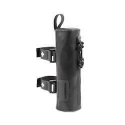
Be prepared and self-sufficient by packing these essentials:
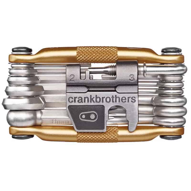
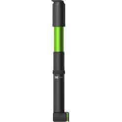
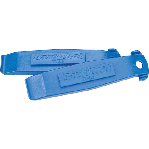
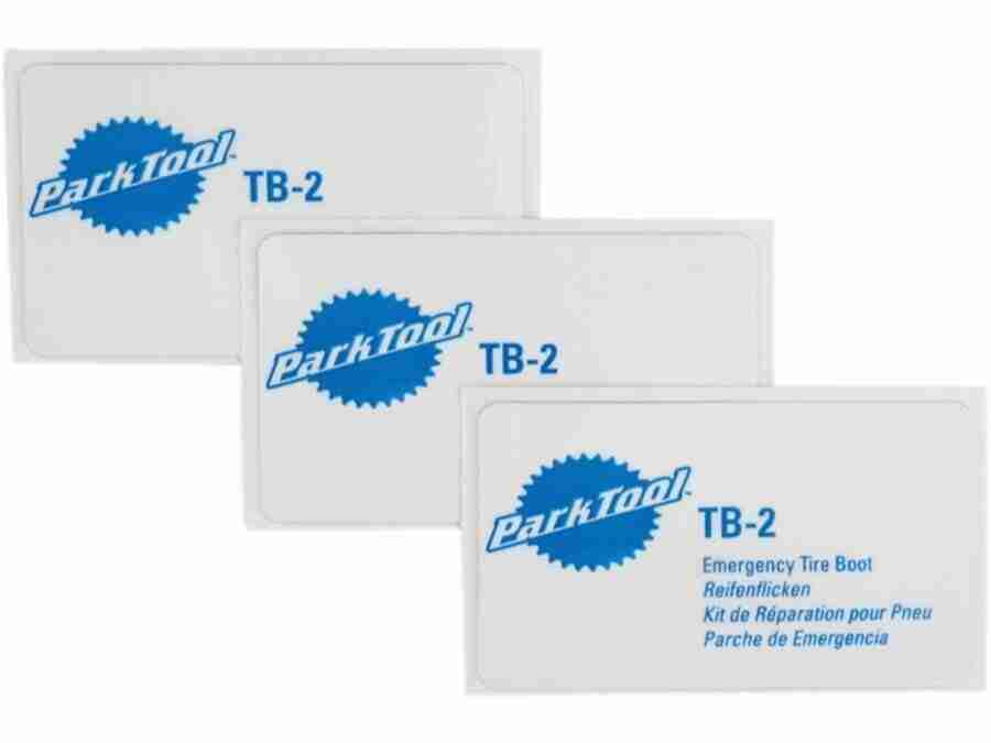
- A multi-tool with a chainbreaker
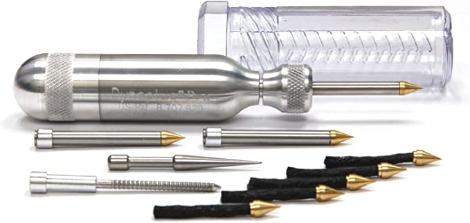
- A tire plug kit
- Hand pump and/or CO2 inflator & cartridge
- Tire levers
- A spare tube
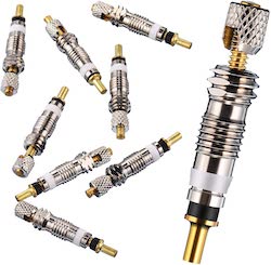
- Spare valve core
- Spare master link
- First aid kit
- Zip ties
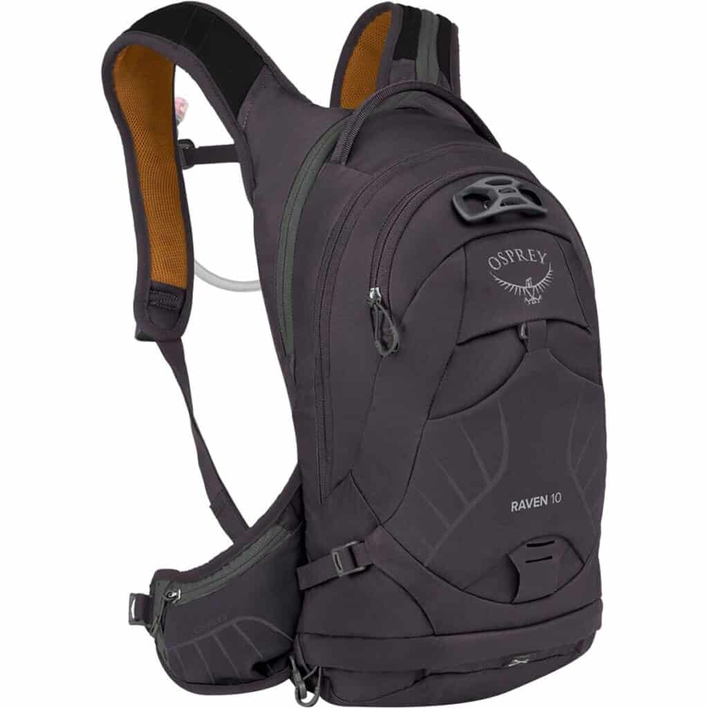
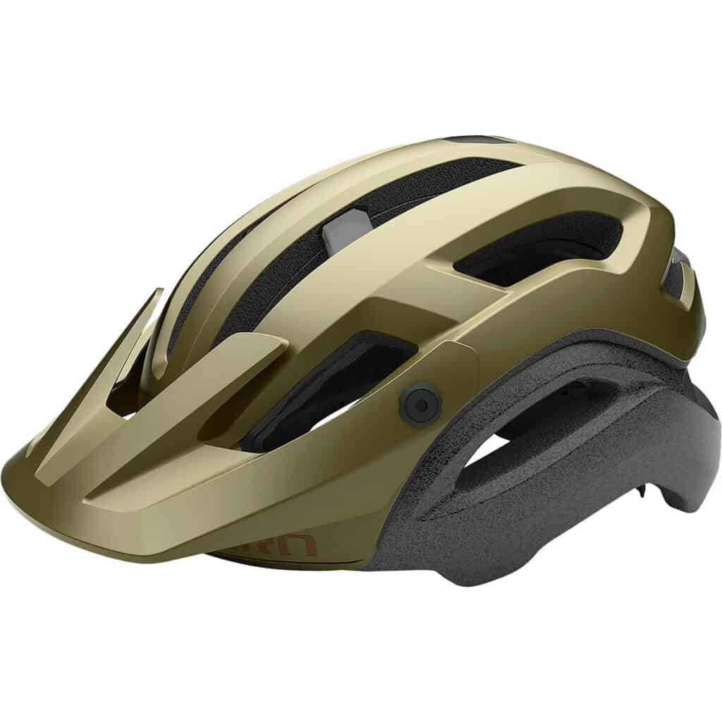
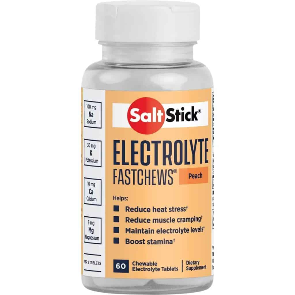
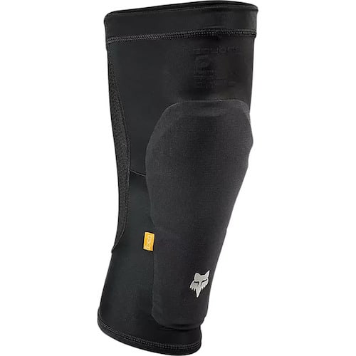
Mountain Bike Packing List
Below are a few of my favorite pieces of mountain biking gear and recommendations for your mountain bike trip or ride:

7. Don’t underestimate the heat
The timing for The Whole Enchilada is tricky because too early or late in the season and Burro Pass will be under snow, but mid-summer the temps are brutal.
Anticipate temps well into the 80’s with no shade cover.
Bring lots of water as I mentioned above, sunscreen, electrolyte tablets, and maybe even a long-sleeve sun shirt.
8. Scope out the alt-lines
For the more experienced riders, there are a ton of sneaker lines along the second half of the trail (i.e. UPS, LPS, and Porcupine Rim).
Take your time exploring the drops, kickers, wall rides, and other features along the sides of the trail.
Each time you ride TWE you’ll probably discover a new alt line and when you link them all together TWE becomes a whole new trail!
9. You don’t have to do the whole thing
The Whole Enchilada is a big day that will be pretty taxing for most riders.
If the full run isn’t in your wheelhouse, you have options:
10. Stop and enjoy the views
It’s easy to get into a flow and fly down the trails that make up TWE (or keep your eyes locked ahead to prevent going over the bars..), but you owe it to yourself to stop and take in the views. They’re spectacular!
The Whole Enchilada Trail Guide
Now for the fun part! Time to ride TWE. Here’s your trail guide to one of the best descents in Moab.
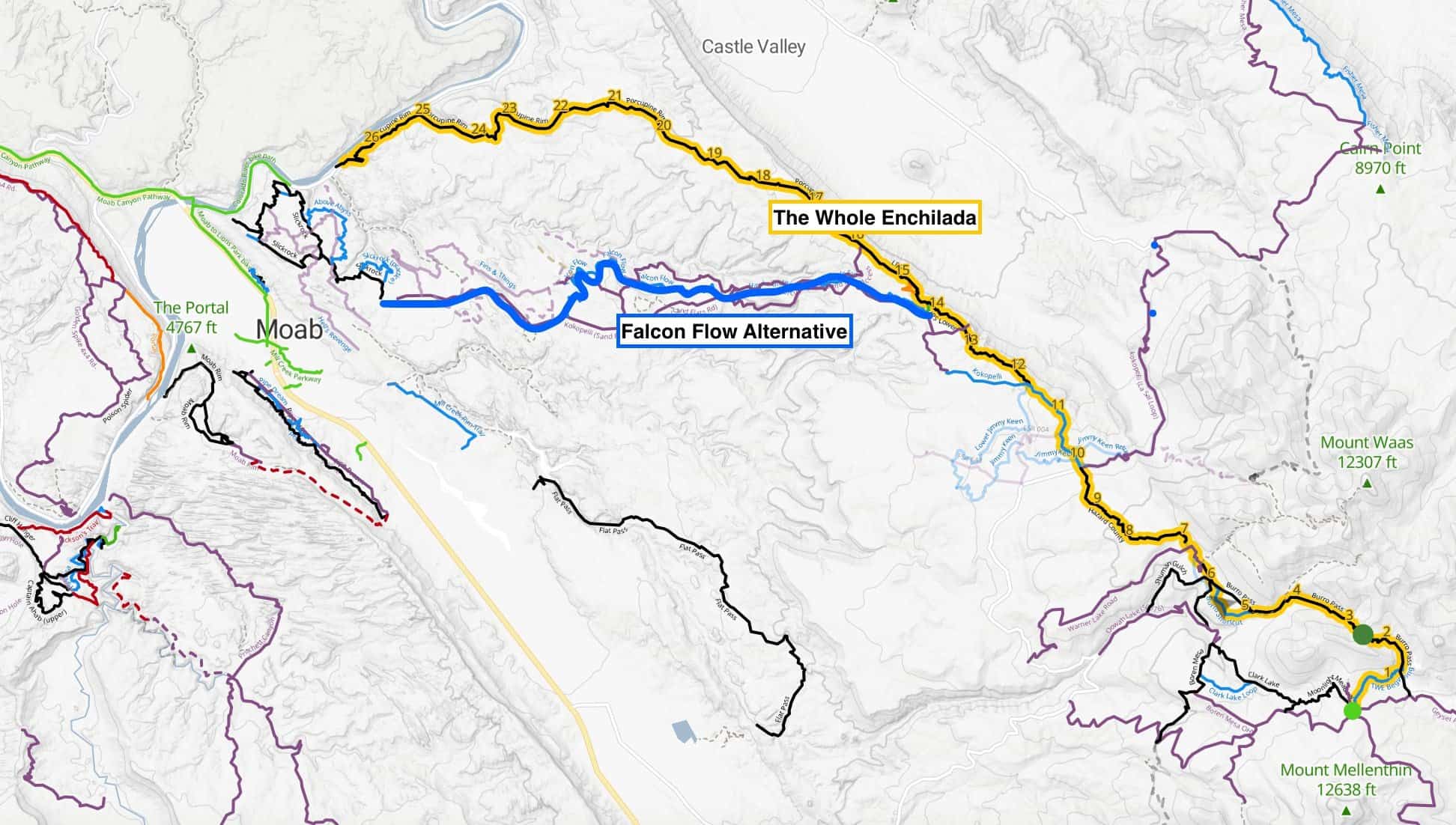
The Whole Enchilada Route
This is the full route from the start of Burro Pass to the end of Porcupine Rim.
Route Difficulty
Mileage
Route Type
Elevation Gain
Elevation loss
MAX elevation
E-bikes allowed?
Map/GPS
Route directions: (Park at your shuttle provider – see options below) > TWE Beginning/Burro Pass > Hazard County > Kokopelli > UPS > LPS > Porcupine Rim > Bike Path
Route notes: There is a 5-mile pedal along a (flat-ish) bike path at the end. Most riders don’t take this extra mileage into account – so really, the full ride is 32 miles.
Make it easier: You can cut out most of the hard-core technical riding by skipping LPS and Porcupine Rim. Instead, when you reach the start of LPS, take the Raptor Route: Eagle Eye trail to Falcon Flow to Sand Flats Road, which will drop you into Moab.
Do less: You can cut out a lot of climbing and miles by skipping Burro Pass and starting at Hazard County. Of course, some people will say that you didn’t ride The Whole Enchilada if you didn’t do Burro Pass, but hey, this is your ride. Any shuttle company will drop you at Hazard County.
Keep in mind, cutting out Burro Pass doesn’t make the ride any less technical.
Trail breakdown
The Whole Enchilada is actually a link-up of several trails in the La Sal Mountain range above Moab. It includes Burro Pass, Hazard County, Kokopelli, UPS, LPS, and Porcupine Rim.
The ‘official’ route starts with a shuttle up to the Burro Pass trailhead at 10,500 ft where you’ll then climb a few miles to over 11,000ft before plunging all the way down to the Colorado River.
Alternatively, you can choose to skip the massive 3-mile Burro Pass climb and instead book a shuttle to the lower Hazard County trailhead. See more information on start options in the shuttle section below.
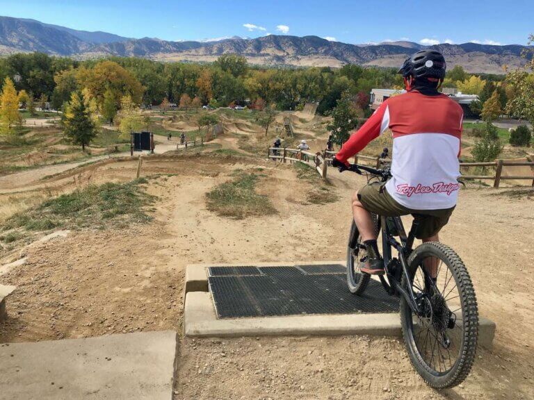
Sorry for the lack of photos – it’s too fun to stop!
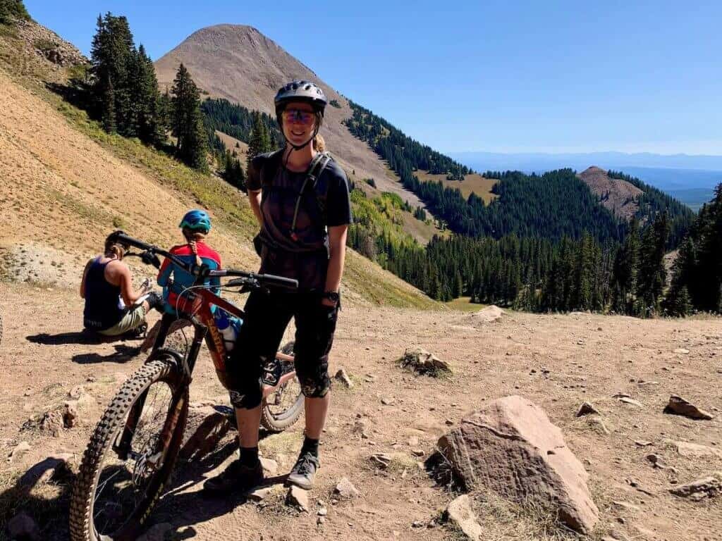
Burro Pass
Burro Pass is the climb at the start of The Whole Enchilada and it is a beast, especially if you’re not acclimated to the elevation.
From the shuttle drop-off point, the climb starts out pretty mellow with some easy pedaling and rolling terrain, but then you get right into it with a grinding climb that lasts f.o.r.e.v.e.r.
Keep in mind that you’re close to 10,000 feet in elevation, so it’s probably going to feel even harder.
BUT the views are stellar, especially once you make it to the top (yay you!). The backside of Burro Pass is super fast, steep, and loose with some tight switchbacks, so check your speed.
Hazard County
Once you make your way down the steep slopes of Burro Pass, you’ll come to Hazard County.
This trail starts with a short climb (not nearly as bad as Burro Pass) and then opens up into fast-linked turns with precariously placed rocks to keep you on your toes.
This section can get pretty rutted out, but it’s super fun with awesome views if you can manage to take your eyes off the trail ahead. There are also some sneaky gap jumps to the side if you’re into getting air.
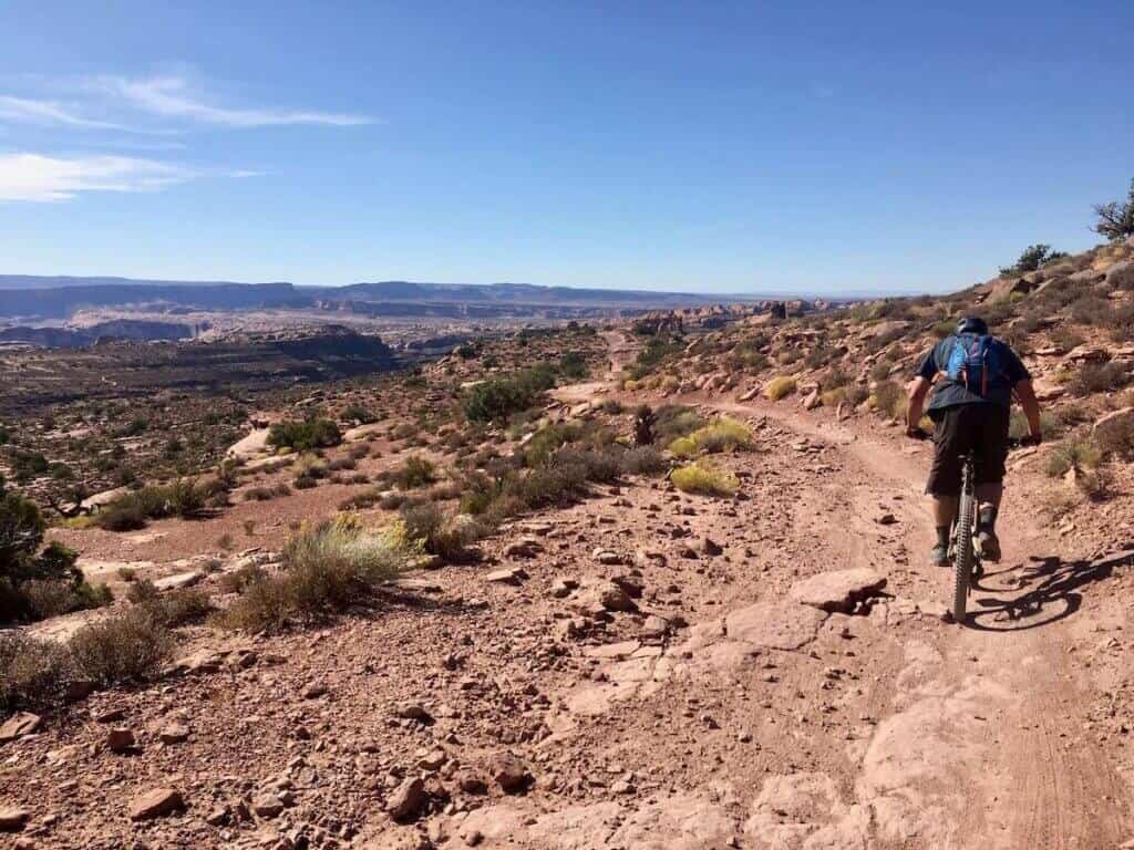
Jimmy Keen OR Kokopelli
At the bottom of Hazard, you have two options: either take the straight, fast and chundery route on the doubletrack Kokopelli Trail or turn off onto Jimmy Keen for 8 miles of hot, flat pedaling (with great views).
Most people keep going straight on Kokopelli, but if you’re feeling like you want to add a few more miles to your ride – especially if you didn’t do Burro Pass – take a left onto Jimmy Keen.
But remember that the whole route back to town without Jimmy Keen is 32 miles and the hardest, most technical sections are still to come!
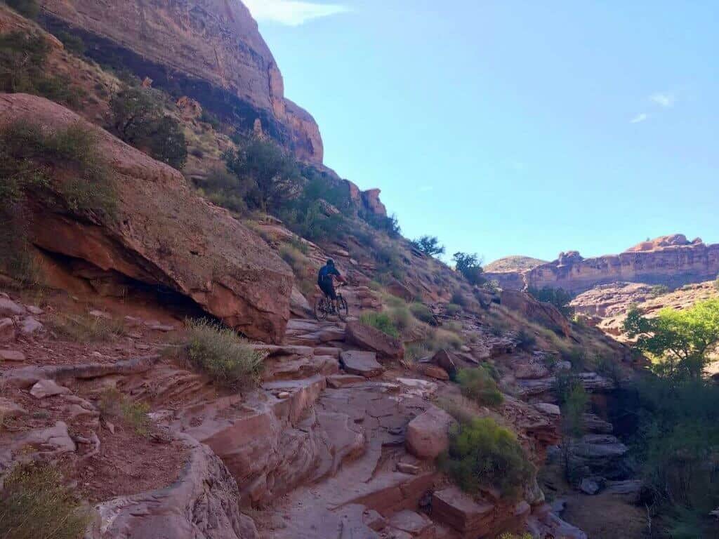
UPS & LPS (Upper & Lower Porcupine Singletrack)
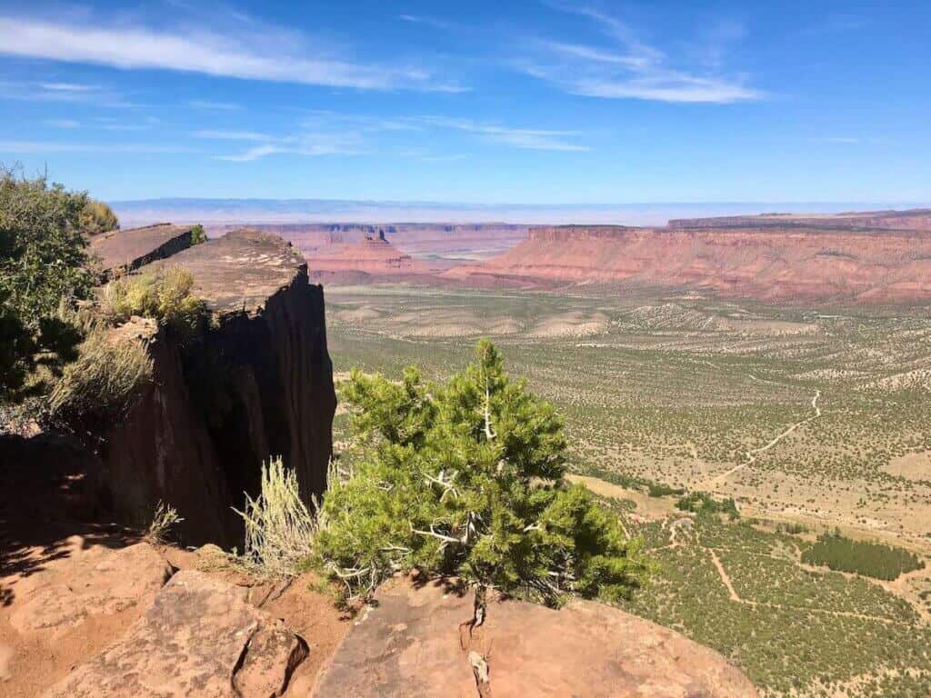
Now things start to get fun! The chunder of Kokopelli turns into the iconic red Moab slickrock and the trail skirts the edge of Porcupine Rim for amazing views of Castle Valley.
There’s a bit of everything on UPS and LPS including tricky drops, swoopy turns, rock ledges, and smooth slickrock.
About halfway down LPS you have a choice of staying straight on The Notch – perhaps the hardest feature on TWE – or taking a right into Snotch – perhaps the second hardest feature on the trail. Either way, you’ll probably be walking this short technical stretch.
Porcupine Rim
My favorite part of The Whole Enchilada! The run-out of Porcupine Rim to the Colorado River is fast and flowy with technical slickrock features and gorgeous views of the river down below. It’s really the best part of the whole shebang and it goes on for almost 11 miles (the last 4 or so are truly the best).
Look out for alt-lines on the sides of Porcupine Rim. There are little (and big) rock drops, ridges, kickers, and other fun features to play around on.
Colorado River Bike Path
Porcupine Rim spits you out right on the Colorado River and there’s a paved bike path that will take you back into town. It’s about 5 miles and mostly flat. If you need to cool off, take a dip in the Colorado River.
Shuttle Options
There are a handful of mountain bike shuttle companies in Moab that offer shuttles to both Burro Pass and Hazard County. If you choose Burro Pass you’ll be doing the full Whole Enchilada while Hazard County cuts off about 6.5 miles and 1,500ft of climbing.
Keep in mind that Burro Pass may not be an option early in the season due to the snowpack.
Some shuttle companies offer two shuttle times per day and others only offer one. Similarly, some only shuttle to the top of Burro Pass (depending on conditions), and others offer the Hazard County option as well.
During peak season (October-November) shuttles tend to fill up, so book early!
Final Thoughts
The Whole Enchilada is one of my favorite trails in Moab (and across the US!) for its unique terrain, challenging features, and all-day epic appeal.
But this trail should not be taken lightly. Bring more water and food than you think you’ll need and respect your skill and fitness levels. This is not a trail for everyone. If you don’t do it this year, hit it next time you’re in Moab when you’ve honed your skills and fitness.
Have fun!
Looking for more great riding around Moab? Check out these related blog posts:
Have you ridden The Whole Enchilada in Moab? Did you choose Burro Pass or Hazard down? Do you think this trail lives up to the hype? Leave a comment below!


“The best time to ride The Whole Enchilada is between October and November”. What months are between October and November that we could ride! Just kidding, great write up and I agree with pretty much all you said. Last time I was 55 and a solid intermediate and didn’t really have any issues, but I did walk a couple of spots. I’ve done it in early May and it was fine, but I’ve never gotten to do the entire thing. Early May it was snowed in and when I went in the fall there was roadwork, but that is OK, I didn’t look forward to the climb and I’m from Hazard, KY, so it was kinda fitting. When we did it in the fall it poured the rain the day before, we were going to just ride slickrock, but the lady said just don’t ride around the puddles and go for it. The mud was terrible and I was pushing the limits of tire clearance anyways, because….well, its the desert and I didn’t expect mud. It was still a blast, but the little connector road where you start really gummed things up.
Haha, I guess there’s no month between October and November 🙂 Sounds like you’ve had some adventures on TWE! Such a great trail
Hi Becky,
Thanks for the description, we have nothing like this is the here hence I am looking at coming over from the UK to do as much of the MOAB trails as I can (well when i say looking the flights are booked lol), and TWE is top of my list, I am looking at three days of solid riding . Plan is to get some easier rock riding trails in on the 1st day (Sliprock was suggested) then TWE on day 2 leaving a day spare at the end to explore. The only time I can get out there is early June so I am hoping the snow pack is gone to do the full run, although I am going to be honest I will be doing this on a Foes Mutz full sus fatbike so it might might make it if the bus up can! Firstly do you think its a good idea to warm up on some easy trails round there or should I just jump in to TWE and not waste time, the Muts runs 4.4 tyres and has 150mm of travel so do you think this is enough to enjoy the ride as I have seen that a few HT fatties have done it but there is a difference between doing and enjoying a trail! Also I carry a water filtering Camelpak and wondered if there were any places to refill from springs on the way??
Hi Matt! You’ll love Moab 🙂 I would suggest doing the Navajo Rocks loop over Slickrock, but that’s my personal preference. As for snow in June, there might still be some… It just depends on the year. I would recommend doing a ride or two before hitting the Whole Enchilada so you get a better idea of what the riding is like in Moab. You should be fine on a fat-tire 150mm full suspension bike – it’ll roll over all the rocks! As for water, it’s best to carry all that you need because there’s very little water in the desert. Have a blast!
So this is more a thank you than a question, we rode the TWE on the fatties in Septemeber and it is awsome. All the info here was useful, one thing i would add is maybe take some water / drinks for the shuttle up to hydrate as much as before and eat well, and yes as much water as you can carry for the ride as Becky says. The trails are as scary or easy as you want them to be, and also beware of a few fallen trees on Burro that have yet to be cleared. We thought about it and stashing some frozen water in spare Camelbak bladders at the end of Hazard / start of Kope the night before works so we knew we had a reserve and used it all. We used the tool list here and used none of it luckily but you NEED all of it believe me. We did the Brand trails too over the trip and will be back in Sept ’24 to do it all again, and once again thanks!
So glad to hear you had a great time! TWE is a classic 🙂
Hi Becky,
Yes, got it! I did Falcon Flow and Eagle Eye last year. So fun, and flowy. I guess I could take Eagle Eye and link back onto TWE at the end of Eagle Eye with the access trail.
However, I think I’ll do TWE and do a gut/body check at the end of LPS and decide whether to keep going or not.
Thanks for the tips! Check out Eagle Eye and Falcon Flow next time you are there.
Dan
Hi,
Thanks for the awesome break down. I’ve done Slickrock and Captain Ahab, and wondering how those trails compare. I’ve heard portions of the Whole Enchilada get extremely chunky, and for a long period of time. Captain Ahab has alot of that chunky, with medium drops, which I didn’t particularly enjoy. Is it very similar to Ahab? Or only a short stretch of it?
In your opinion, if you’ve ridden those trails before, is the Whole Enchilada harder than those? Captain Ahab kicked my ass, but I managed it.
any advice helps! I’m debating on starting at UPS, or doing the whole thing!
D
Hey Dan! So parts of The Whole Enchilada are definitely similar to Captain Ahab. It actually gets harder and more like Ahab toward the end on UPS, LPS, and Porcupine Rim. The stuff higher up (Burro Pass and Hazard County) are less technical. If you want more flow and less chunk, I would recommend doing Jimmy Keen to Eagle Eye (which is new, I haven’t ridden it) to Falcon Flow. You’ll have to ride on Sand Flat Road a bit to connect them, but this descent will skip the chunky tech on the lower part of The Whole Enchilada. You could also do UPS to see how you like the riding and then decide if you want to take Eagle Eye instead. Hope that make sense!