
Tsali Mountain Biking: Finding Flow on the Tsali Loops in NC
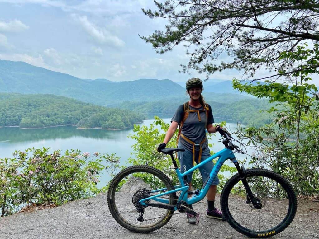
When I was first putting together my guide on all the IMBA Epic Mountain Bike Trails, for some reason the Tsali Mountain Biking Loops in North Carolina caught my eye. Beautiful lake views, fast and flowy singletrack, a relatively remote and rugged setting? Sign me up! I’m always a sucker for big days in the saddle with the promise of world-class riding.
Now, after having mountain biked the full Tsali trail system, I can say that it does not disappoint.
The views are stunning and the riding, while not challenging or technical in the least, is a pleasant mix of mellow pedaling, some punchy climbs, and fast flowy descents.
Before you head out to the Tsali Trail System, though, there are some important things you need to know including trail fees, the horse/bike schedule to keep the peace, and which Tsali trails to ride.
In this post, I cover everything you need to know about making the most of your two-wheeled escapades out to the Tsali Recreation Area in western North Carolina.
Getting to Tsali Recreation Area
Tsali Recreation Area is located in the Nantahala National Forest in western North Carolina.
It’s quite remote and not really located near any big town or city. The closest town is Bryson City, which is about 20 minutes east.
The closest cities are Knoxville, Tennessee (2 hours north) and Asheville, North Carolina (1.5 hours east).
Where does the name ‘Tsali’ come from?
Before I dive into the Tsali mountain bike trails, I think it’s important to learn about the (cruel) history of Tsali Recreation Area and where the name comes from.
Tsali is named after a Cherokee Indian man who was executed in 1838 after refusing to leave his home in what are now called the Great Smoky Mountains.
In 1838, the United States government forced the Cherokee people to leave their homes in the southeastern United States and move to Oklahoma. This forced relocation, known as the Trail of Tears, resulted in the deaths of thousands of Cherokee people.
Tsali was one of the Cherokee who refused to leave their homes. He and his family hid in the mountains, but they were eventually captured by the U.S. Army. Tsali was executed, along with his son and brother-in-law for trying to stay in his homeland.
Important Things to Know
Mountain biking at Tsali Recreation Area is awesome, but there are a few things to know before hitting the trails:
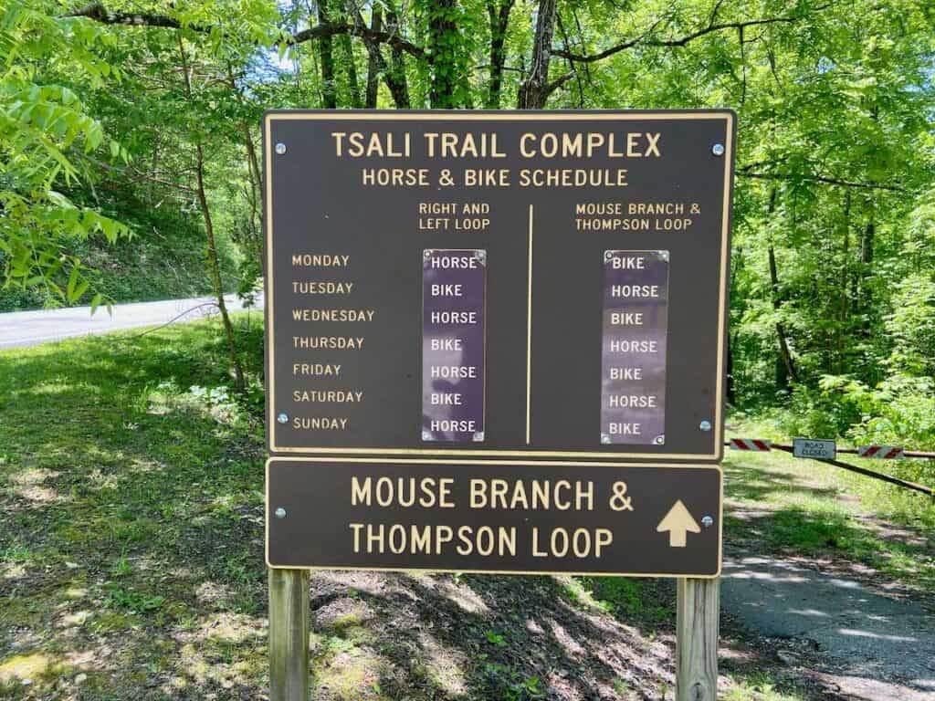
The Tsali Trail User Schedule
To keep the peace between mountain bikers and equestrians (and to keep everyone alive…) there is a horse/mountain biker schedule that trails users need to adhere to.
The schedule is based on days of the week and months of the year (click to enlarge):

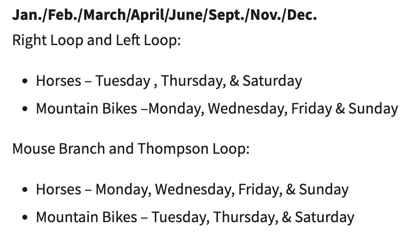
I arrived on a Sunday in May, so I could ride Mouse Branch and Thomspon Loops, but then I had to wait until Tuesday to ride the Right and Left Loops.
This schedule is here for a reason. Please respect it and don’t mountain bike the trails on a “horse” day.
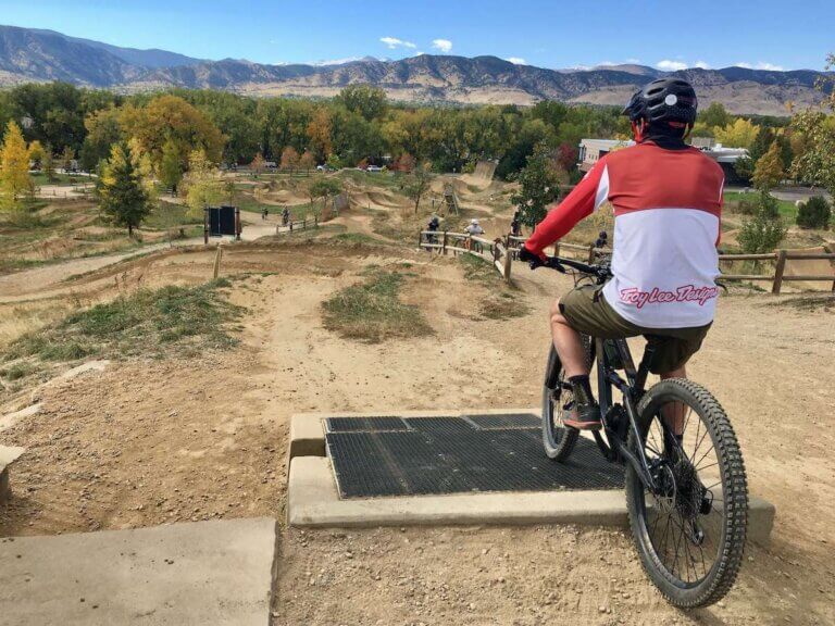
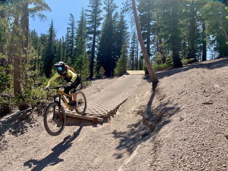
Mountain biking at Tsali
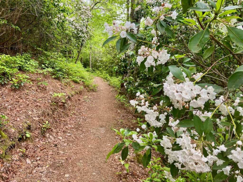
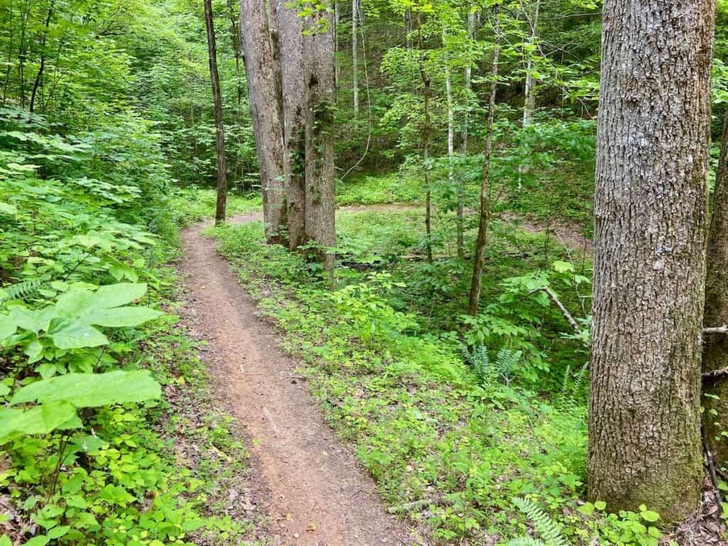
The mountain bike trails at Tsali are classic singletrack that have been around for decades.
Over the past few years, a ton of work has been done on these trails (namely the Left and Right Loops) and they are a super fun destination for any avid mountain biker.
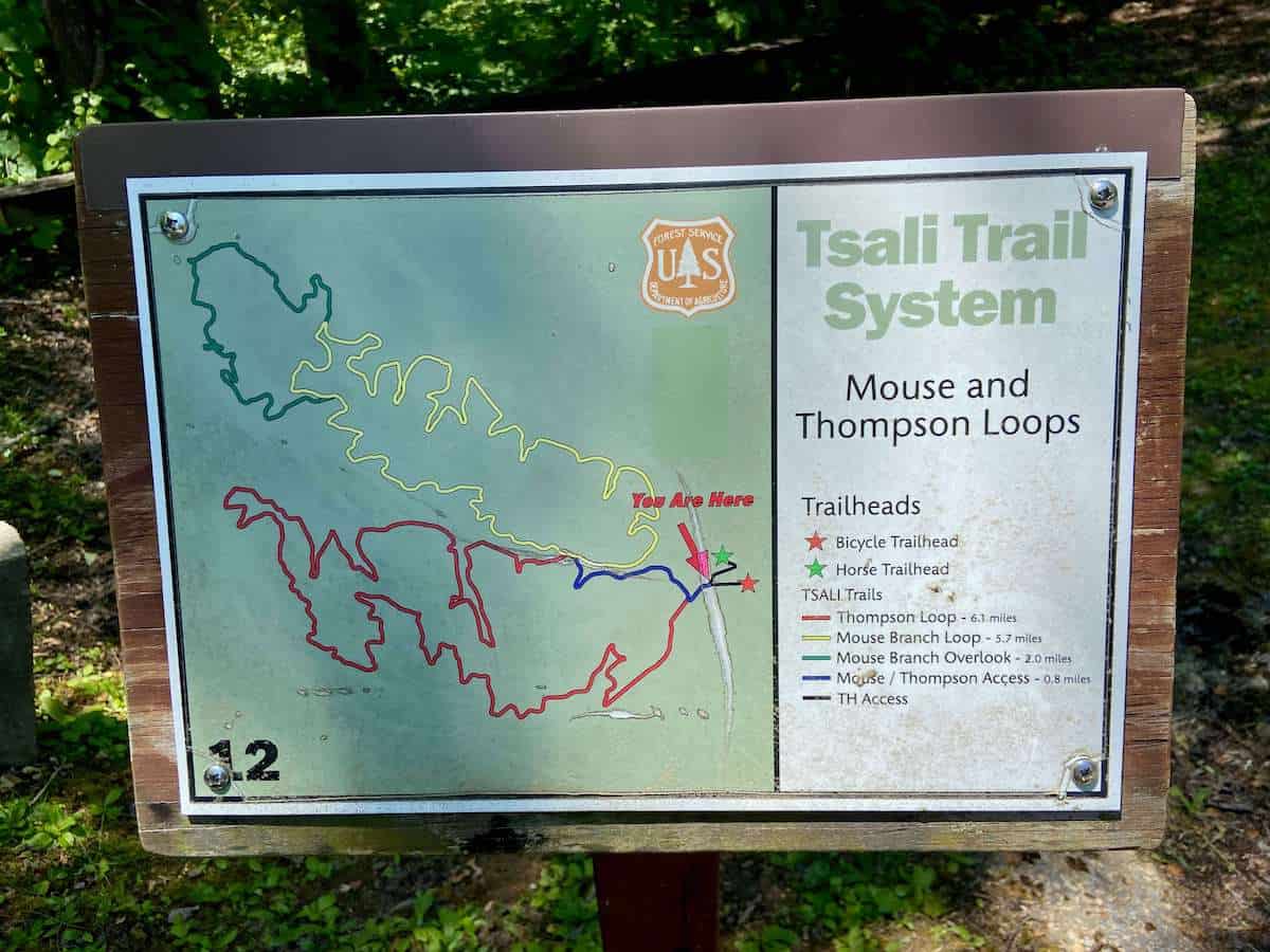
Trail breakdown
There are four main loops in the Tsali Recreation Area with a few shorter ‘bonus’ loops. Here’s what I thought about all of them:
Tsali Trail Maps
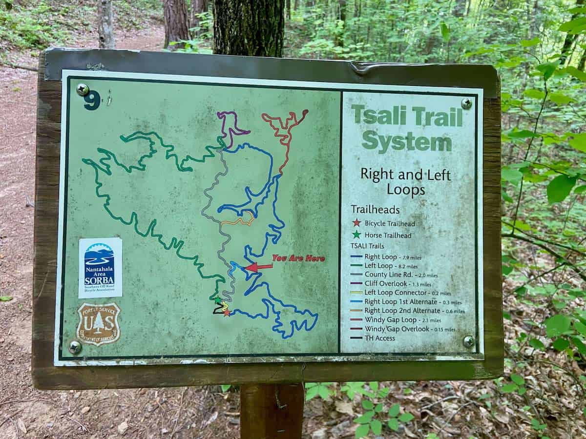
Route recommendation
>> Tsali Loops – Left & Right
The two most popular loops at Tsali are the Left and Right Loops.
You can ride them as one big 19-mile day as this route suggests, or you can break them into two (slightly shorter) loops by taking County Line Road (this road has a steep beginning, but it mellows out after about a .4 mile)
Route directions: Tsali Trailhead Parking > Right Loop > Overlook Loop (optional) > Right Loop > Cliff Overlook > Left Loop
Route notes: 19 miles may sound like a lot for a mountain bike ride (or maybe not!) but I found that these trails flow really well and 19 miles went by quickly.
There’s not a ton of elevation gain for that mileage, so if you’re in decent shape, you should be fine.
Do less: If 19 miles is a bit much, you can split the Left and Right loops into two days by taking the Country Line Road back to the parking area. This will make each loop roughly 11-13 miles each.
Keep in mind that you can’t ride the left/right loops two days in a row because of the trail schedule. You’ll need to wait a day (which you could use to ride the Thompson and/or Mouse Branch Loops).


What about Thompson Loop and Mouse Branch?
If you’re staying for a few days, you can ride the Thompson and Mouse Branch Loops as a second route.
I didn’t love Thompson Loop and Mouse Branch was ok. However, the lookout on Mouse Branch Overlook is spectacular!
Tsali Campground
There is a first-come-first-serve campground located just a short distance from the Tsali trailhead.
The campground has 42 sites with picnic tables and first pits. There are showers, bathrooms, and potable water. Camping per night is $20.
There is limited cell service in the campground, but you can walk up to the parking area for a better signal.
Best time to visit
I rode the Tsali Loops in mid-May and it was perfect. The temps were a delightful 60’s, spring flowers were blooming, there were no bugs, and I mostly had the trails to myself. I’d say April-May are prime months to visit.
I suspect fall (September-October) would be a good time to visit as well for cool temperatures and a bit of fall foliage.
Summers can get really hot and humid and winter can be cold and snowy.
Other things to do around Tsali Recreation Area
Want to stay awhile? There are lots of other great things to do around Tsali aside from mountain biking.
Here are a few ideas if you want to make a longer trip of it:
Final thoughts
I really enjoyed exploring and riding the trails at Tsali Recreation Area. Mouse Branch and Thompson Loops were meh, but Left and Right Loops were fast, flowy, and fun with great views out over Lake Fontana.
Before you plan your trip, though, remember that the trails have a user schedule to coordinate with horseback riders, so be sure to check the schedule before you go.
RELATED POSTS
Planning a trip to the South? Check out these biking posts around the southeast:


Thank you, Becky. I’m planning a fall trip to either Tsali or Dupont Forest. Thank you for putting together these guides! Very helpful, indeed.
Both Tsali and Dupont are awesome – can’t go wrong with either. Have a great trip!
Great article! Thank you for all of the information and for your personal insights! I am planning a trip now for April or May. Have a blessed day!
I love the Tsali loops – have fun!