
Mountain Biking Bentonville, Arkansas: Your Complete Planning Guide


Bentonville has quickly earned a spot on the map as one of the premier mountain biking destinations in the U.S.—and the buzz just keeps growing. I first rolled into town in 2020 and was instantly hooked. Since then, I’ve returned every year (sometimes twice!), and each visit reveals new trails, features, and surprises. Simply put, Bentonville is one of the most fun and thoughtfully built places I’ve ever ridden.
Love it or hate it, Walmart’s influence—via the Walton Family Foundation—has completely transformed this once-sleepy corner of Arkansas into a full-blown mountain biking mecca. And while you’ll find plenty of buttery-smooth flow trails, jump lines, and bike park-style features, don’t be fooled into thinking it’s all polished and tame. There’s also a ton of rough, rocky, hand-cut singletrack that’ll keep even the most die-hard tech riders grinning.
Even better? The trail-building boom is far from over. Word is there are plans to add 1,200 miles of singletrack between Bentonville and Little Rock in the coming years—so if you haven’t made the trip yet, now’s the time.
In this guide, I’ve pulled together everything you need to plan your mountain biking trip to Bentonville—from must-ride trails and route suggestions to post-ride eats and practical travel tips.
Why I love mountain biking in Bentonville
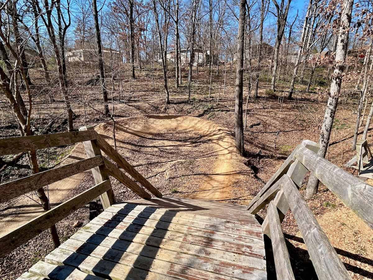
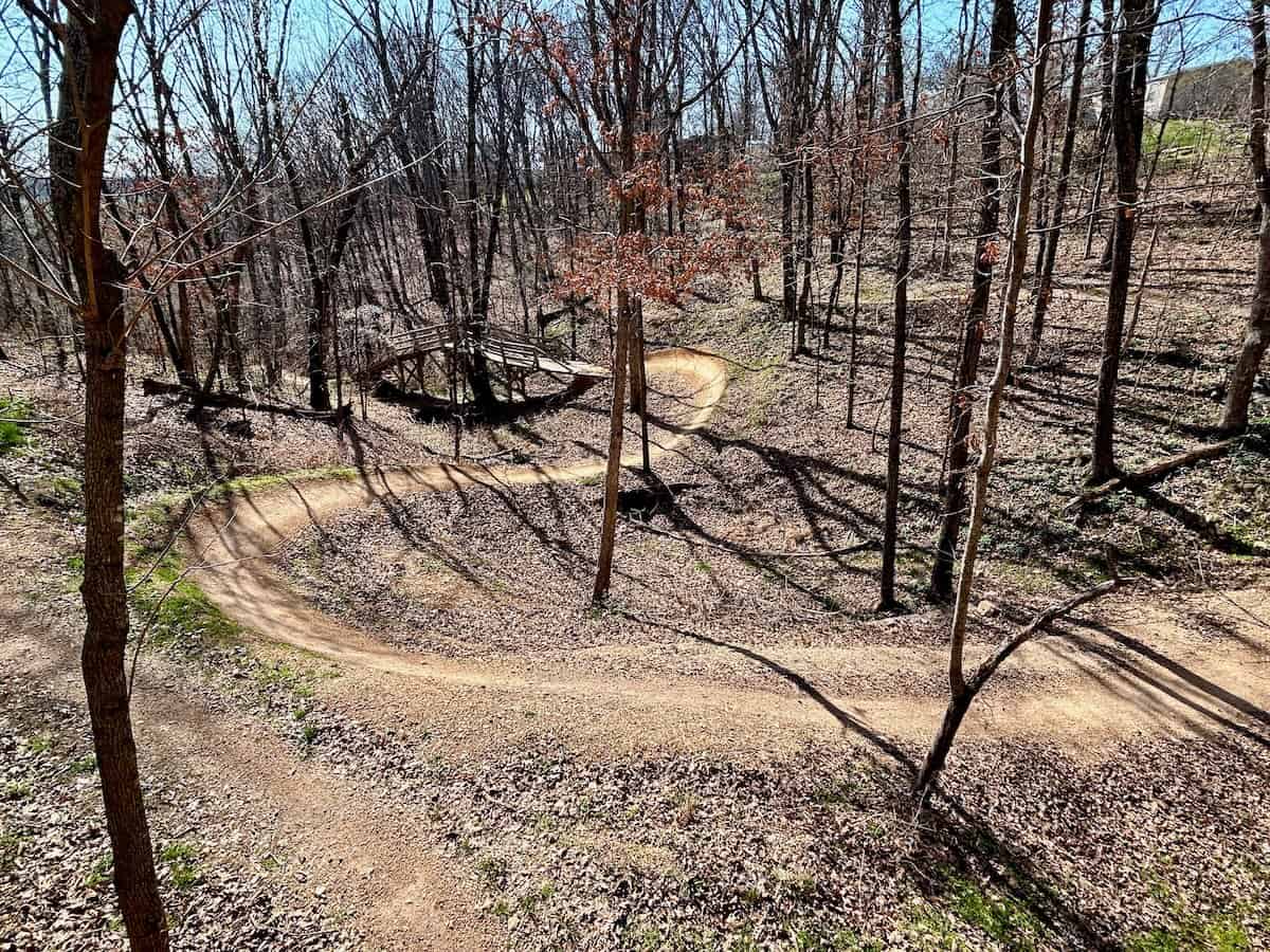
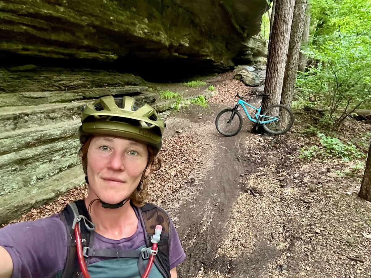
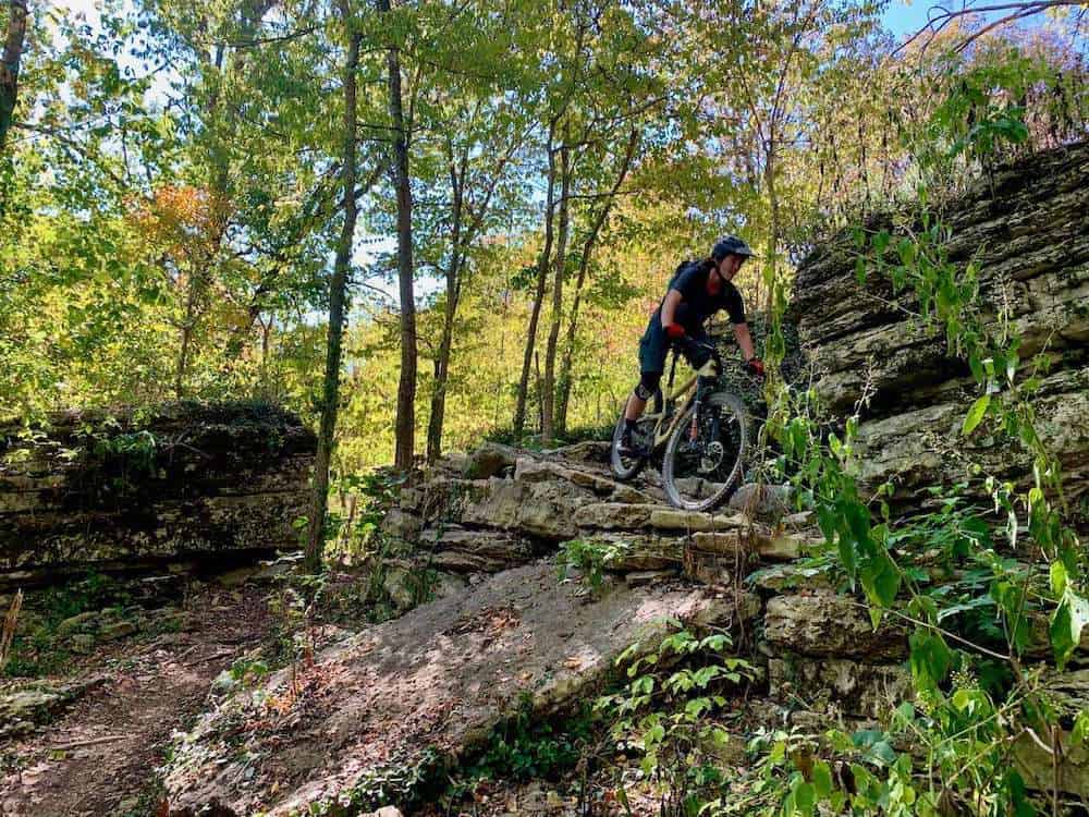
✨ Photo Gallery


Bentonville Mountain Biking Map
This map shows all the main mountain biking trail networks around Northwest Arkansas. If you’re looking for even more riding, check out my post on the best mountain biking in Arkansas.
⚡️ Heads up on e-bikes: Bentonville is one of the most e-bike-friendly mountain bike destinations I’ve been to. You’ll see them everywhere out on the trails and there doesn’t seem to be any animosity between the e-bike crew and analog crew. Let’s keep it that way 🙂

5-Day Bentonville Mountain Biking Itinerary
Looking for the best trails and route recommendations for mountain biking in Bentonville? Download my 5-day itinerary packed with tips, links, and local secrets including the best trails to ride and route recommendations. Grab it now and start planning your trip to the Mountain Bike Capital of the World!
Plan your rides
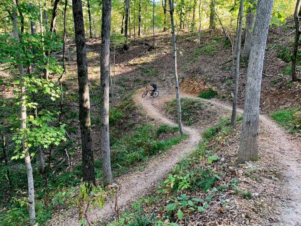
1. Start at Slaughter Pen
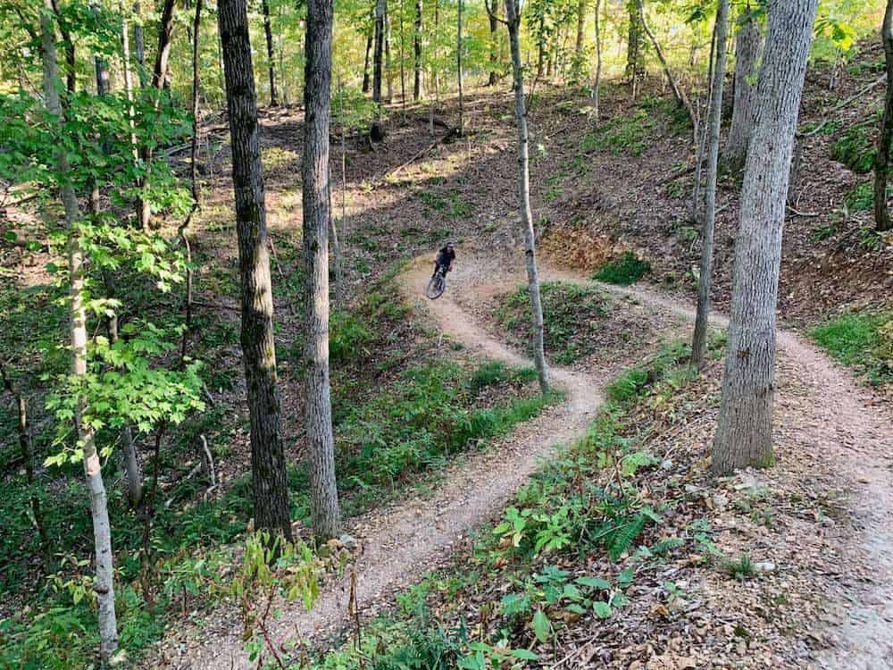
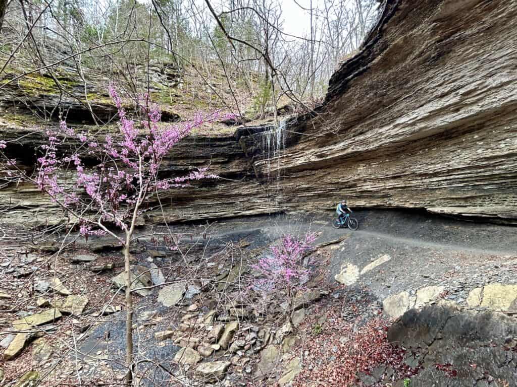
The Slaughter Pen Trails are probably the most famous Bentonville mountain biking trails and a good place to start. They’re located basically in town – you can literally catch singletrack trails from downtown Bentonville. It’s amazing!
There is everything here and to be honest, it can be a bit overwhelming if it’s your first time visiting. There are machine-built flow trails, hand-cut old school trails, a skills park with jumps and drops, a CASTLE, cross-country riding, and even big stuff I will never hit (hello Boneyard).
I think most visitors get into the trap of only riding the Slaughter Pen trails when they visit Bentonville, and while they are awesome, don’t fall into that trap. It’s worth checking out the other networks I’ve listed as well. I’d say 2 days at Slaughter Pen is good (obviously more if you have the time).


2. Head to Blowing Springs & The Alice in Wonderland Trails
As you venture a bit farther from downtown Bentonville, the Blowing Springs and Alice in Wonderland trails connect the Slaughter Pen system to Bella Vista’s Back 40 and Little Sugar networks (more on those below).
This area isn’t huge, but it packs a punch and it’s home to some of my favorite trails in the area. If you’re into old-school tech, don’t miss Boom Diggity. Prefer modern flow? Ace of Spades delivers.
It’s easy to overlook this zone when planning your Bentonville rides, but I definitely recommend carving out time for at least one loop here, you won’t regret it.


3. Get your XC on at Little Sugar
Little Sugar (and The Back 40—more on that below) make up the rolling cross-country side of Bentonville’s trail scene, though if you know where to look, you’ll find some fun techy bits tucked in here and there. Located northwest of downtown in the residential area of Bella Vista, Little Sugar weaves through quiet neighborhoods and forested hills.
The main feature is a 25+ mile loop called Tunnel Vision. It’s a mix of mellow terrain, punchy climbs, and long, fast descents. I’ve done the full loop twice, and honestly, it’s a solid day on the bike— it’s challenging but fun, and definitely worth it if you’ve got the legs (and don’t mind feeling it the next day). Not up for a big ride? No worries, there are plenty of shorter loops to stitch together if you’re looking for something more chill.
Little Sugar is also home to the Huntley Gravity Zone. This cluster of trails is located almost smack dab in the middle of Little Sugar and has a few machine-built flow and jump lines. Air-Raid is the most popular and a great trail to build confidence on jumps and drops. (Note: the Huntley Gravity Zone isn’t on the big Little Sugar Loop. You’ll need to take the trail Uphill Both Ways to access it).
Lastly, the last time I rode Little Sugar, I discovered a little pocket of trails on the north end that were a ton of fun. This is where Staggerwing, Sister Rosetta, and Immortal Amanda are. Don’t miss them!
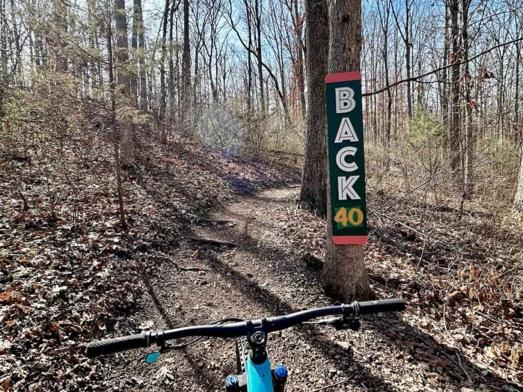
4. Lose the Crowds at Back 40
The Back 40 trail network is similar to Little Sugar in that it’s mainly cross-country and has one long 22+ mile loop – the Back 40 Loop. There are also plenty of ways to put together shorter (and arguably more interesting) rides with the crisscrossing of trails throughout the trail network.
The Back 40 is also located up in Bella Vista but on the right side of the community. It’s home to one of my favorite mountain bike trails in Bentonville – The Ledges – which follows a band of rock with some exposure and a few tricky rock gardens.
Little Sugar or the Back 40? If you only have time to check out one or the other, I prefer the Back 40 over Little Sugar. It’s more flowy, fewer steep climbs, and has more variety of trails to put together interesting routes.

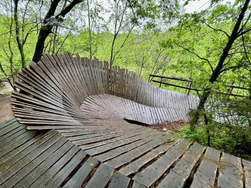
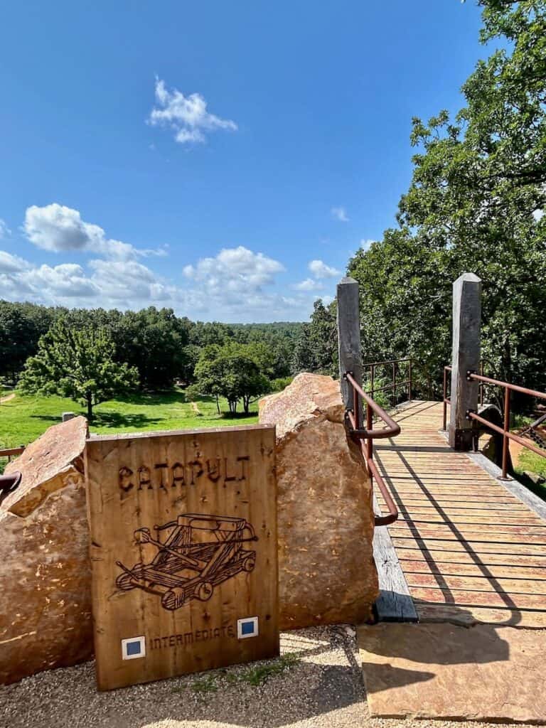
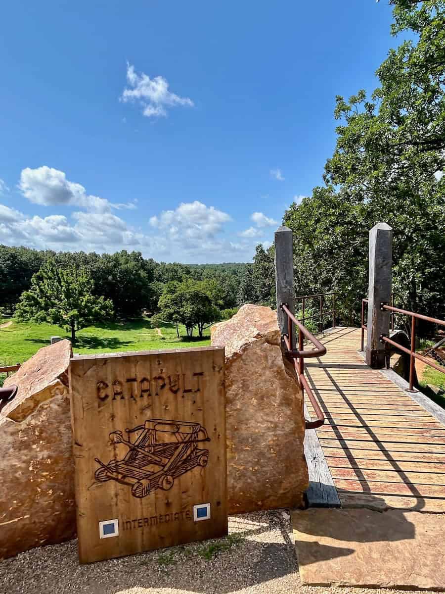
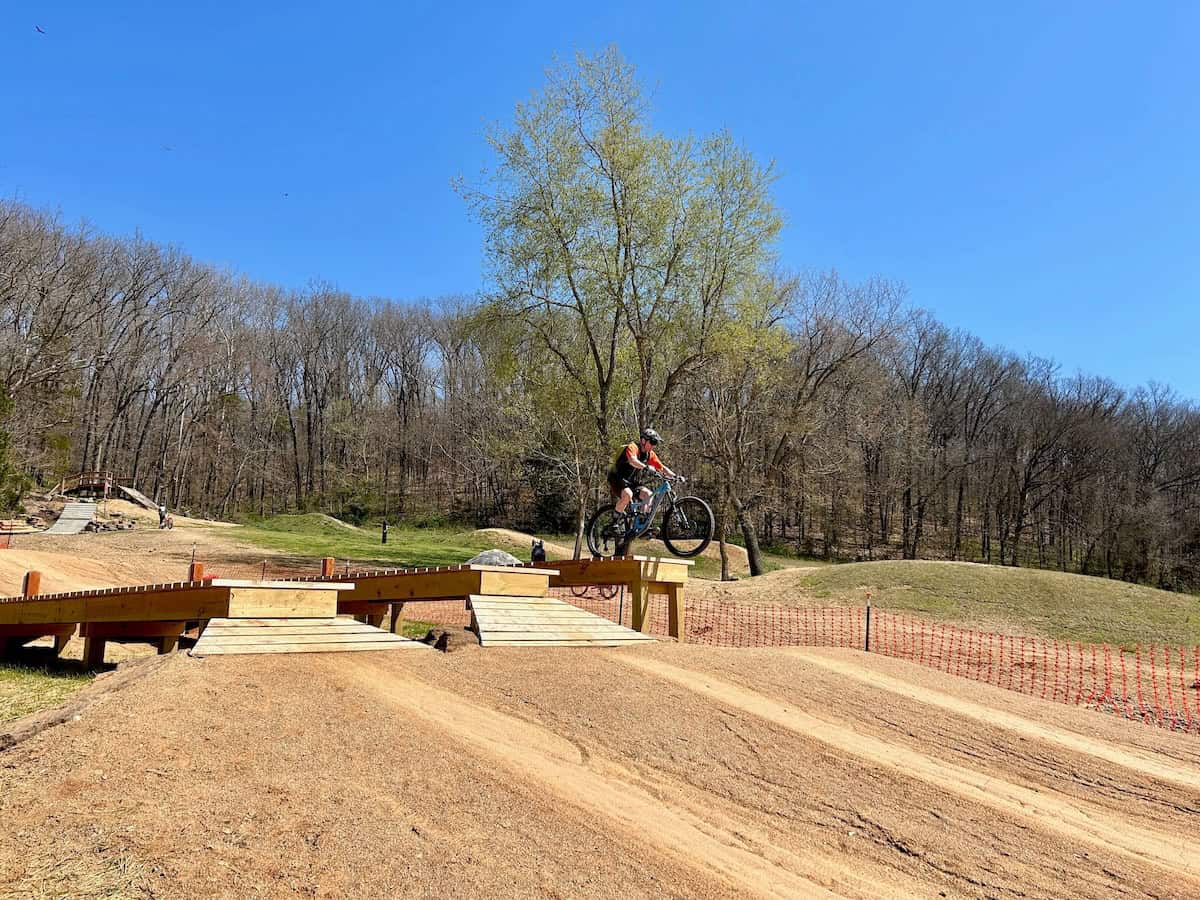
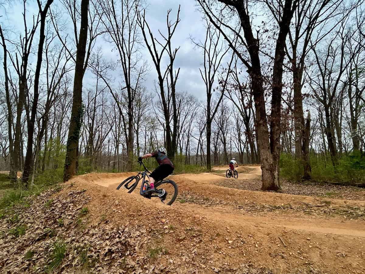
5. Turn up the fun at Coler Preserve
If you only have time to visit one mountain bike network in Bentonville, make it Coler Mountain Bike Preserve. This place is awesome! There’s a ton to explore here and there’s a great variety of trails, features, and terrain.
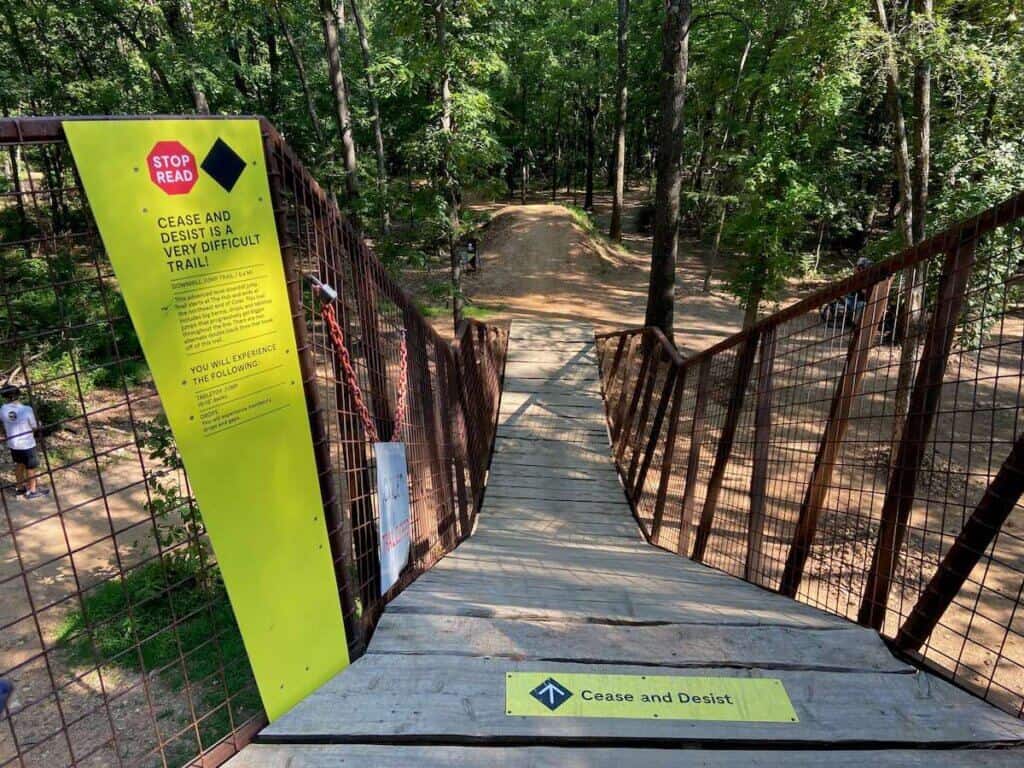
Most of the downhill trails start at The Hub on the north side. This alien-looking structure is an elevated launchpad with ramps dropping down into different trails. Fire Line is a must! Cease & Desist and the famous Drop The Hammer start from here as well.
On the south side of Coler, Thunder Dome and Family Flow are two fast and flowy machine-built trails that are worth lapping a couple of times.
In between the north side and south side are a mix of cross-country trails ranging from beginner-friendly to the expert-only Here’s Johnny.
Need a snack? Be sure to hit up Airship Coffee, which is located in the middle of the Coler Preserve trails and can only be accessed by foot or bike. You can also book a site at the Coler Campground if you want to shred sunup to sundown.

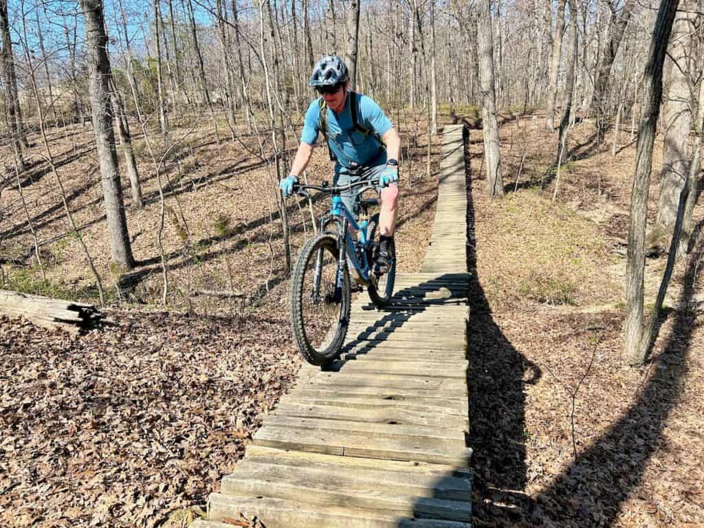
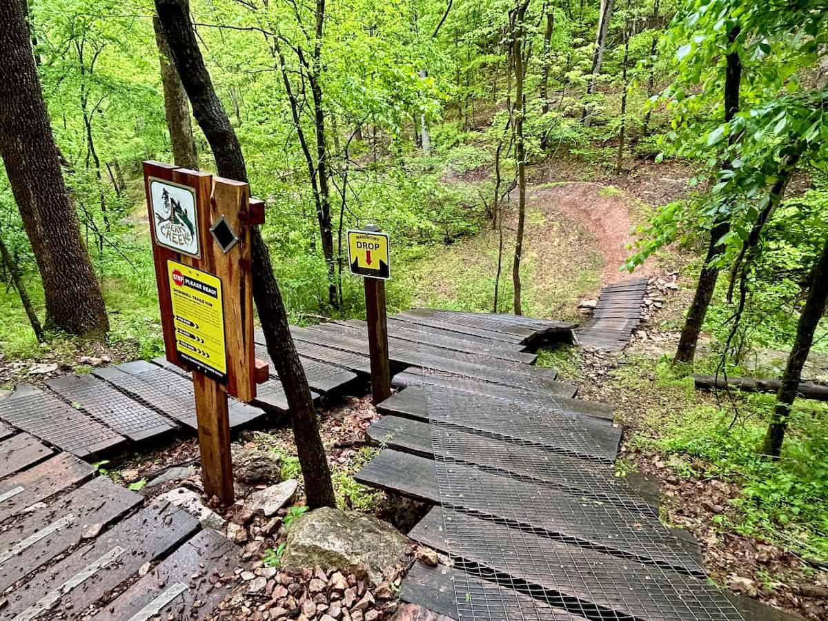
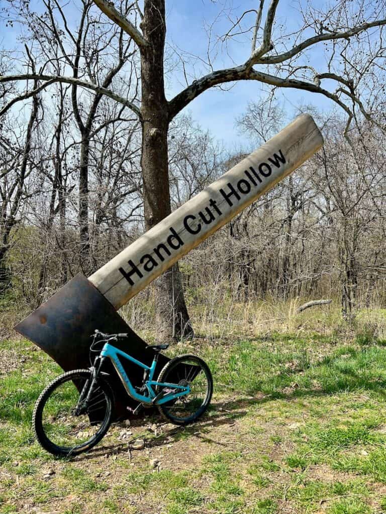
6. Find old school tech at HandCut Hollow
HandCut Hollow is one of the newer trail networks in Bentonville. As you’d suspect from its name, there are a lot of natural trails here, BUT it’s not all handcut. The Hub does access a few machine-built lines like my favorite – Interplanet Janet (so fun!) – and some impressive rock work trails like The Body Machine. Mother Necessity is the climb trail up to the hub.
If you are looking for old-school hand-cut, though, you’ll love Traverse Loop. It’s a good mix of cross-country and tech. When I rode it, I had the trail mostly to myself. This area is less popular than other Bentonville mountain biking networks.
Handcut Hollow is also home to the infamous Zone 4 trail. The brief for the trail builders was to build the hardest climb they could! As of this post, no rider – even the pros who’ve tried it – has been able to ride the whole thing in one smooth shot.
Trail Networks Farther Afield
The six trail networks listed above make up the riding closest to Bentonville. However, there is great riding all around Northwest Arkansas! Here are a few other trail networks to check out if you have the time:
FAQs & Planning Tips
Ready to plan your mountain bike trip to Bentonville, Arkansas? Here are some FAQs and tips to consider before heading out:
Need gear recs?
Head over to my gear closet! I’m always testing out new pieces of bike gear and if I really like them, they earn a place on this page.
Bentonville really does live up to the hype. Whether you’re into flowy jump lines, backcountry-style singletrack, or just want to explore somewhere new on two wheels, there’s a little bit of everything here.
Every time I visit, I find new trails to ride, new spots to eat, and more reasons to come back. If you haven’t made the trip yet, I highly recommend it—and if you have, you already know how easy it is to get hooked!
Have you been to Bentonville to ride? Does it live up to the hype? What questions do you still have about Bentonville mountain biking? Leave a comment below!
Read next
Want even more planning tips? Download my Bentonville Mountain Biking Guide


you had bike shop recommendations, on this page. I bookmarked it for a upcoming trip and now there are no local bike shops listed….. bummer
Hi Dane – I moved the bike shops to my 5-Day Bentonville Itinerary, which also includes the Google maps locations for them (and a lot more!). I’m trying to move away from ads as much as possible while still keeping most of my content free. I hope you understand and have a great trip to Bentonville!
What’s the lay of the land when it comes to e-bikes? Wanting to get a Sur Ron X soon and am not sure how welcome it would be in Bentonville.
Bentonville is very pro e-bikes. You’ll see a lot of them there 🙂
I’m from Wisconsin and get winters off from work. I would like to get some off-road action late Feb or March. How is the riding in Bentonville that time of year?
Bentonville does get snow, but it doesn’t usually last more than a day or two. Temps are typically in the 50’s.
Hi! What is there to do when you are NOT riding? Thanks, this guide is great!
There’s a ton of fun stuff to do around Bentonville! The Crystal Museum is really cool (and I’m not a museum person). If you have kids, the Amazeum is supposed to be awesome. There are also a lot of really cool hikes, parks, and outdoor off-bike things to do within a short drive. And there are some great restaurants and bars and a cute downtown to walk around.
Do you recommend renting a car? Or most of the trails are accessible directly from Bentonville with 10-20 minutes bike ride?
A car is not absolutely necessary since all of the trail networks are connected by bike paths. However, you may need to add quite a few miles to your ride depending on where you’re staying (I’d say 10-30 minutes one-way). I just did a quick search for mountain bike shuttles in Bentonville and it looks like Shuttle Hound has some good options if you don’t want to rent a car. If you’re not staying in or close to downtown Bentonville, though, I’d recommend renting a car. Have fun!
Becky-glad you had a good time in our little paradise. Next time don’t forget to check out Pedalers Pub. Very best pizza, staff and beer selection.
Thanks for the recommendation! I’ll definitely check it out next time I’m in Bentonville 🙂
So glad I came across your post as we will be making our first biking trip to Bentonville. Your tips on what to do, where to go and where to stay were very helpful. Thank you!
So glad you found it helpful! Have an amazing time in Bentonville 🙂
Nice guide. I appreciate the tips. This will definitely help me decide on where to bike this summer on a cross-country road trip. I have 1 day/night in Arkansas and I was struggling on which city to camp and hit some easy to intermediate level trails. My main objective is scenery without being too technical.
Thanks for reading Charles and glad these posts are helpful. Bentonville is awesome and definitely worth a stop. There’s also a lot more mountain biking around Arkansas that I haven’t ridden (yet). Hobbs State Park is supposed to be amazing as are Pinnacle and Mount Nebo State Parks. Hoping to hit those this fall. Check out the Monument Trails page