
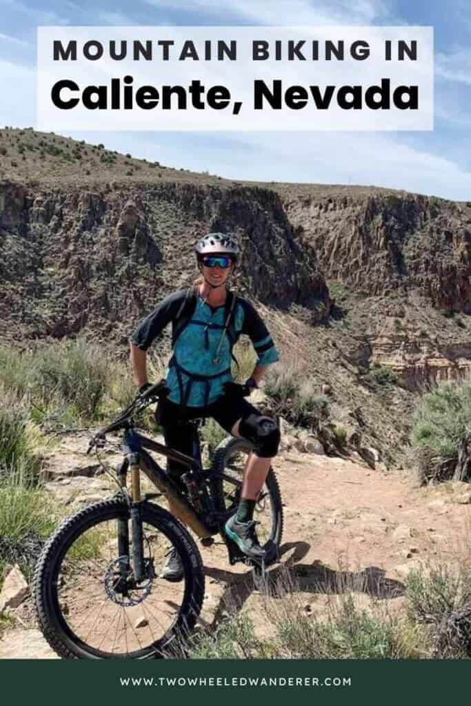
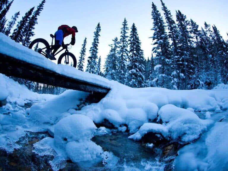
Mountain Biking in Caliente, Nevada
Caliente, Nevada… Where is that? Pretty much the middle of nowhere Nevada. BUT so was Fruita back in the day and so was Oakridge, Oregon a few years ago. Now both of those places are household destination names within the mountain biking community. In a few years, Caliente, Nevada may very well be a household name as well thanks to all the trail work and planning that has been going on over the past few years to make Caliente, Nevada a mountain biking hotspot.
This tiny little town is located in the southeastern corner of the state and it’s perfectly situated near several larger mountain biking destinations. While Caliente is not a ‘destination’ in and of itself (yet), its proximity to other areas makes it ideal for a road trip stopover. Caliente is:
- 1.5 hours from Cedar City/Brian Head
- 2 hours from St. George/Hurricane
2.5 hours from Las Vegas
- 5 hours from Park City
- 5.5 hours from Moab
- 6 hours from Flagstaff/Sedona
- 7 hours from Tahoe
So pretty much wherever you’re coming from and wherever you’re going on your mountain biking road trip in the southwest, Caliente is a great stop if you’re looking to stretch your legs or seek out some new singletrack.
A brief history of Caliente, Nevada
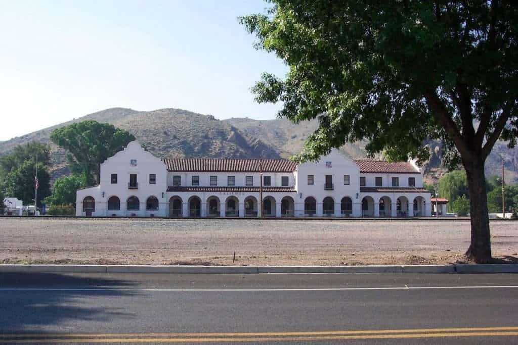
The town of Caliente was established in 1901 and given the name ‘caliente’ because of nearby hot springs (which are still bubbling today). In 1905 the Union Pacific Railroad was completed and a Spanish Mission-style train depot was built in the center of town.
“For more than 40 years, Caliente was one of the major division points on the railroad line. When steam engines were replaced by diesel locomotives in the 1940’s, the division point moved to Las Vegas. Without the depot as a main railroad stop, the town’s growth dwindled but not its spirit.”
Lincoln County Nevada website.
In 2012, a local mountain bike chapter alerted IMBA (International Mountain Bike Association) about the amazing potential of Caliente’s terrain for purpose-built mountain bike trails.
The ridges and canyons surrounding the town cater to switchbacked climbs, amazing views, and flowy descents with fun features sprinkled throughout. After five years of talking and planning with the BLM, IMBA finally got the go-ahead to start building.
To date, Caliente has received 1.75 MILLION dollars in grant funds to be allocated for the sole purpose of turning the hills outside of Caliente into a mountain bike destination. There is a full-time trail crew in place who are slowly but surely digging new singletrack and there are over 150 miles of trail planned for the network including a 24-mile shuttleable descent from Mt. Ella.
There are already almost 40 miles in place that are open to riders.
If all of this pans out as it should, Caliente is going to be the next mountain biking hot spot in the southwest, no doubt about it!
Want to learn more about mountain biking in Caliente?
- Funding secured for new trails in rural Nevada
- Caliente, Nevada: Building a destination trail system from scratch
- Moving mountain biking forward in Caliente
Caliente Mountain biking Guide
As of right now, Caliente is best visited as a stop along your road trip to one of the more established mountain bike destinations around (for example, Las Vegas or Sedona).
I’d say there are about two full days of riding to be had in Caliente with another day if you want to check out the skills park or poke around Barnes Canyon a bit more.
Hopefully, in the coming seasons, there will be many more miles to explore, but as of right now the 40 or so miles of built trail are good for 2 – maybe 3 – days of riding.
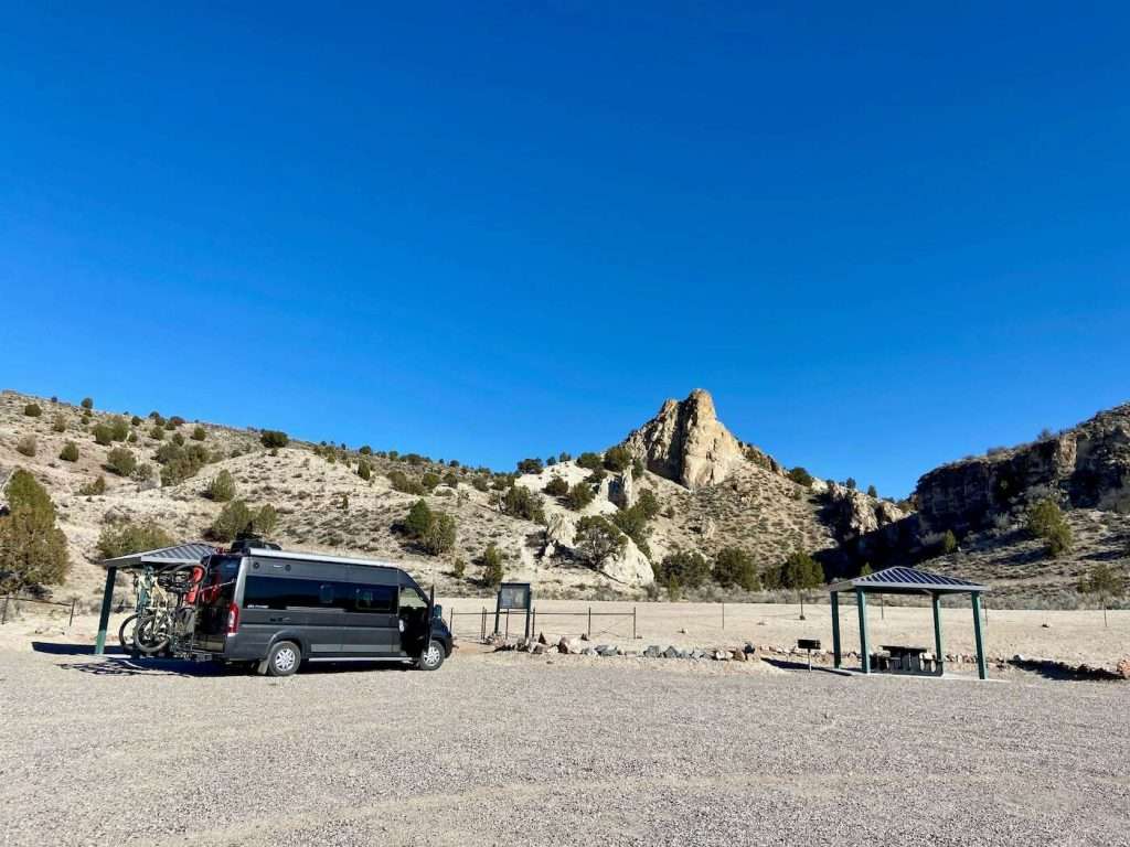
Barnes Canyon
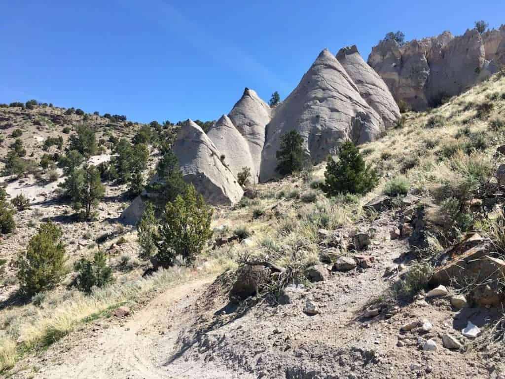
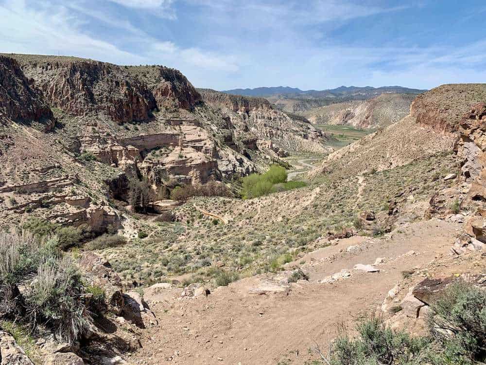
The Barnes Canyon network is located about five miles outside of town on Clover Creek Road. There are currently about 16 miles of trail, but some of it is very raw and very rough. It just needs more bike traffic! The area is beautiful, though, with big views of the canyon and a trailside look at the super unique Tepee Rocks.
The road into Barnes Canyon does have a shallow creek crossing, but most vehicles, even low-clearance ones, shouldn’t have a problem going through it.
Best trails to ride at Barnes Canyon:
- Beginner: Mongoose (climb & descent), Back 40
- Intermediate: Rocky Top, Boar’s Head
- Advanced: Wake Up Call
Barnes Canyon Route recommendation
>> #1 Barnes Canyon Easy Loop
This is a great 8-mile loop with an easy pedal up Mongoose, amazing views along Back 40, and a fun mellow descent down Parallel. If you want to add a little more tech take a detour on the Rocky Top loop. Note: It might be tempting to choose the “blue” Primer trail on the way back down, but it’s not worth it. It’s super sandy and not very well routed.

Route directions: Barnes Canyon Trailhead > Mongoose > Rocky Top > Back 40 > Parallel > Primer
Make it longer: Add the 2-mile Rocky Top loop at the top of Mongoose. There’s not much elevation gain or loss along this trail, but it has some punchy features and great views out over the canyon. There is some exposure as well.
Make it harder: Take Wake Up Call instead of Back 40 to Parallel. You’ll miss out on some fun, flowy singletrack, but if you’re looking for a techy challenge you’ll dig Wake Up Call.
Barnes Canyon Route recommendation
>> #2 Barnes Canyon Maximum Enjoyment
This route includes the best of Barnes Canyon (or what’s been built so far) with some mellow climbing and fun, fast, flowy descents. When I rode the final descent down Wake Up Call, it was quite rough and unpolished, but I think it’s going to be a killer DH trail when it sees more traffic!

Route directions: Tepee Rock Parking > Parallel > Back 40 > Rocky Top > More Goose > Boar’s Head > Moar Boar > Mongoose > Rocky Top > Wake Up Call
Kershaw-Ryan State Park
Kershaw-Ryan State Park is a sweet little oasis about two miles outside of town. There’s a full-service campground at the entrance and lots of outdoor opportunities to be had. There’s a volleyball court, a wading pool, miles of hiking trails, and a big 6-mile mountain bike loop.
There is a $5 day-use fee if you start from the main entrance. Please pay it.
Best trails to ride at Kershaw-Ryan State Park:
- Beginner: Kershaw Redemption
- Intermediate: Rainbow Rim
- Advanced: No advanced trails
Kershaw-Ryan State Park Route recommendation
>> Kershaw Redemption Loop
Kershaw-Ryan State Park has one big 6-mile loop with several bonus options if you want to make it longer (Rainbow Rim and Eric’s Anthill). It’s best-ridden counterclockwise for the best flow.
There are a handful of tabletops and optional jumps and drops on the descent down the northwest side, so keep your eyes peeling for alt-lines if that’s your jam.

Route directions: There are a couple of ways to do this loop but definitely ride it counterclockwise to hit the tabletops and kickers on the northwest side flowy descent.
There are two places you can start this ride:
- Kershaw-Ryan State Park Day Use Area: This is a good option if you want to use the bathrooms, fill up on water, relax on the grass post-ride, etc… There’s a steep switchbacked climb at the start, which isn’t all that much fun to come down at the end of the loop.
- Caliente Tower Road: If you want an alternative starting/ending point, park on Caliente Tower Road (or Ella Mountain Road depending on the map you’re looking at) and climb up Eric’s Anthill. Ride the loop counterclockwise from there. This option skips the steep switchbacked climb at the start and gives you a fun descent down Eric’s Anthill at the end.
Make it longer: There are two ‘bonus’ trails you can hit at Kershaw – Rainbow Rim and Eric’s Anthill. I thought Rainbow Rim was meh, better to stay on the main loop, but I do recommend hitting Eric’s Anthill.
Connector Trail
Truthfully, I’m a little confused about the Connector Trail. This is a pretty new trail that connects Kershaw-Ryan State Park to Barnes Canyon. It sounds like a good idea if you want to ride both networks, but the Connector trail is just shy of 10 miles one-way.
Doing it as an out-and-back would be a big 20-mile day in of itself with almost 3,000 ft of climbing. If you add miles in Barnes Canyon and/or Kershaw-Ryan that would be a huge day.
Plus, there’s no shuttle company in Caliente, so you can’t do a one-way pedal unless you set up a shuttle yourself.
It’s a bit of a weird trail addition in my opinion.
Ella Mountain Trail
The 22-mile Ella Mountain Trail is the newest addition to the mountain biking scene in Caliente. It’s a shuttled ride that starts at 6,770ft and descends more than 2,400 ft down to Caliente.
I have not ridden this trail, so I can’t speak to how it is. I have a feeling that it’s a bit more of a pedally ride than some people think it will be. That being said, it has received good kudos on TrailForks and the photos look awesome.
If you’ve ridden Ella Mountain, please leave a comment and let us know how it is!
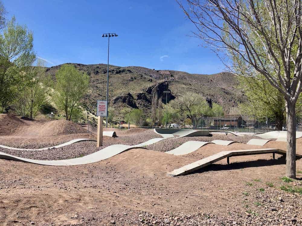
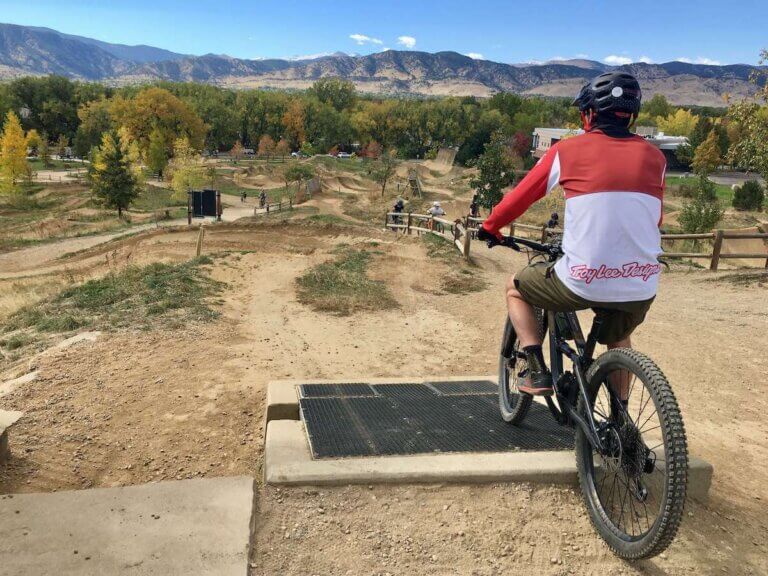
Caliente Skills Park + Flow Trail
There is a rad little skills park in the center of Caliente that has a pump track, some skinnies, a few small drops, and three progressive jumps to hone your skills in the air.
Above the Skills Park is about three more miles of singletrack. Unfortunately, these trails don’t seem to get a whole to of traffic. When I rode them, they were pretty rough and haven’t seen much maintenance. I’d recommend focusing your time on Barnes Canyon and Kershaw-Ryan.
Where to stay, camp, & Eat In Caliente
Camping
Much of the land surrounding Caliente is BLM land and free to camp on. We found a campsite off of Clover Creek Road on the way out to Barnes Canyon that was tucked away and shaded. You can also camp at the Tepee Rocks for free (or anywhere along that road).
Recently, several campsites with shade structures, fire pits, grills, and a bathroom have been built right in the Barnes Canyon trailhead parking lot. We stayed there for our most recent trip and it was great!
If you want something with more facilities, Kershaw-Ryan State Park has a really nice campground with full amenities.
Where to eat
Caliente is a little lacking in quality restaurant options, but Side Track is probably the best bet. There is also a small grocery store, however, I recommend bringing plenty of food and snacks with you.
Best time to visit Caliente
Like most places in the American southwest, Caliente gets pretty hot during the summer months. Even though the town is situated at 4,400ft it can get into the high 90’s or above during the summer.
The shoulder season months of October/November and February/March/April are probably the best times to plan a mountain bike trip to Caliente. Winter months can also be good if no snow is in the forecast and you’re prepared for chilly temps.
I hope this post has inspired you to start planning your next mountain bike road trip through Caliente, Nevada. Keep in mind that trails are still being built and burned-in, so they are kinda rough and raw, but they just need more trail traffic!
Related posts:
- A Complete Guide to Mountain Biking in Las Vegas, Nevada
- The Best Mountain Biking in Nevada
- Mountain Biking in Ely, Nevada
What questions do you have about mountain biking in Caliente, Nevada? Have you ridden there already? What did you think? Let us know in the comments below!


Thanks for the good write-up. I’m planning to be there next week and this is very helpful.
It’s a cool place – have fun!
I’m planning on stopping in Caliente this September, travelling from WA state down to Sante Fe, NM. This is some good info.
Last fall I made a couple stops going thru NV and was pleasantly surprised. Did the Cave Lake loop in Ely, very nice. Some fun basic trails in Winnemucca. And the barely ridden loops at Hickison Petroglyphs outside of Austin. I’d go back and ride any of those again, and might, but want to spend a couple days in Caliente.
Caliente is a great little surprise. I haven’t ridden the new Ella Mountain trail, but the rest of the networks are really fun!
Ian, if your trip isn’t over yet, you might also like Spicer Ranch, not too far from Caliente.
The trail from my Ella should not be considered a shuttle descent. Anyone expecting a downhill ride is in for a ride awaking. There is a lot of climbing and the trail wanders aimlessly through the woods in search of miles that are unnecessary. It is a long cross country ride .
Hmmm… sounds like it might be a similar experience to the Palisade Plunge. I still look forward to checking it out, though! Thanks for the pointers
Thanks for visiting Caliente’s trails! We’re proud of the work that’s been done so far and excited about additional miles coming online soon! A great time to check us out will be our 3rd Annual MTB Fest Sept. 16-18. You can learn more at CalienteMTB.org