3-Day Mountain Biking Itinerary to Downieville, California
Use this 3-day Downieville mountain biking itinerary to plan your trip to Downieville including where to ride, where to camp, and more!
Downieville is home to some of the best mountain biking in California if not the whole west coast. The loamy dirt, professionally built and maintained trails, a quaint Lost Sierra town, and the natural beauty of the area make it an all-around amazing destination.
Downieville mountain biking draws riders from near and far. The “ride to do” is the 15-mile Downieville Downhill, which is super fun and throws a lot of stuff at you. But in addition to this classic route, there are also a handful of other trails and networks in and around Downieville that are worth checking out.
In this post, I’ve put together a three-day itinerary for mountain biking in the Downieville area so that you can get the most out of your trip.
Use this 3-day Downieville mountain biking itinerary to plan an epic adventure to the Lost Sierra
Where – and what – is Downieville?
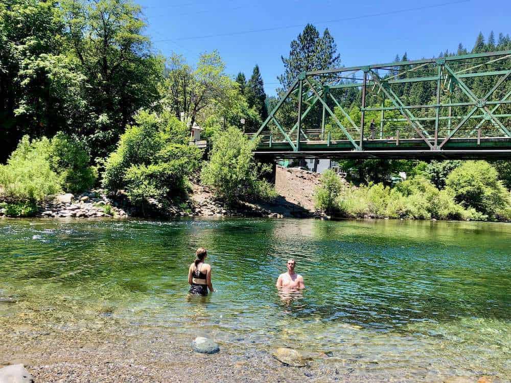
Downieville is a tiny little mining town in the Lost Sierra of northern California about 2 hours northwest of Lake Tahoe and 3.5 hours from San Francisco. This eclectic little town is tucked away in a steep canyon at the confluence of the Downie and North Yuba Rivers and it has become a destination for mountain bikers near and far.
A short film by Patagonia called Dirt Magic: From Dying Mining Town to Mountain-Bike Mecca gives a great overview of how Downieville became what it is today and what its vision is for the future.
What to know about mountain biking in Downieville
No gas in Downieville
There is NO GAS in Downieville. Fuel up in the last large city/town you pass. The closest gas to Downieville is in Camptonville or Bassetts.
Trails are multi-use
Trails in Downieville and the surrounding areas are multi-use and open to all outdoor recreationists including equestrians, motorbikes, hikers, and e-bikers.
I’ve never encountered anyone other than mountain bikers on the classic Downieville descent, but I have met dirt bikers and hikers on other trails. Be courteous and share the trails.
Please stop at the stop signs
The residents of Downieville have been super generous about allowing mountain bikers to basically take over their town in the summer, so please obey the rules like stopping at the stop signs (yes, on your bike) and just use common sense.
3-day Downieville Mountain Biking Itinerary
This 3-day itinerary covers the best mountain biking in Downieville as well as the surrounding area.
The Sierra Buttes Trail Stewardship, the organization that is behind the majority of the mountain bike trail building and maintenance around Downieville, is working hard to transform the entire area – called the Lost Sierra – into a recreational playground.
They’ve put a massive effort into building trails all around Downieville including nearby Quincy (a 1.5-hour drive from Downieville) which is home to Mt. Hough – a really fun and fast downhill that I absolutely think is worth doing if you’re in the area.
Day 1: Downieville
Your first day should really be spent on the classic Downieville trails. To get the most of your day, plan on doing 2 or 3 shuttles. Start early (the earliest shuttles leave at 7am on the weekends) and let it rip!
It takes about an hour to drive from Downieville to the top of Packer Saddle where the descent begins and about 2 hours to get down (conservative), so keep that in mind when you’re booking shuttles (i.e allow three to four hours between shuttles).
Downieville Shuttle Option #1
The Downieville Downhill
- Route difficulty: Intermediate+
- Mileage: 15 miles
- Elevation gain: 816 ft
- Elevation loss: 4,915 ft
- Route directions: Sunrise Trail > Butcher Ranch > Third Divide > First Divide
- Trail guide: The Downieville Downhill
- Map/GPS: TrailForks, MTB Project
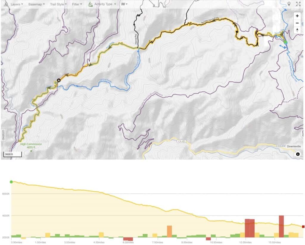
The classic Downieville Downhill route is to take Sunrise Trail to Butcher Ranch to Third Divide to First Divide. This 15-mile, 5,000 ft descent is fast and flowy in sections and also very rough and raw in others. If you’re moving relatively quickly, it takes about an hour and a half to two hours to get from top to bottom.
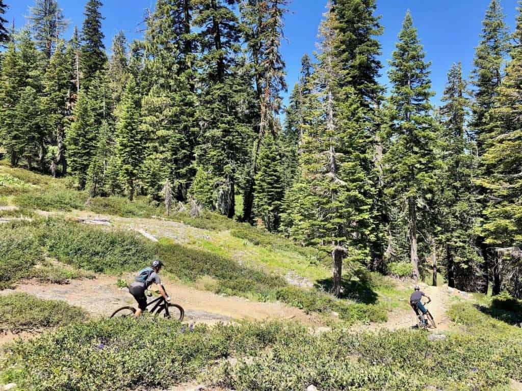
The highlight for most people is the fast section along Third Divide, which is super fun and scenic as it runs parallel to the river.
Because the Downieville classic route is so popular, many people make the mistake of thinking that this ride is easy or mostly buffed singletrack. It is not. You need to be an intermediate+ rider.
Downieville Shuttle Option #2
Gold Valley Rim to Big Boulder
- Route difficulty: Intermediate/Expert
- Mileage: 21.6 miles
- Elevation gain: 2,509 ft
- Elevation loss: 6,612 ft
- Route directions: Gold Valley Rim > Gold Valley OHV Trail > Big Boulder > Third Divide > First Divide
- Map/GPS: TrailForks
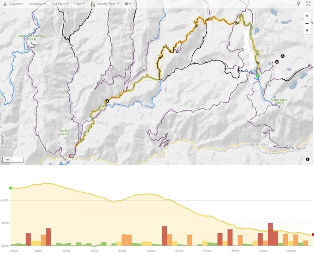
For shuttle #2 you can do the classic descent again (it’s that much fun!) or another option from the top of Packer Saddle is to take Gold Valley Rim Trail to Big Boulder to Third and First Divide.
This route adds quite a bit more elevation gain with one steep and grueling climb up a baby head-rock-studded fire road. But both Gold Valley Rim and Big Boulder are beautiful!
If you want a slightly shorter variation, you can take Pauley Creek to Butcher Ranch instead. (I haven’t ridden Pauley Creek, so I can’t attest as to what it’s like).
Downieville Shuttle Option #3
Second Divide
- Route difficulty: Intermediate/Expert
- Mileage: 16 miles
- Elevation gain: 1,263 ft
- Elevation loss: 5,357 ft
- Route directions: Sunrise Trail > Butcher Ranch > Second Divide > First Divide
- Map/GPS: TrailForks
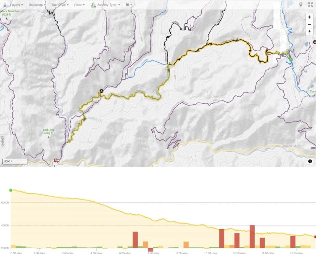
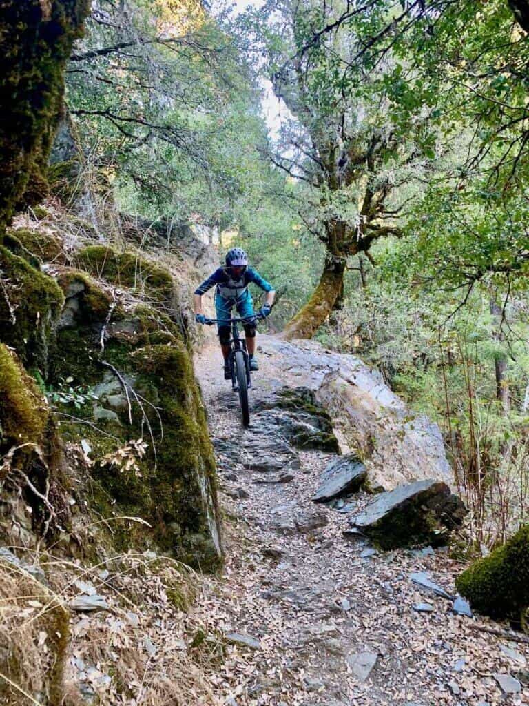
I really like Second Divide, but it’s not everyone’s cup of tea. It’s not nearly as fast and flowy as Third Divide (which is part of the classic descent – see shuttle option #1), but this trail rolls alongside the picturesque Pauley Creek and it is a bit more technically challenging and has significantly more climbing.
Only choose this option if you’re still feeling strong and don’t mind a bit of exposure! It is absolutely beautiful, though.
Day 2: Graeagle
If you want to explore farther afield after doing a few shuttles on the Downieville trails on Day 1, head an hour north to Graeagle. This small town is the launching point for Mills Peak or the ending point for Mt. Elwell, both of which are scenic and fun(ish) rides.
Relax and cool off at The Millpond post-adventure.
Graeagle Option #1
Mills Peak
- Route difficulty: Intermediate
- Mileage: 11.6 miles
- Elevation gain: 1,036 ft
- Elevation loss: 3,132 ft
- Route directions: Mills Peak Trail
- Need to know: There are no commercial shuttles for this ride so you will need to have two cars
- Map/GPS: TrailForks
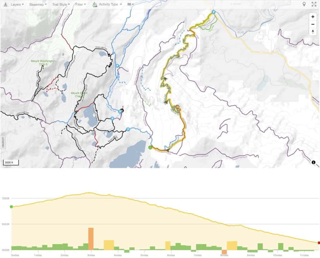
Mills Peak, which is located outside of Graeagle, is a good ride, but be forewarned: it’s not for everyone. The trail is definitely old-school with lots of rocks and rough singletrack, but the views are great and there is some good flow on the descent.
Unfortunately, there is no shuttle service to the top of Mills Peak, so you’ll need to set up your own (you could pedal up to the top as an out-and-back, but that would be a struggle!).
You can either drive up to the lookout if you have a high-clearance 4×4 vehicle, which would cut off about 900 ft of climbing, or you can park off of Gold Lake highway and climb up the Mills Peak fire road to the lookout.
Graeagle Option #2
Mt. Elwell
- Route difficulty: Expert
- Mileage: 13.4 miles
- Elevation gain: 1,944 ft
- Elevation loss: 4,041 ft
- Route directions: Gold Lake/Mills Peak Connector > Bear/Round Lake Connector > Silver Lake Trail > Mount Elwell Peak Trail > Smith Creek Trail
- Map/GPS: TrailForks
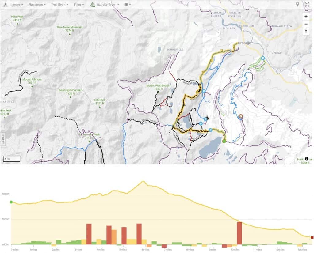
I have not done this ride.
That being said, I’ve heard good things about the Mt. Elwell Trail if you’re up for a big adventure with lots of climbing and technical riding. Before you do this ride, talk to the folks at Downieville Outfitters to get their take.
Day 3: Mt. Hough
If you head to the Downieville area for a few days of mountain biking, I personally think it’s worth the 1.5-hour trek north to Quincy to ride Mt. Hough, pronounced ‘Huff’. (You can read more about Quincy and Mt. Hough in this post).
Yuba Expeditions has a bike shop and shuttle location in Quincy and they provide lifts to the top of Mt. Hough (Adventure Monkey’s is another shuttle company). It’s a 50-minute shuttle ride up a steep and loose gravel road and there are currently two main options for getting back down. It is possible to do both of these shuttles in one day.
Mount Hough Shuttle Option #1
Mt. Hough DH
- Route difficulty: Beginner/Intermediate
- Mileage: 9.7 miles
- Elevation gain: 170 ft
- Elevation loss: 3,667 ft
- Route directions: Mt. Hough Trail
- Map/GPS: TrailForks
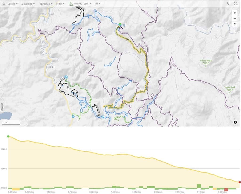
Fast, flowy, hard-packed, and a whole lot of fun, the Mt. Hough trail is much tamer than the Downieville descent. If you like speed and flow (who doesn’t?) you’ll dig it. There is a bit of exposure toward the end, but nothing life-threatening.
This ride can be done in under an hour, so take a few laps!
Mount Hough Shuttle Option #2
Indian Falls Ridge
- Route difficulty: Intermediate
- Mileage: 25.3 miles
- Elevation gain: 1,355 ft
- Elevation loss: 5,091 ft
- Route directions:
- Map/GPS: TrailForks
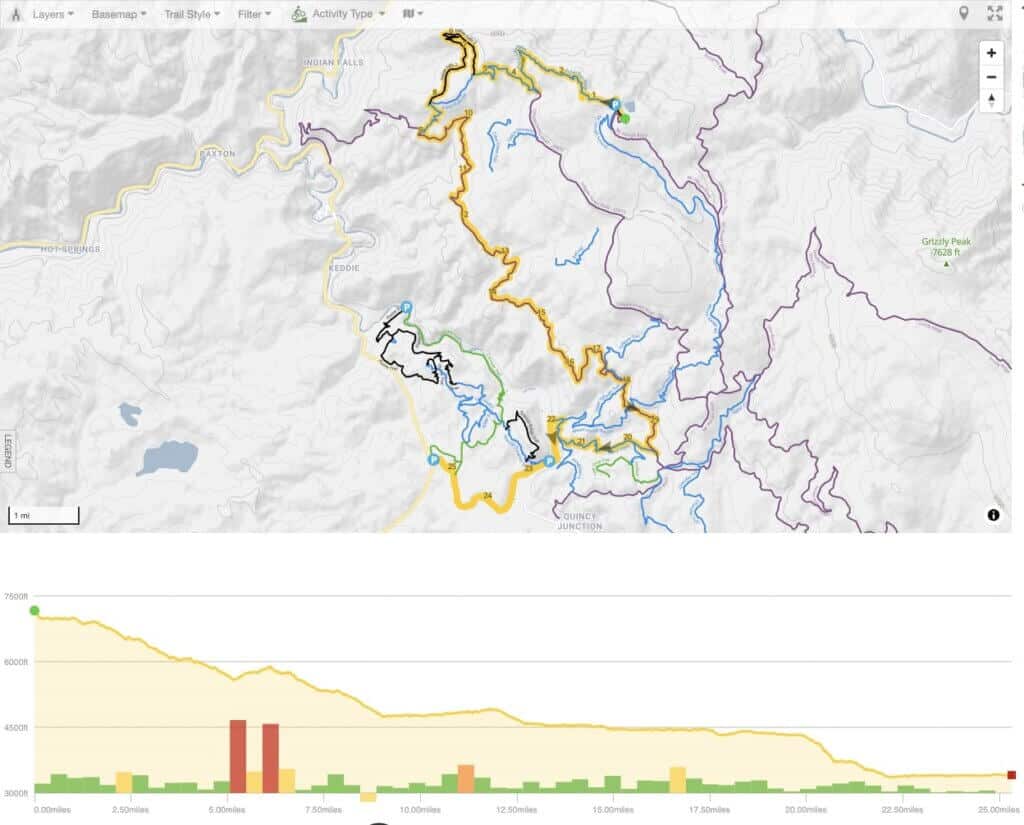
This isn’t the ‘classic’ Mt. Hough route, but if you’re up for a backcountry adventure, this is a great ride. I like to do this descent first because there’s quite a bit more pedaling and elevation gain involved compared to the Mt. Hough descent.
The Indian Falls Ridge Trail is still under the radar, but it is a really fun and scenic remote ride, especially the Indian Falls 2 offshoot. You might even see some black bears! Be sure to bring a map (preferably TrailForks downloaded to your phone) because the route-finding is tricky on this one.
*Note that there is a 10-mile fire road pedal at the end. It is easy spinning and super mellow and actually quite nice, but this may deter some people from doing this route. You can connect the fire road into the last section of the Mt. Hough trail or end with Berry Creek Trail (shown on map above). If you don’t want to do this ride but still want to get a couple of shuttles on Mt. Hough in, do the classic descent below two or three times!
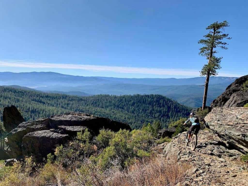
bike shuttles & rentals
There is currently only one shuttle outfitter in town that offers mountain bike shuttles in Downieville. Downieville Outfitters is located on the ‘main drag’. I’ve never used them so I can’t speak to their service (I used to book through Yuba Expeditions, but they stopped doing shuttles in 2021). Downieville Outfitters gets great reviews and they have a couple of different shuttle options and times. They’re also a full-service bike shop and offer mountain bike rentals.
Even though they’re not doing shuttles in Downieville, Yuba Expeditions is still running shuttles in Quincy. They are a non-profit so any proceeds from shuttles go straight back into trail maintenance and building, which is awesome! Booking shuttles with Yuba Expeditions can be done online or over the phone and they have a full-service bike shop as well as mountain bike rentals.
Adventure Monkeys is another shuttle company based in Quincy. I haven’t used them personally, but they get great reviews.
Downieville mountain biking logistics
Where To Stay & Camp
Accommodations are actually few and far between in Downieville. There are several Airbnb’s/VRBO’s but they’re pretty pricey (if you want to splurge, the Carriage House Inn is super cute and overlooks the Dowie River). There is also a number of lodges, inns, and resorts near Downieville but they fill up quickly, so you’ll want to book well ahead of time especially if you’re visiting in the peak summer months.
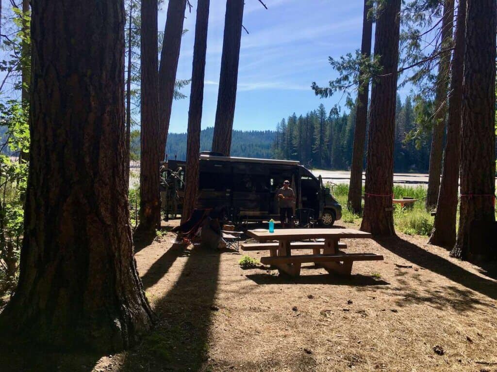
Luckily, there are plenty of camping options. Yuba Expeditions has a great list of Downieville campgrounds on their website. Downieville gets REALLY busy in the summer, especially on weekends, so definitely book campsites several months ahead of time.
For dispersed camping, There are a handful of sites along Packer Lake Road on your way up to the start of the Downieville descents. These are first-come-first-serve and do not have any facilities.
There is no dispersed camping close to the town that I know of.
Where To Eat
Despite its size (population 158), Downieville actually has some delicious places to eat. My favorite is La Cocina De Oro Taqueria. They have great Mexican food, but they only take cash or check. Sit outside on the patio in the back. Two Rivers Cafe is also good. They serve American food like pizzas, burgers, and beer. For breakfast and coffee, definitely fuel up at Sabrina’s At The Forks.
But my favorite place to eat is over in Quincy. If you ride Mt. Hough (which you really, really should – see Day 3) make sure you stop by Quintopia Brewing on your way out of town. The loaded fries are amazing!
Where To Park in Downieville
Downieville has imposed a two-hour limit for parking in town. I’m not sure how strictly enforced this is, but personally, I don’t want a ticket. There is plenty of parking a short pedal ride away at the trailhead parking lot on Durgan Flat Way.
Best Time To Visit Downieville
Downieville does get a blanket of snow over the winter months, so the trails usually aren’t clear until late May or early June. Of course, this all depends on snowpack and weather patterns.
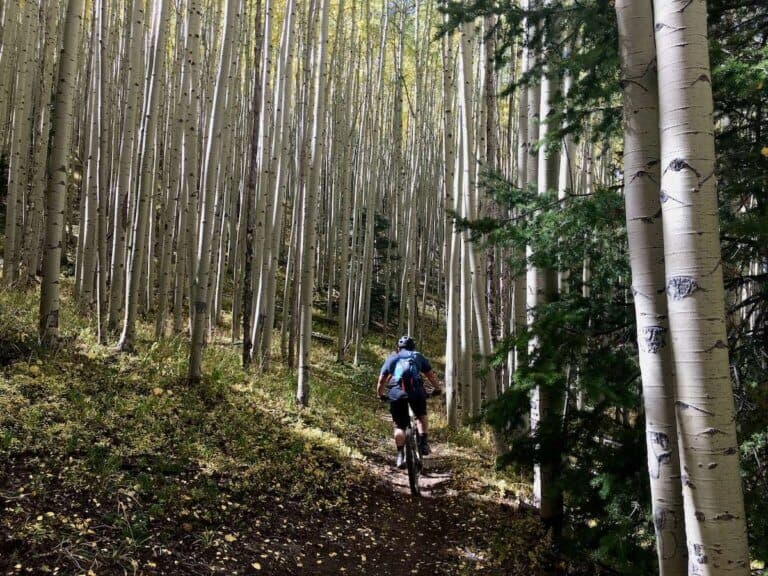
Summers in Downieville tend to be pretty busy, especially on weekends. And the weekend of the Downieville Classic Race is just insane. I prefer visiting in the fall around September or October because the crowds have thinned and the foliage is stunning.
And there you have it! A 3-day mountain biking itinerary to Downieville and the Lost Sierra. Have you experienced Downieville mountain biking for yourself? What are your favorite trails? What would you add to this itinerary? Leave a comment below!
Pin it for later!

I love hearing from you and appreciate your comments! However, if you leave a rude, unconstructive, or spammy comment, it will be deleted. It’s cool to be kind. Have an awesome day!